Country:

 City:
City:


Please note: following a violent storm at the end of August 2026, a number of trees have fallen along the route.
The main difficulties are encountered in the following sections:
– between the points (6) and (7) up to the middle of this section;
– just before the point (10);
– a significant section of the path between the point (10) and the road.
I do not currently recommend following the route as described.
From Molinges, follow the Marignat road (RD63E1). The starting point is just past the second bridge, about a hundred metres from the buildings of the former Marignat Mill: there are a few parking spaces available at the side of the road.
(S/E) Follow the road, keeping the Bienne on your left, until you reach the sign marking the entrance to the village of Molinges.
(1) Take a path on the right, which runs mainly through woodland alongside a field, which you will go round.
(2) At a clearly visible junction, carry on straight ahead, then do the same at the second junction you come to a little further on: these two junctions are not shown on the IGN map. Just before a cliff, turn left at the third junction. From this point, the route isn’t necessarily obvious: quite soon, look out for a path on the right – which is only moderately visible at the start – leading up a short but somewhat steep climb.
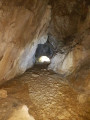
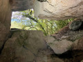
(3) Immediately after reaching the top of the climb, take another path on the right: after a short descent, followed by another section with a slight incline, you’ll reach the Grotte de l’Enragé in no time:
see the ‘Practical Information’ section for further details.
(4) Retrace your steps back to the previous junction.
(3) Turn right, then, a short distance further on, turn left. A little further on, at another fork, take the path on the right, heading uphill. Follow it for a short while until you reach a junction where aGR®® de Pays route is marked (yellow and red markings).
(5) Continue to the left, along the path heading uphill, and ignore two paths on the left. You’ll come to a junction after a series of two closely spaced hairpin bends.
(6) Follow the path on the right, heading uphill: the route winds its way through a series of bends. Ignore the start of a path on the left, and carry on until you reach a track: follow this to the left for a short distance, until you reach the nearby junction.
(7) Continue along the path on the right, marked in yellow, and follow it for a short while. You’ll come to a fork marked by a signpost.
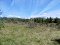
(8) Turn right onto the path towards Pas de l’Âne, and follow it for a good distance, through some lovely meadows, until you reach another fork.
(9) Head down to the right, towards Molinges. Along the way, turn right at the two junctions you come to, following the signposts. You’ll join theGR®® de Pays route (marked in yellow and red).
(10) Carry on almost straight ahead, ignoring the tempting turn-off leading towards the field. About 50 metres further on, take a path to the right and, shortly afterwards, turn right at the junction with another path: the path straight ahead is a dead end.
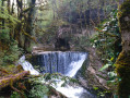
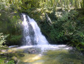
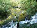
Shortly afterwards, you’ll reach the area with the waterfalls. Weather permitting, you’ll see the first waterfall on your right, with the Grotte de l’Enragé in the background; continuing to the left, the path leads to a second, rather pretty waterfall.
(11) Retrace your steps back tothe GR®® de Pays, then continue to the right until you reach the junction with the departmental road, opposite the old Marignat mill. Turn right to return to the starting point (S/E).

 Visorando Member
 Difficult
 Easy
Easy