Country:

 City:
City:


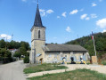
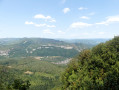
The route starts in Lavancia at the end of Rue du 12 Juillet 1944 (parking available at the roadside).
(S/E) Head due north, following the track.
(1) At the first junction, turn right and cross the bridge over the old disused railway line. Shortly afterwards, turn right onto another track; then, a few dozen metres further on, look out for and follow a path to the left, where you’ll begin to walk through woodland (note: it’s also possible to continue straight ahead on the track and rejoin the route at point (2)).
(2) At the next junction, carry on almost straight ahead and follow the carriageway uphill for a good while.
(3) At the junction of three paths, take the one on the right. After a hairpin bend, head slightly to the right.
(4) At the next junction, continue straight on along a fairly steep path, walking more or less close to a cliff.
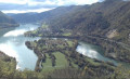
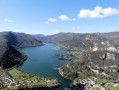
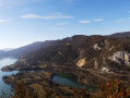
(5) You’ll reach a viewpoint offering a lovely view towards Vaux-lès-Saint-Claude. Carry on, ignoring any junctions. Further on, the path leads out onto an open, grassy area.
(6) Carry on straight ahead along the same path and, further on at a junction, turn right and head downhill.
(7) Walk through the hamlet of Sièges to the Chapelle Saint-Michel and the Mémorial des Martyrs de Sièges. A little further on, turn right onto the Chemin de la Balinette (GRP® route): takethe first right-hand fork straight away, then at the Fork in the road take the left-hand branch and follow this path for a considerable distance (please note: the route marked by IGN in the‘SouslePerron’ areanowcrosses a field andis nolonger valid). Further down, ignore two successive junctions; at the third, continue to the right.
(8) Continue along a path with a steep gradient, almost vertical.
(9) At the next junction, turn left under the bridge of the old railway line. After a short descent down a steep slope, you’ll come out onto a street below: follow it to the left for a few metres.
(10) Take Rue de la Gare on the right, which slopes downwards.
(11) When you reach a stone cross, turn right onto Rue de la Fontaine. A few metres further on, turn left onto Rue des Prés, which becomes a track suitable for vehicles after the last houses.
(12) Just before reaching Lavancia, the road becomes tarmac again and joins Rue du 12 Juillet 1944. Turn right onto this road, heading uphill as you pass the former Saint-Georges Church, and you’ll soon be back at the starting point (S/E).
 Association / Club / Walk leader
 Difficult
 Visorando Member