The Grand Tour of Lake Vouglans

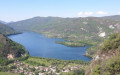
Lake Vouglans offers an ideal playground for outdoor sports enthusiasts.
This 86km route is designed for experienced mountain bikers. It is quite hilly and features numerous technical trails, with a well-balanced mix of surface types (woodland, scree, roots…) and trail types (singletrack, footpaths, dirt tracks…).
This route is signposted as a major mountain bike route (red ‘VTT’ symbol on a white background, with the letters ‘TLV’).

Details

n°1596243
Creation:
Last update:
Last review:
  • Mountain biking
    Activity: Mountain biking
  • ↔
    Distance: 52.47 mi
  • ◔
    Duration according to the author: 7 hrs 
  • ▲
    Difficulty: Very difficult

  • ⚐
    Back to start: Yes
  • ↗
    Ascent: + 4,859 ft
  • ↘
    Descent: - 4,839 ft

  • ▲
    Highest point: 2,129 ft
  • ▼
    Lowest point: 1,083 ft
  • ⚐ Country: France
  • ⚐
  • ⚐ City: Moirans-en-Montagne (39260)
  • ⚑
    Start/End: N 46.445415° / E 5.70693°
  • ❏
    IGN map(s): Ref. 3327OT

  • ◶
    Type of surface:
  •  
     
     
    ■ 33% Road ■ 34% Byway ■ 33% Path
  • ⇧
    Bike carrying: Not specified
  • ▲
    Difficulty: Not specified
  • Hour-by-hour weather

Photos

Description of the route

Head towards the restaurant Le Regardoir, in the village of Moirans-en-Montagne.
Park near the Via Ferrata chalet.

(S/E) Walk past the chalet and take the small tarmac path for about 200 metres.

(1) After the short climb, take the path to the right (marked TLV).
From there, follow the mountain bike signs or the blue markings labelled ‘TLV’. These markings will guide you along the entire route.

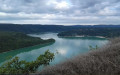
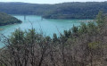
(2) Turn right. Pass the viewpoint overlooking Lake Vouglans and cross the Bois de la Refrèche.

(3) Turn right.

(4) When you reach the Réfrèche forest track, turn left and then immediately take the small path on the right. Cross the stream and continue along the forest path until you reach the tarmac forest track.

(5) Turn right, then right again after about 150 metres.

(6) At the farm, take the path leading uphill on the left. Carry on, keeping an eye on the signposts.

(7) Turn right onto the forest road

(8) Leave the forest track and take the path on the right.

(9) Turn right again and follow the path to join a forest track running alongside the lake. Be careful, as there are many paths crossing each other. Keep an eye out for the signposts.

(10) Turn left and carry on along the Route Forestière des Plans until you reach the hairpin bend.

(11) Leave the forest road before you start the bend, taking the small path that continues from the road. You’ll arrive in the village of Vouglans.

(12) Turn right onto the D299. Then take the first left and continue to follow the signposts.

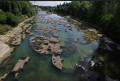
(13) Opposite the factory, turn left and carry on to the River Ain. Follow the river to the bridge.

(14) At the bridge, turn left (from the bridge, you can see the base of the Vouglans Dam).

(15) At the entrance to the village of Menouille, take the first right and follow the road towards the dam for 1 km.

(16) At the junction, turn left to join the D60.

(17) Carry on to the right and drive past the dam. Continue for a further 1.5 km past the dam.

(18) At the bend, leave the D60 by taking the path at the end of the car park. Please note: there are still numerous paths and forest tracks criss-crossing the area, so follow the signposts carefully.

(19) At the road, turn right, then keep right at the Fork in the road further on.

(20) Turn right again, cross the bridge over the stream and you’ll come out onto the forest track near the hamlet of Chavia.

(21) At the hamlet of Chavia, turn right. Continue to follow theGRP® towards the Bourlaches viewpoint, heading mainly north-west.

(22) At the Bourlaches viewpoint, continue to the right down the slope and join the path that runs alongside Lake Vouglan.

(23) Turn left and walk along the lake to Bellecin beach.

(24) Walk past the sewage treatment plant and enter the Bellecin water sports centre. Head for the first building at the top left of the centre (with the lake behind you) to rejoin the signposted path, which starts again behind the building.

(25) Follow theGRP® through the pine forest.

(26) At the hairpin bend, turn right towards the south-east.

(27) Turn left and walk along the lake to Bellecin beach.

(28) Cross the road and head straight on towards the harbour and the restaurants. Go past the restaurants on the left, walk past the campsite and rejoin the signposted path, which continues along the road.

(29) Turn right, following the signposts.

(30) At the factory, turn right again. Walk through the village of Largillay-Marsonnay and carry on straight on to Pont-de-Poitte (D49).

(31) At the roundabout, turn right, passing the Port de la Saisse. Continue to the bridge crossing the River Ain.

(32) Cross the bridge and turn right immediately. Follow the river towards Barésia-sur-l’Ain.

(33) At Piételle, leave the main road and take the path on the right. A little further on, pass the chapel and the small cemetery on your right, then turn immediately right to reach Barésia-sur-l’Ain.

(34) Turn right at the church.

(35) Go straight on and follow the forest track running alongside the lake, towards Coyron. Continue to follow the signposts.

(36) At Auge, turn right, then right again straight after.

(37) Turn right and head towards Coyron. Walk through the village until you reach the D470.

(38) Cross the road (take care) and take the path directly opposite leading to the football pitch. Continue until you reach the four-way junction.

(39) At the junction, turn right towards Maisod and Belvédère de la Braise. Continue for 3 km until you reach the D301.

(40) Turn left for about 50 metres, then turn left again onto the path heading uphill towards Maisod. Back on the D301, turn left, then stay on the road heading right towards Maisod Castle.

(41) After walking alongside the wall surrounding the château, turn right. You are now on the first section of the “La Sirène Enragée” walk. Please be aware that you may encounter families and groups of children.
Carry on until you reach the long descent; at the bottom, turn left towards Port de la Mercantine.
Walk alongside the VVF, carry on to the lake and pass in front of the harbour.

(42) After the harbour master’s office, turn right towards the lowest car park. Go to the end of the car park, walk past the restaurant and take the path on the right. Walk along the lake for a few hundred metres and, before Plage de la Mercantine, take the path on the left. Walk uphill to the D301 and the Neige et Plein Air holiday centre.

(43) Follow the D301 to the right and continue for 1 km.

(44) Take the path on the left (always follow the mountain bike signposts). Join the Route du Lac, continue to the right for 300 m, then take the small path branching off to the right. Carry on until you reach the Jurassienne farmhouse inn.

(45) Walk past the farmhouse inn and take the path at the end of the car park until you reach the tarmac road. On this tarmac road, turn right until you reach the D470 car park. Walk alongside this car park for 100 m.

(46) Just as you’re leaving the car park, take the small path on the right which leads back to the starting point (S/E).


Waypoints

  1. S/E : mi 0 - alt. 1,814 ft - Car park near the Via Ferrata chalet
  2. 1 : mi 0.08 - alt. 2,008 ft - Path on the right
  3. 2 : mi 0.34 - alt. 1,995 ft - On the right
  4. 3 : mi 1.35 - alt. 1,969 ft - To the right
  5. 4 : mi 1.76 - alt. 1,854 ft - Turn left, then right
  6. 5 : mi 2.29 - alt. 1,847 ft - Turn right onto the forest track
  7. 6 : mi 2.53 - alt. 1,824 ft - Left-hand path
  8. 7 : mi 3.5 - alt. 2,028 ft - Turn right onto the forest track
  9. 8 : mi 4.58 - alt. 2,060 ft - Path on the right
  10. 9 : mi 5.12 - alt. 1,886 ft - On the right
  11. 10 : mi 5.59 - alt. 1,604 ft - To the left
  12. 11 : mi 6.82 - alt. 1,335 ft - Path opposite
  13. 12 : mi 7.02 - alt. 1,283 ft - D299, turn right
  14. 13 : mi 7.53 - alt. 1,188 ft - Factory, on the left
  15. 14 : mi 8.06 - alt. 1,109 ft - Turn left onto the bridge
  16. 15 : mi 8.47 - alt. 1,171 ft - Menouille, turn right
  17. 16 : mi 9.24 - alt. 1,184 ft - At the crossroads, turn left
  18. 17 : mi 9.62 - alt. 1,217 ft - RD60, turn right
  19. 18 : mi 10.75 - alt. 1,572 ft - Path at the end of the car park
  20. 19 : mi 12.16 - alt. 1,726 ft - Turn right onto the road
  21. 20 : mi 13.92 - alt. 1,732 ft - On the right
  22. 21 : mi 14.91 - alt. 1,903 ft - Chavia hamlet - Chartreuse de Vaucluse
  23. 22 : mi 14.99 - alt. 1,906 ft - Path on the right
  24. 23 : mi 17.57 - alt. 1,781 ft - To the left
  25. 24 : mi 19.39 - alt. 1,457 ft - Bellecin Beach
  26. 25 : mi 20.46 - alt. 1,430 ft - Path to the left of the building - Lac de Vouglans
  27. 26 : mi 22.12 - alt. 1,647 ft - To the right
  28. 27 : mi 23.49 - alt. 1,667 ft - Pont de la Pyle, opposite
  29. 28 : mi 28.4 - alt. 1,444 ft - On the right
  30. 29 : mi 29.33 - alt. 1,844 ft - Factory, on the right
  31. 30 : mi 29.78 - alt. 1,827 ft - At the roundabout, turn right
  32. 31 : mi 32.14 - alt. 1,585 ft - Turn right after the bridge
  33. 32 : mi 33.58 - alt. 1,437 ft - Piételle, path on the right
  34. 33 : mi 33.96 - alt. 1,427 ft - At the church, turn right
  35. 34 : mi 34.07 - alt. 1,430 ft - At the junction, go straight on
  36. 35 : mi 40.35 - alt. 1,480 ft - Auge, on the right
  37. 36 : mi 41.75 - alt. 1,660 ft - On the right
  38. 37 : mi 43.27 - alt. 1,729 ft - D470, path opposite
  39. 38 : mi 43.68 - alt. 1,772 ft - At the junction, go straight on
  40. 39 : mi 44.71 - alt. 1,745 ft - Turn left, then take the path on the left
  41. 40 : mi 45.16 - alt. 1,729 ft - Junction, turn right
  42. 41 : mi 48.12 - alt. 1,617 ft - Towards the lower car park
  43. 42 : mi 49.12 - alt. 1,421 ft - D301, turn right
  44. 43 : mi 49.51 - alt. 1,417 ft - Path on the left
  45. 44 : mi 50.29 - alt. 1,663 ft - Jura Farm Inn
  46. 45 : mi 50.8 - alt. 1,847 ft - Path on the right before leaving the car park
  47. 46 : mi 51.34 - alt. 1,916 ft - Car park near the Via Ferrata chalet
  48. S/E : mi 52.47 - alt. 1,834 ft - Car park near the Via Ferrata chalet

Notes

Ideal for electric mountain bikes – provided you plan to recharge the batteries at lunchtime – this route is signposted as a major mountain bike route (red mountain bike symbol on a white background, with the letters ‘TLV’).

The ride is long and challenging. Don’t forget to bring plenty of food and drink!
Also remember to take your mobile phone and bike repair kit, as in some places you’ll be far from any road suitable for vehicles.
Throughout the route, you’ll come across a multitude of paths and a variety of markings.
Don’t forget to use the Visorando GPS app.

Worth a visit

(DA) Back at the starting point, you’ll have well earned a refreshing drink at the Regardoir, where you can rest and enjoy a panoramic view of the route you’ve just completed.

Places to see:
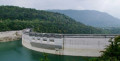
The Vouglans Dam.
The reconstructed gate of the Chartreuse de Vaucluse Abbey.
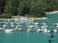
The Bellecin water sports centre.
The Pont de la Pile.
The Regardoir restaurant.
The Saut de la Saisse.
The Marmittes de Pont de Poitte.
The countless viewpoints all along the walk.

Reviews and comments

4.2 / 5
Based on 2 reviews

Reliability of the description
4 / 5
Ease of following the route
4 / 5
Route interest
4.5 / 5
cindy warland
cindy warland

Overall rating : 5 / 5

Date of your route : Aug 13, 2019
Reliability of the description : ★★★★★ Very good
Ease of following the route : ★★★★★ Very good
Route interest : ★★★★★ Very good

Stunning – a brilliant view.

Machine-translated

gazok54
gazok54 ★

Thank you, bohwaz, for this information.
As for the signposting, that is not managed by Visorando.

Machine-translated

bohwaz
bohwaz

Overall rating : 3.3 / 5

Date of your route : Dec 28, 2018
Reliability of the description : ★★★☆☆ Average
Ease of following the route : ★★★☆☆ Average
Route interest : ★★★★☆ Good

Thanks for the information and the suggestion. It really is a good mix of paths, single tracks, woodland, roads and so on.
As time was short with the short December days, I only did the short loop.

Please note that the route is only signposted in the direction indicated here; in the other direction it isn’t signposted, so you’ll have to find your own way. Even if you’re careful, many junctions have no markings at all; fortunately there’s the GPS track, but this doesn’t always match the actual terrain (the IGN map is incorrect).

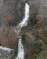
Between points 28 and 29 there’s a tricky descent (slippery rocks, steep), so it’s better to do it the other way round (long, easy descent, short climb where you have to push your bike), especially for the waterfall at the Tour de Meix!

To get here from Lons-le-Saunier (TER), there’s the PLM greenway (joining at Perrigny), which is very pleasant (several tunnels, lovely views, a continuous but easy climb). You can leave it before the last tunnel (GPS 46.6409 5.6792, point 519 on the IGN map): just before the bridge leading to the tunnel (signposted “Tunnel”), turn right, join the small road and, at the first junction, take the track on the right; follow it to the main road, continue on the D678 towards Pont-à-Poitte and take the first right until you rejoin the route at the hamlet of “Poitte”. If you take this route, allow

Machine-translated

Other walks in the area

For more walks, use our search engine .

The GPS track and description are the property of this route's author. Please do not copy them without permission.