


 Country:

 City:
City:



To get to the starting point, head towards Moirans-en-Montagne via the D470, then towards Martigna on the D299. After leaving the roundabout, drive for about 200 m and park on the left.
(S/E) Start the walk by turning left onto the D299 and following it for 200 m. Leave the D299, heading towards “Drôle de Ferme”, and 50 m further on, take the middle path leading towards the farm.
At the farm, take the path leading down to the left and continue along this path to the left at the next fork.
(1) At the junction, follow the path on the right towards Grange Neuve until you reach the forest track.
(2) Turn left and take the first path branching off to the right. Walk along the meadow and continue through the woodland until you reach the Murgin stream.
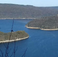
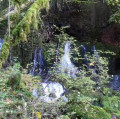
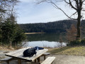
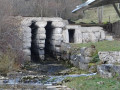
(3) After the small stream, take the path branching off to the left, then 20 metres further on, turn right until you reach the shore of Lac de Vouglans. Head left to discover the Grotte des Forges.
(4) Retrace your steps and continue along the forest track skirting the lake. At the junction with the tarmac road, continue downhill to the left (north-east) until you reach a place known as “Crique de la Refrèche”.
(5) After admiring the cove, head back up the forest track for about 100 metres and, at the signpost, take the first path on the left, following the signs for the Tour du Lac Vouglans. Walk along the left-hand side of the lake until you reach the junction with a steeply ascending path.
(6) Turn right to begin a steep climb, despite the Red Cross and white cross. Be careful, as this is quite a steep climb. Continue uphill until you reach the junction with a tarmac road. At the signpost, head left, following the signs for the Regardoir viewpoint.
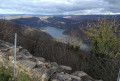
(7) Once at the Regardoir viewpoint, after admiring the superb view of the lake, retrace your steps, passing in front of the Via Ferrata chalet, and continue along the tarmac path. At the top of the small hill, at the signpost marked ‘l’Araignée’, turn right onto the stony path, following the signs for the Tour du lac Vouglans. Carry on to the viewpoint, which offers a bird’s-eye view of the lake.
(8) Continue along the path to begin the descent to the ‘Champ Piernet’ signpost.
(9) Turn left (east) towards Moirans-en-Montagne. Carry on along this path (GR®9) until you reach the track running alongside the D470. Turn right and continue until you reach the roundabout.
(10) Cross the road and continue along the path that runs alongside the D470. Carry on for a further 1 km until you reach the RD299. Head straight on to reach the car park, 200 m away (S/E).

 Visorando Member
 Moderate
 Very difficult


 Easy
Easy 
