Country:

 City:
City:


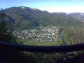
Starting point: Villards-d’Héria. Park at the side of the small road in front of Yasar furniture, on the D470, on the right after the viaduct heading towards Saint-Claude.
(Out/Return) Follow the D470 towards Saint-Claude for 2.5 km.
Watch out for traffic; stay on the hard shoulder. The road climbs gently, giving you a chance to warm up.
(1) When the road widens from 3 to 4 lanes and starts to descend, after this short warm-up, take the first forest track on the right leading to the hamlet of Petit Châtel.
At the end of the track, in front of the fountain, turn left for about 100 metres and pass the landscape gardener’s premises.
(2) Immediately afterwards, take the first path on the right and continue along this path to the left at the next junction.
(3) When you reach the wooded area (Bois des Équevilliers, near the high-voltage power line), follow the track to the right and carry on until you reach the junction.
(4) Continue along the marked path to the right towards Saint-Romain de Roche. Follow this path to the highest point.
(5) At the highest point of the path, follow the sign for Chapelle Saint-Romain.
(6) At the bottom of the descent, turn right and carry on to the chapel and its viewpoint.
(7) At the Chapelle Saint-Romain, enjoy the view over the Bienne Valley and, if you wish, visit the chapel. Return along the path in the opposite direction.
(6) Ignore the path you took on the way there and carry on to the hamlet of Saint-Romain de Roche. Walk through the hamlet until the road splits in two. Keep to the right, up the steep climb, and carry on to the top.
(8) Carry on to the right for a further 200 metres, then begin the descent. Follow this path, ignoring any paths branching off to the right or left, until you reach a wider, more carriageable track.
(9) Turn slightly to the right and weave your way between the two large stones that block motorised vehicles from accessing the Lavans-lès-Saint-Claude fitness trail
Follow the descending route of the fitness trail and carry on along the path, passing the exercise equipment.
Caution: you are on a fitness trail, so you are likely to encounter joggers, walkers and children. Keep your speed under control!
(10) At the end of the fitness trail, cross the road and stay on the path for about 150 metres.
(11) Leave the main path and head left towards a hunting lodge, then immediately take the path on the right. Caution: technical descent.
(12) As soon as you reach the tarmac road, continue left for 150 metres and take the path leading down to the right. Carry on along the second path on the left and emerge back into the housing estate. Go to the end of the street and turn right.
Leave the road at the bend and carry straight on along the path through the fields.
(13) After passing the first hedge, leave this path to the left. This path runs between two rows of trees.
Cross the Lizon Tram Viaduct and carry on to the road. Take the small path directly opposite and walk behind a row of houses until you reach the wider stony track.
(14) On this wider path, turn right and head downhill to the road. At the road, continue to the right, cross the level crossing on the left, then turn right. Walk alongside the old station platforms.
At the end, take the path which first follows the old railway line, then heads down towards the Bienne via a challenging path through the woodland.
(15) At Brive d’Aval, take the wide white path overlooking the river on the right bank as far as Chassal.
(16) At the end of the path, turn left and continue to the right through the village as far as Molinges. Cross the small stone bridge.
(The water flowing under the small stone bridge you cross comes from the many lakes and streams of Grandvaux, where it disappears underground only to resurface at the Grotte de l’Enragé, just above you).
(17) At the end of the road, turn right onto the uphill road immediately after the Bayar company, then continue by turning left, then right, and straight on through the Pavillon housing estate.
(18) At the end of the street, continue along the narrow path that winds its way between two hedges (with the Bornarel Électricité business on your left); follow this path uphill for 50 metres, then take the footpath branching off to the left.
Follow this path to the village of Vaux-lès-Saint-Claude.
Enter the housing estate and carry on to the junction.
(19) Opposite the football pitch, turn right onto the forest track. You are now on the ‘Sentier de Découverte de La Sorcière Attendrie’ trail with its surprising installations.
After this foray into the world of legends, continue your journey along the River La Bienne on your left.
(20) At the three-way junction, take the middle path which runs alongside a meadow. Continue along the fairly technical path to the Moulin crossroads, where you’ll discover the recipe for Papet.
(21) Turn right.
“Don’t forget to refuel, as you’re likely to find the 6km climb ahead of you up to the car park quite a challenge.”
At the end of the long forest track, continue left onto the tarmac road.
(22) At the hamlet of Grand Châtel, turn left past the fountain. Continue along the forest road for about 3 km. Pass under the Villards d’Héria viaduct (you can see the Accro-pont facilities beneath the viaduct).
(23) At the junction with the village road, turn right to reach the viaduct.
Turn left to reach the car park, which is 100 metres away (S/E).
 Visorando Member
 Difficult

 Very difficult