Country:

 City:
City:


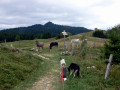
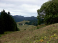
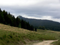
Parking is available on Route de la Pesse, near the hotel-restaurant.
(S/E) Head to the crossroads and follow the D25 to the right, towards Moussières.
(1) At the Fork in the road (sign for “Pré Gaillard 1190 m”), turn left towards L’Embouteilleux (red and white markings forthe GR®509). Pass a ruin on your right and a pretty white house on your left.
(2) Continue straight on along the road towards Berbois (pass the turn-off to the lake on your right). After a right-hand bend, stay on the road, following the yellow and red markings ofthe GRP® Haut-Jura Sud (let theGR®509branch off to the left). The road gives way to a track; continue south-east towards Berbois.
(3) When you reach the D25, follow it to the left for about a hundred metres. Then turn right towards the Ferme de l’Enquerne and, immediately afterwards, pass the entrance to the farm on your right and continue along the road.
(4) Ignore the turn-offs on the right again and continue south-east along a track (black arrows for mountain bikes and yellow arrows). Stay on the main track, which makes a wide circular loop further south, and ignore all turn-offs on the right.
(5) As you emerge from the woods, ignore the path on the left and, further on, another turn-off on the right. Pass in front of a building at a place called Au Reculet and reach a crossroads (sign for “Sous les Loges 1315 m”).
(6) Join theGR® (red and white markings) and turn right (south-west) towards Le Berbois.
(7) At the Col de Malatrait, turn right towards a house and, just in front of the house, turn left into the meadow. Follow the fence and, a little further on, join a path that climbs (there are a few signs featuring a white goat on a red background). Enter the forest and continue climbing. As you emerge from the forest, keep to the right (south-west) and cross a meadow to reach the Crêt du Nerbier.
(8) Then veer left and stay on the ridge (south-south-west). At the T-junction, at the edge of the forest, turn right and head back into the forest. You’ll reach the Route de la Borne au Lion.
(9) Head right for about twenty metres and take thesecond path on the left into the woods (red and white markings). Return to the road and follow it to the right for about fifty metres.
(10) Then take the path on the right (red and white markings). At the Combe Froide building, on the edge of the woodland, head diagonally left and re-enter the woodland. You’ll come to a road at elevation 1224; follow it to the right until the next junction.
(11) Follow the road to the right (still following the red and white markings). Stay on this road and ignore any paths branching off to the sides. Walk past a house on your left, ignore the access to the aerial masts on the left, then look out for a grassy path branching off to the left about fifty metres before the next houses in the hamlet of Le Talonard.
(12) Leave the access to the hamlet of Le Talonnard on your right and take the path on your left through the meadows (red and white markings). Join the access road to La Combe aux Bisons and continue straight on (north). You’ll come out onto the D25 (Route de la Pesse) and follow this to the right until you reach the car park (S/E).

 Visorando Member
 Association / Club / Walk leader
 Tourist office
 Very difficult