Around Mont Robert

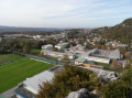
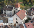
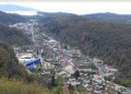
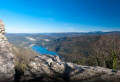
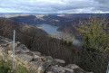
A pleasant route on the slopes of Mont Robert, interspersed with sections through the undergrowth, offering unobstructed views of Moirans-en-Montagne.

Details

2758321
Creation:
Last update:
Last review:
  • Walking
    Activity: Walking
  • ↔
    Distance: 3.63 mi
  • ◔
    Average duration: 2h 20 
  • ▲
    Difficulty: Easy

  • ⚐
    Back to start: Yes
  • ↗
    Ascent: + 794 ft
  • ↘
    Descent: - 771 ft

  • ▲
    Highest point: 2,415 ft
  • ▼
    Lowest point: 1,988 ft

Photos

Description of the walk

To get to the start, leave the D470 (Orgelet – Saint-Claude) at Moirans-en-Montagne and head towards the school complex. Park on the lay-by opposite the southern end of the football ground.

(S/E) From the lay-by, follow the small path that climbs towards the climbing site (signposted).
After exploring the climbing site, return to the starting point and walk along Rue du Collège heading south-south-east for 150 metres.

(1) Leave Rue du Collège and follow the path to the left. Continue along this path for just over 1 km.

(2) When the path splits into two tracks, continue along the one on the left, which heads due south. Please note: although it is not shown on the map, the path does exist and is marked with red markings.
Follow these red markings for approximately 1.7 km, making a wide left-hand bend.

(3) Turn 90° to the left, then right 100 metres further on, to continue the climb.

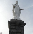
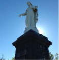
(4) At the junction, head right, then very quickly left towards the Vierge de Moirans viewpoint.

(5) From the Vierge de Moirans viewpoint, enjoy the beautiful view over the town of Moirans-en-Montagne. Then continue down the path.

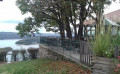
(6) From the Stade Jura Sud viewpoint, continue downhill to Rue Voltaire. Turn left onto Rue du Collège to return to the car park (S/E).

Waypoints

  1. S/E : mi 0 - alt. 1,995 ft - Parking is available near the football ground
  2. 1 : mi 0.19 - alt. 1,991 ft - Path on the left
  3. 2 : mi 0.93 - alt. 2,100 ft - Fork in the road, turn left
  4. 3 : mi 2 - alt. 2,192 ft - Turn left at the fork
  5. 4 : mi 2.71 - alt. 2,303 ft - At the junction, turn right then left
  6. 5 : mi 2.99 - alt. 2,402 ft - La Vierge viewpoint
  7. 6 : mi 3.32 - alt. 2,182 ft - Stade Jura Sud viewpoint
  8. S/E : mi 3.63 - alt. 1,995 ft - Parking is available near the football ground

Notes

To view the car park and starting point: click here

To watch the video showing the route profile: click here

Practical tips for starting the hike:
I strongly recommend using the app on a smartphone, which will also allow you to be geolocated at all times, so you can track your progress accurately.

Watch out for ticks;
A real hazard in the Jura forests – ticks are voracious and can be found everywhere.
Don’t forget to check yourself over after the hike.

There are no water points along the route.

Worth a visit

Toy Museum in Moirans-en-Montagne.

Reviews and comments

4.1 / 5
Based on 4 reviews

Reliability of the description
4.3 / 5
Ease of following the route
4 / 5
Route interest
4 / 5
bguylain
bguylain

Overall rating : 3.7 / 5

Date of your route : May 18, 2026
Reliability of the description : ★★★★☆ Good
Ease of following the route : ★★★☆☆ Average
Route interest : ★★★★☆ Good
Very busy route : No

It’s a shame the trail isn’t well maintained – there are lots of fallen trees – but otherwise it’s a very pleasant walk, with lovely paths through the woodland and a beautiful view of Moirans from the mountains.

Machine-translated

GRP2016DABO
GRP2016DABO

Overall rating : 4.3 / 5

Date of your route : Jul 23, 2024
Reliability of the description : ★★★★☆ Good
Ease of following the route : ★★★★☆ Good
Route interest : ★★★★★ Very good
Very busy route : No

Lovely views of Moirans, particularly around the statue of the Virgin Mary. The trail starts off unmaintained and muddy in wet weather, with a risk of slipping. You can then visit Moirans-en-Montagne. The noise from the nearby road and the chainsaws is certainly a downside.

Machine-translated

joss-lille
joss-lille
• Edited:

Overall rating : 4.3 / 5

Date of your route : Mar 06, 2024
Reliability of the description : ★★★★★ Very good
Ease of following the route : ★★★★★ Very good
Route interest : ★★★☆☆ Average
Very busy route : No

A walk through the woodland on the hills above Moirans. The path is very pretty, but the noise from cars and lorries really spoils it for almost the entire walk.
Please be careful – the descents can be very slippery in places.

Machine-translated

Azimut71
Azimut71

Overall rating : 4 / 5

Date of your route : Sep 03, 2023
Reliability of the description : ★★★★☆ Good
Ease of following the route : ★★★★☆ Good
Route interest : ★★★★☆ Good
Very busy route : No

After the 3, at the top of the long climb, there are several paths: take the one on the right, heading due north, which follows the ridge.
Unfortunately, the peace and quiet of the area is disrupted by the go-kart track situated to the west of the route.

Machine-translated

Other walks in the area

For more walks, use our search engine .

The GPS track and description are the property of this route's author. Please do not copy them without permission.