Country:

 City:
City:


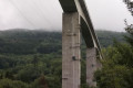
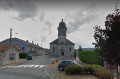
Start in Villards-d’Héria. Park at the side of the small road in front of a furniture shop on the D470, on the right after the viaduct, heading towards Saint-Claude.
(S/E) Cross the D470. Take the small road opposite, continue for 150 m along the village road until you reach the junction.
(1) Turn right onto a small, steeply ascending road. Carry on to the bridge over the Héria, take the small uphill stretch to the right, then turn left at the junction.
Walk through the old village, past the town hall, and continue towards the viaduct.
Just before the viaduct, turn right to rejoin the D470 and carry on to the right. Go round the roundabout and take the exit towards Martigna.
(2) At the first bend, leave the road and take the stony track on the right
.Take care on the downhill sections
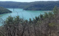
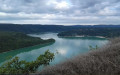
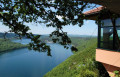
At the end of the track, cross the road and carry straight on to the Belvédère du Regardoir.
(3) On the verge at the Belvédère du Regardoir, head towards the largest open area by following the row of shrubs on the left, then take a small, signposted path leading downhill.
Leave the path, turn left and continue along the tarmac section. Leave the tarmac road and take the path on the left, 50 metres before the D470.
(4) At the Auberge Jurassienne, cross the road and continue along the path opposite for about 6 km until you reach a three-way junction.
Take care: there are two road crossings and you’ll reach the junctions quite quickly.
(5) Take the track on the right. Cross the D470 and carry on straight ahead.
In the village of Coyron, ignore all roads and paths coming from the left or right until you reach a signposted junction for Meussia.
(6) Follow the sign for Meussia to the right. Continue in this direction until you reach the junction.
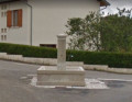
(7) Turn right at the junction and carry on to the village. At the fountain, turn left and walk through the village.
(8) At the junction, head straight ahead and follow the signs for Étival, passing to the left of the church.
Carry on along this tarmac road for about 6 km. Leave the road towards Étival at thefirst junction with another tarmac road on the right.
(9) Head towards Les Ronchaux. Ignore all the side roads until you reach the junction with a tarmac forest track.
(10) Turn right towards Les Crozets. Continue along the forest road for 4 km. Enter the village.
(11) After the church, turn right towards Ravilloles. Continue along the forest road for about 4 km.
(12) Leave the road towards Ravilloles before the descent and carry on along the forest road on the right, which climbs steeply towards the hamlet of Montain.
(13) Just after a fairly sharp bend, keep left onto the forest track.
(14) Before the large yellow house, continue along the forest track to the left.
(15) Turn right off the forest track and take the La Ragea forest track for about 2 km.
(16) At a place called La Ragea, leave the forest track and continue along the path towards Les Louvières, to the right.
Carry on along the forest track until you reach the sign for Les Louvières. Ignore this sign and carry on along the track to the left for about 300 metres.
(17) At the yellow signpost, continue along the path leading down to the left.
Head down the slope to the D470.
(18) Cross the D470 and carry on towards Petit Châtel.
Pass through the hamlet of Champied, go through the hamlet of Petit Châtel and take the forest track leading to Grand Châtel.
(19) In the hamlet of Grand Châtel, turn right past the fountain. Continue along the forest road for about 3 km.
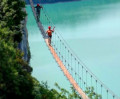
Pass under the Villards-d’Héria viaduct (you can see the Accro-pont facilities beneath the viaduct).
(1) At the junction with the village road, turn right twice to reach the viaduct. There, turn left to reach the car park, which is about a hundred metres away (S/E).
 Visorando Member
 Difficult
 Very difficult