Country:

 City:
City:


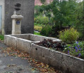
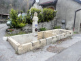
Meet at Grand Châtel, and park near the fire hydrant, which is on the left after the fountain in the centre of the hamlet.
(S/E) Start the walk by taking the stony path on the right towards Grand Châtel.
Continue along this path. After a left-hand bend followed shortly by a right-hand bend, you’ll come to a crossroads with a footpath.
Please note: this path is not immediately visible. It is on the right. Look out for the red-orange stones on the ground and, just past this marker, a red dot on a tree.
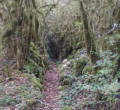
(1) Leave the forest track and take the path on the right. The first few metres are through tall grass. Follow the red marks on the trees until you reach a water catchment.
Then continue downhill (the red marks have disappeared); look out for the stream on your left. At the wire fence, cross the stream and follow its course to rejoin a proper path. You’ll reach the junction with theGRP® variant of the Tour du Haut-Jura Sud
(2). Turn left onto it and follow the yellow and red markings. Carry on until you reach a meadow. At the signpost, follow the directions for Vaux Stadium.
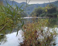
Go round the meadow on the right and carry on straight ahead along the forest track that runs alongside the Bienne. At the end of the bend, you’ll come to another junction.
(3) Leave theGRP® here and take the path on the left. You’ll then face a steep climb.
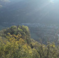
(4) When you reach the Chapelle Saint-Romain, take a short break to admire the view over the Bienne valley and the village of Vaux-les-Saint-Claude.
Continue along the path, passing behind the chapel. You’ll rejoin the GRP®.
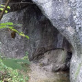
(5) Turn left onto it and continue slightly uphill, passing close to the Lacuzon Cave. Stay on theGRP®, passing under the high-voltage power line before reaching another junction with a signpost.
(6) Leave theGRP® and turn left towards Grand Châtel and Petit Châtel. Near the high-voltage power line, the path splits into two.
(7) Follow the path on the right, running parallel to the high-voltage power line, and continue keeping to the right at the following junctions until you reach the hamlet of Petit Châtel.
(8) Turn left and carry on to the fountain. Take the path on the right between the houses and continue along the forest track to reach the D470.
(9) Turn left onto it for a few hundred metres, cross the road and continue along the small road on the right, running parallel to the RD470. You’ll come to the Grotte de Coinans, which is hidden amongst the bushes.
If there is no water, you can enter it safely.
(10) Stay on this road, ignoring the one branching off to the right at the bend. Join the RD470 again.
Turn left onto it and follow it for about 200 metres, until you reach the next junction.
(11) Turn right onto the forest track. Stay on the main track at all times.
On the descent, the track turns into a footpath. Continue downhill until you reach a fenced-off water intake. Carry on for another hundred metres or so until you reach a small path branching off to the right.
(12) Turn right onto the path and head straight on to reach the Grand Chatel car park (S/E).

 Visorando Member
 Moderate
 Easy
Easy