Country:

 City:
City:


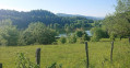
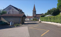
Park in the car park at the Moirans-en-Montagne village hall.
(S) Head towards the post office, then turn right onto Rue de Saint-Claude, heading south. At the junction, head towards Les Crozets, then turn right 50 metres after the junction to continue towards Roche Rive. At the end of this street, follow the narrow path for 1.2 km until you reach the D470. Continue towards the roundabout, then take thethird exit towards Martigna. Walk for about a hundred metres until you reach a junction.
(1) Turn left onto the stony track. Pass the Grange de Pré and then the Grange de Bioux. Here, take a wide circular route to the right to reach the junction with the D295.
(2) Turn left onto this road and head towards the church in the village of Martigna.
(3) Continue along this road to reach Lac de Chanon and, more specifically, the signpost for Côte Venière.
(4) Turn right onto thePR®®, marked in yellow, towards Nezan. In a bend, you’ll come to the signpost for the Chemin de Cruzille.
(5) Continue westwards, keeping towards Nezan. Pass through the Cruzille woods and the Prés au Loup to reach the hamlet of Nezan.
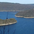
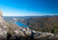
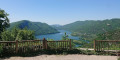
(6) Turn right towards Chancia. Leave the hamlet and continue along the stony track, following the yellow markings. Please be aware that there are Patou dogs here guarding the herds. Continue down the slope, crossing the tarmac forest track several times. You will then reach the viewpoint overlooking Chancia. Enjoy the superb view of Lake Coiselet.
(7) Continue downhill along the tarmac road, then turn left onto the path marked in yellow. Carry on downhill, crossing the tarmac road several times, until you reach the signpost for Sur Vallière.
(8) Carry on straight ahead to the Chancia roundabout.
(9) Cross Rue du Jura carefully – this is also the D60E2. After a few metres along the village street, turn right to walk alongside the lake on your left-hand side.
(10) Follow the lakeshore to the entrance to the campsite, where you’ll rejoin the D60E2. Take this road straight ahead with care and stay on it until the junction after crossing the River Ain.
(11) Turn left onto the road towards Condes. Continue along this road, taking great care with the traffic. You’ll come to another junction just before a high-voltage pylon.
(12) Turn right onto the white track, which climbs steeply towards Nord-Oues (a red sign indicates a watercourse where motor vehicles are prohibited). Begin the climb to reach the Y-junction markedPR®®.
(13) Take the left-hand fork and follow the yellow markings towards Olliferne Castle. Continue uphill until you reach Au-dessus-des-Puits. Take the track on the left to reach Olliferne Castle (E) quickly, today’s campsite.
 Visorando Member
 Easy
Easy 
 Moderate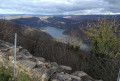
 Very difficult