The remote valleys of the Enragé

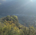
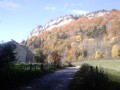
On this fairly challenging route, you’ll enjoy panoramic views and sounds of the Bienne valley.
A fairly challenging route, but the scenery is well worth the effort.

Details

2766780
Creation:
Last update:
Last review:
  • Walking
    Activity: Walking
  • ↔
    Distance: 5.26 mi
  • ◔
    Average duration: 3h 35 
  • ▲
    Difficulty: Difficult

  • ⚐
    Back to start: Yes
  • ↗
    Ascent: + 1,322 ft
  • ↘
    Descent: - 1,309 ft

  • ▲
    Highest point: 2,126 ft
  • ▼
    Lowest point: 1,112 ft
  • ⚐ Country: France
  • ⚐
  • ⚐ City: Pratz (39170)
  • ⚑
    Start/End: N 46.366067° / E 5.752461°
  • Accessible from the train station Gare de Molinges.
  • ❏
    IGN map(s): Ref. 3327OT, 3328OT
  • Hour-by-hour weather

Photos

Description of the walk

To reach the start point, head to Pratz on the D470, then follow signs for Saint-Romain.
Park before entering the village in the car park reserved for hikers and walkers.

(S/E) Head towards the village, then take the first street on the left, which goes uphill all the way to the last house on the right.

(1) Leave the street and follow the path that branches off to the right, heading south towards Pas de l’Âne/Molinges.
Stay on this path for about 2 km, ignoring any paths coming from either side, and continue to follow the signs for Pas de l’Âne and the red and white markings. At the end of the path, leave the sign for Pas de l’Âne on your left and follow the sign on your right for Chassal/Molinges.

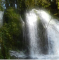
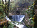
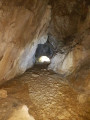
(2) After about fifty metres along the path, take the track on the right to head towards the Grotte de l’Enragé and the waterfalls, which appear depending on the season.
Please note: the path is not signposted but is easy to spot. Take great care! Do not go too close to the banks when the water is flowing strongly; and when there is no water, the rocks in the riverbed leading to the cave are slippery.

Turn back.

(2) Continue to the right along the path for 150 metres until you come to a small track branching off to the right.
Please note, this narrow path is not signposted and is not very visible. If you cannot find it, carry on straight ahead.

If you have found the narrow path (see map), follow it alongside the stream for a few hundred metres, then continue south-west until you reach the road.

(3) Continue to the right onto the D63E1. Follow the Bienne until you reach a small business (a building with blue cladding). Take the small street next to the business and, once at the top, turn right into the Pavillon housing estate.
Carry on to the end of the street and continue along the path between the two rows of conifer hedges.

(4) At the signpost, turn left (south-south-west), away from the direction of Saint-Romain. Please note: even though your final destination is Saint-Romain, at this point you must follow the direction opposite to that indicated on the sign!

Continue along this path until you reach the entrance to the village of Vaux-lès-Saint-Claude.

(5) At a place called Les Granges de Chiriat, take the path to the right of the white house towards Saint-Romain. Please note: the climb is quite steep and rather long. Take a moment to catch your breath.

(6) Be careful here! It’s not easy to find the right path. Head left towards the north-north-east along a narrow, barely visible track 4 to 5 metres past the sign.

Continue along the path, which continues to climb steeply, until you reach a meadow. Cross the meadow towards the pine forest, then follow the path on the left alongside it until you come to a wide path of white pebbles.
Carry on along this path to the left until you reach Saint-Romain.

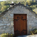
(7) Opposite the bread oven, continue to the left towards the Saint-Romain-de-Roches chapel.
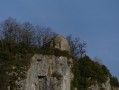
After the second bend, just past the monks’ spring, take the small path on the right to reach La Roche de Vaux, unless you’d prefer to visit the Saint-Romain Chapel – if you haven’t seen it before, it’s well worth a detour.

(8) When you reach the inverted Y-Fork in the road, follow the path that winds to the right and head down to the starting point (S/E).

Waypoints

  1. S/E : mi 0 - alt. 2,024 ft - Car park at Saint-Romain de Roche
  2. 1 : mi 0.18 - alt. 2,077 ft - Turn right after the last house
  3. 2 : mi 1.57 - alt. 1,230 ft - Path on the right
  4. 3 : mi 2.25 - alt. 1,148 ft - D63E1 - Bienne (rivière)
  5. 4 : mi 2.83 - alt. 1,211 ft - Signpost, on the left
  6. 5 : mi 3.8 - alt. 1,112 ft - Granges de Chiriat, on the right
  7. 6 : mi 4.06 - alt. 1,575 ft - Junction: turn left
  8. 7 : mi 4.59 - alt. 2,014 ft - Bread oven, on the left
  9. 8 : mi 4.91 - alt. 2,126 ft - At the fork in the road, turn right
  10. S/E : mi 5.26 - alt. 2,021 ft - Car park at Saint-Romain de Roche

Notes

To watch the video of the route profile: click here

Practical tips for starting the hike:
I strongly recommend using the app on a smartphone, which will also allow you to be geolocated at all times, so you can track your progress accurately.

I completed this route on a lovely sunny day with good walking conditions (dry ground). I cannot guarantee that it will be passable when the ground is soggy or snow-covered, or obstructed by trees felled by foresters.

Watch out for ticks;
a real problem in the Jura forests; ticks are voracious and can be found everywhere.
Don’t forget to check yourself over after the walk.

No water points. Picnic area at Saint-Romain, at the Chapelle Saint-Romain.

Worth a visit

Saint-Romain-de-Roche Chapel.
Port de Molinges.

Reviews and comments

4.5 / 5
Based on 4 reviews

Reliability of the description
4.5 / 5
Ease of following the route
4 / 5
Route interest
5 / 5
jpv1950
jpv1950

Overall rating : 4.3 / 5

Date of your route : Jul 06, 2026
Reliability of the description : ★★★★☆ Good
Ease of following the route : ★★★★☆ Good
Route interest : ★★★★★ Very good
Very busy route : No

Logging has altered the route in some places, but you can follow the trail to find the path again. It is impossible to reach the cave

Machine-translated

anges123
anges123

Overall rating : 4.7 / 5

Date of your route : Aug 23, 2022
Reliability of the description : ★★★★★ Very good
Ease of following the route : ★★★★☆ Good
Route interest : ★★★★★ Very good
Very busy route : No

A very well-described route, which I completed in 2 hours 40 minutes. The only snag was at the waterfalls – I went round in circles for 15 or 20 minutes before finding my way back, having to make my way through brambles and tall grass (without my GPS, I reckon I’d still be going round in circles…)
From point 5, there’s a HUGE and LONG climb.
A lovely route best suited to those in good physical shape for the ascent – the only difficult part of the route.

Machine-translated

Loic Morel
Loic Morel

Overall rating : 4.7 / 5

Date of your route : Nov 22, 2020
Reliability of the description : ★★★★★ Very good
Ease of following the route : ★★★★☆ Good
Route interest : ★★★★★ Very good

Thank you very much!!

Machine-translated

Other walks in the area

For more walks, use our search engine .

The GPS track and description are the property of this route's author. Please do not copy them without permission.