Crêtes du Mont Chabot à partir de Saint-Claude

Le Mont Chabot est une des montagnes-phare dominant la ville de Saint-Claude.
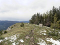
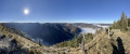
Il s'agira d'accéder à sa crête en empruntant un parcours en boucle partielle permettant de visualiser de superbes points de vues sur la ville et les alentours. La randonnée est assez courte, mais attention certains passages sont relativement raides et peuvent s’avérer glissants.
Attention : le parcours présenté en 2016 vient d'être partiellement remanié (lire § Infos pratiques).

Details

417196
Creation:
Last update:
Last review:
  • Walking
    Activity: Walking
  • ↔
    Distance: 2.49 mi
  • ◔
    Average duration: 2h 25 
  • ▲
    Difficulty: Difficult

  • ⚐
    Back to start: Yes
  • ↗
    Ascent: + 1,480 ft
  • ↘
    Descent: - 1,480 ft

  • ▲
    Highest point: 2,838 ft
  • ▼
    Lowest point: 1,473 ft

Photos

Description of the walk

Le départ est situé à Saint-Claude au Chemin de la Combe du Marais, à proximité d'un parking dominant le cimetière.

(S/E) Empruntez un passage entre deux immeubles situés à quelques mètres d'une rue en cul de sac (attention aucune indication n'est visible), puis assez rapidement gravissez la pente. Le sentier fraye son chemin au mieux dans un environnement rocheux et la pente est relativement raide avec certains passages pouvant être délicats.

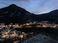
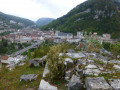
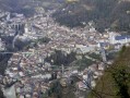
(1) Arrivez assez rapidement (environ 5 mn) à un surplomb avec vue sur le socle d'une ancienne madone : il s'agit d'un très beau point vue sur la ville de Saint-Claude (dont le Grand Pont et la cathédrale). Continuez le sentier sur une pente modérée au début, mais qui s'accentue de manière sensible après. Après quelques minutes de montée continue, arrivez à une bifurcation.

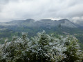
(2) Suivez le sentier de gauche. Ce dernier continue d'évoluer avec quelques passages en pente raide ; en cours, le tracé passe à proximité de jolis points de vue sur la vallée du Tacon. Plus loin, arrivez à une bifurcation. Obliquez à gauche afin d'atteindre le Belvédère du Marais qui est tout proche (joli point de vue sur la vallée du Tacon).

(3) Revenez sur vos pas et obliquez à droite à la bifurcation en reprenant le même tracé qu'à l'aller. Après une petite descente, continuez jusqu'à atteindre la 2ème petite combe. Allez à gauche en suivant le fond de la combe sur un itinéraire hors chemin et non balisé ( pas de difficulté à rencontrer à l'exception d'un court raidillon).

Après un petit replat, continuez dans le sens de la descente en mode azimut : allez tout droit, puis prenez une orientation sur la droite. Il s'agit de la seule difficulté rencontrée au niveau de l'orientation. Plus bas, le chemin menant à l'Oiselière est rejoint, il faut virer à droite et continuer jusqu'à un lacet.

(4) Allez sur la droite presque tout droit. Environ 250m plus loin, le sentier mène à un belvédère aménagé avec des vues du côté Ouest sur la vallée de la Bienne. Le sentier remonte légèrement sur quelques mètres avant de prendre un sens descendant sans excès et aboutit à la bifurcation rencontrée à l'aller.

(2) Filez tout droit en faisant attention au terrain si ce dernier est glissant. Suivez le même chemin qu'à l'aller pour revenir au point de départ (S/E).

Waypoints

  1. S/E : mi 0 - alt. 1,473 ft - Saint-Claude – Car park overlooking the cemetery
  2. 1 : mi 0.07 - alt. 1,588 ft - Madonna’s pedestal
  3. 2 : mi 0.42 - alt. 2,224 ft - Junction: Circular. Near the - Grotte du Diable (Saint-Claude)
  4. 3 : mi 1.23 - alt. 2,838 ft - Belvédère du Marais (Saint-Claude)
  5. 4 : mi 1.56 - alt. 2,503 ft - Junction towards the viewpoint
  6. S/E : mi 2.49 - alt. 1,473 ft - Saint-Claude – Car park overlooking the cemetery

Notes

The starting point can be seen here.

This is not a new walk. You can see the route described here in the *Journal du Progrès*, although it is shown going in the opposite direction at the circular route.

Please note: the original route, dating from 27 November 2016, was revised on 25 September 2019 in the vicinity of the Belvédère du Marais, as the access route via L’Oiselière has been blocked off by a landowner.
I have not found any alternative access routes after examining the cadastral map and surveying the terrain on site on several occasions
Part of the route therefore now runs off-trail between points (3) and (4): finding your bearings can be tricky (partly by azimuth through the undergrowth) and you’ll need to be very careful about which direction to take.

Overall, the route is straightforward to follow:
- From (S/E) to (3): the route poses no problems; yellow markings are sparse at the start but become more visible further on.
- From (3) to (4): part of the route is off-trail and unmarked during the descent. The rest of the route poses no problems (no markings).
- From (4) to (2): the path is clearly visible (no markings).
- From (2) to (S/E): the route is clearly visible (yellow markings). Take care on the steep sections of the descent.

Footfall: low throughout the route.

Alternative route:
At point (4), after a possible round trip to the viewpoint, continue along the Chemin de l’Oiselière to reach a small road further down. Follow this road to the right, heading downhill (visible yellow markings).
At the end of the road, take the street on the right to return to the starting point.
The advantage of this route is that it avoids steep sections which may be slippery.

Good walking boots are recommended.

Worth a visit

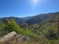
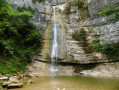
- Le parcours est ponctué de nombreux points de vues. Outre les accès bien visibles, je vous en recommande un qui est accessible en 5 minutes à partir du point GPS N 46.38024° / E 5.862787°.

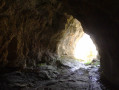
- Accès relativement facile à une grotte (pas de nom) avant la bifurcation ((2)) au point GPS N 46.37945° / E 5.861389°.

Reviews and comments

3.7 / 5
Based on 2 reviews

Reliability of the description
4 / 5
Ease of following the route
3.5 / 5
Route interest
3.5 / 5
User 27734151

Overall rating : 2.7 / 5

Date of your route : Sep 29, 2025
Reliability of the description : ★★★☆☆ Average
Ease of following the route : ★★★☆☆ Average
Route interest : ★★☆☆☆ Disappointing
Very busy route : No

A little-used and very slippery path

Machine-translated

Henka
Henka

Overall rating : 4.7 / 5

Date of your route : Oct 29, 2023
Reliability of the description : ★★★★★ Very good
Ease of following the route : ★★★★☆ Good
Route interest : ★★★★★ Very good
Very busy route : No

Hike done at dawn to watch the sun rise over the ridges above Saint-Claude. Very beautiful views and panoramas. The path seems fairly unfrequented and the markings are indeed very discreet
The description of the hike is very good; the descent between points 3 and 4 is unmarked and off-trail but not very complicated, even if you do wonder which valley to descend through. It is easy to reach the forest road. I recommend avoiding the return via this road and following the route described. The road is of no interest.

Machine-translated

Other walks in the area

For more walks, use our search engine .

The GPS track and description are the property of this route's author. Please do not copy them without permission.