From Saint-Claude to the heights of Septmoncel, a circular route

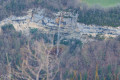
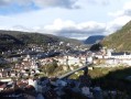
I suggest you try this lovely, slightly challenging route from Saint-Claude to the heights of Septmoncel. Along the way, you’ll come across some lovely views.

Details

48462697
Creation:
Last update:
Last review:
  • Walking
    Activity: Walking
  • ↔
    Distance: 10.35 mi
  • ◔
    Average duration: 7h 40 
  • ▲
    Difficulty: Difficult

  • ⚐
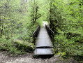
    Back to start: Yes
  • ↗
    Ascent: + 3,356 ft
  • ↘
    Descent: - 3,353 ft

  • ▲
    Highest point: 3,720 ft
  • ▼
    Lowest point: 1,407 ft

Photos

Description of the walk

The route starts from the Pont de l’Isle car park on the RD436 road towards Geneva.

(S/E) With your back to the road, take the path running alongside the river on your left for about 800 m.

(1) Just before the path steepens significantly, look out for the start of a track on the right (marked by a cairn) and follow it uphill. Shortly afterwards, the route continues along a track suitable for vehicles, still heading uphill; ignore the junctions to the right and left, then head downhill.

(2) Once you reach Montbrillant, continue along the RD436 road to the left, heading uphill for about 1 km (watch out for traffic).

(3) Shortly after passing through the tunnel, take a path on the right, heading downhill, following the yellow markings.

(4) At a fork, continue along the path to the left towards the Saut du Chien: the uphill slope is steep in places (there are cables at the top of this section).

(5) Follow the road to the right for about 200 m (watch out for traffic) and take a path on the left which cuts across the hairpin bends twice.

(6) Continue along the path towards Sur les Grès, walking across meadows on fairly steep slopes. Along the way, you can optionally take a detour to a lovely spot of interest (see the ‘During the walk’ section).

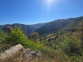
(7) Near the summit of Sur les Grès, there are some lovely views to enjoy: continue to the right along the path towards Septmoncel. At thefirst junction (Chemin des Moines), keep right and then, fairly soon after, turn left towards the Col de la Tendue. You’ll then come across a roller-ski track; take either the one on the right or the one on the left, as you prefer. At the junction, carry on straight ahead across the open space.

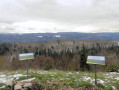
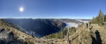
(8) You’ll reach a lovely viewpoint at a paragliding launch site. Retrace your steps slightly back to the previous junction and turn left onto a path leading downhill. The slope then becomes steeper; continue along the path until you reach a fork.

(9) Carry on to the left towards the Col de la Tendue, on a slope that is quite steep to begin with.

(10) Further up, you’ll come to a lovely viewpoint. Follow the path as it winds up and down like a rollercoaster. You’ll reach the Col de la Tendue, which offers another lovely view.

(11) Carry on to the left towards La Main Morte, following theGR®®9(white-red) markings. The slope, which is gentle at first, becomes steeper further on.

(12) You’ll come to a large timber storage area: leave the signposted route and continue left along the forestry track. As you go, always keep right at the various junctions you encounter (note that the path is, at times, somewhat uneven). Further down, you’ll come to a fork in the track.

(13) Continue to the left, heading south-west, along the path, then ignore the paths branching off to the right and left as you come to them. (If in doubt, we recommend using a GPS app.)

(14) After a fair while, you’ll come to a clearly marked hairpin bend; then, shortly after passing under a power line, follow a path on the left and cross the track twice.

(15) Near La Grange des Orgières, cross a track and take the path heading downhill. Further down, rejoin a track and follow it to the right.

(16) Further on, cross the river via the footbridge (taking the right-hand route), then turn left. Once you reach the road (RD436), continue left over the bridge to return, shortly afterwards, to the car park (S/E).

Waypoints

  1. S/E : mi 0 - alt. 1,414 ft - Pont de l’Isle car park
  2. 1 : mi 0.52 - alt. 1,637 ft - Junction – Cirque des Foules
  3. 2 : mi 1.38 - alt. 1,801 ft - MontBrillant
  4. 3 : mi 1.99 - alt. 2,014 ft - RD436 road – Roche Percée Tunnel
  5. 4 : mi 2.35 - alt. 1,788 ft - Junction towards the - Le Flumen (affluent du Tacon)
  6. 5 : mi 2.73 - alt. 2,300 ft - RD436 road – Saut du Chien
  7. 6 : mi 2.94 - alt. 2,467 ft - Le Chapeau de Gendarme (Septmoncel)
  8. 7 : mi 3.75 - alt. 3,573 ft - Sur les Grès
  9. 8 : mi 4.55 - alt. 3,366 ft - Replan viewpoint
  10. 9 : mi 5.35 - alt. 3,261 ft - On the Roche
  11. 10 : mi 5.8 - alt. 3,602 ft - Pointe de la Roche viewpoint
  12. 11 : mi 6.76 - alt. 3,701 ft - Col de la Tendue viewpoint
  13. 12 : mi 7.41 - alt. 3,314 ft - Junction
  14. 13 : mi 7.92 - alt. 2,900 ft - Junction – La Queue Jacques
  15. 14 : mi 9.32 - alt. 2,254 ft - Lacet des Foules
  16. 15 : mi 9.71 - alt. 1,860 ft - Junction – Grange des Orgières
  17. 16 : mi 10.18 - alt. 1,424 ft - Grosdar footbridge
  18. S/E : mi 10.35 - alt. 1,414 ft - Pont de l’Isle car park

Notes

The starting point can be viewed on Google Maps: click here.

Please take your rubbish away with you – nature will thank you for it.

Good walking boots and walking poles are recommended.

Below is a difficulty rating for each section (a route is not uniform):
- green: fairly easy walking with no significant elevation changes or difficulties.
- Blue: steeper slopes and/or greater elevation changes on a well-marked route.
- Orange: routes presenting some technical difficulties and/or poor route conditions (markings or visibility of the path).

From (S/E) to (2): blue difficulty
No significant difficulties encountered. At most:
- the lower part of the route may be damp (due to springs)
- locating the path at the point (1), where care is required
This section has no markings or signposts (only a cairn marks the start of the path at the point (1))

From (2) to (3): green difficulty
The route follows a fairly busy road, so you need to be quite careful. Given the layout of the road, I advise you to keep to the right-hand side and behind the barriers where possible.
Yellow markings

From (3) to (4): green difficulty
No particular difficulties encountered.
Yellow markings

From (4) to (5): orange difficulty
The main difficulty is the slope, which is a little steep in places
Yellow markings

From (5) to (6): blue difficulty
The route initially runs alongside the road (watch out for traffic), then follows a path cutting across the road’s bends.
Yellow markings

From (6) to (7): orange difficulty
The path runs mainly through meadowland. The main challenge is the fairly steep gradient, which continues throughout.
Yellow markings

From (7) to (8): blue difficulty
The path is fairly easy on the whole.
Yellow markings

From (8) to (9): blue difficulty
The route initially follows a gentle downhill slope, after which it becomes much easier.
Yellow markings

From (9) to (10): blue difficulty
The gradient is a little steep at the start, then the route levels off for a while before encountering a few short, steep climbs.
Yellow markings

From (10) to (11): blue difficulty
No significant difficulties encountered on a route that alternates between ascents and descents.
Yellow markings, and white and redGR®® markings just before the approach to the Col de la Tendue.

From (11) to (12): blue difficulty
Follow a path that runs level for a while, then begins to descend
White-redGR®®9markings.

From (12) to (13): blue difficulty
You’ll follow a reasonably easy forest track, with a few steep downhill sections.
Unmarked section.

From (13) to (14): blue difficulty
The route is fairly easy to follow.
Unmarked section

From (14) to: blue difficulty
The slopes encountered are quite steep in places.
Unmarked section

From to (S/E): green difficulty
A fairly easy section
Yellow markings

Worth a visit

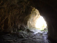
  • Grotte de la Roche Percée: between points (6) and (7), I suggest you make a return trip to visit this fascinating site (descent = approx. 90 metres – estimated time = approx. 10 mins). Please note that the slope is quite steep in places and there is one section where you’ll need to use your hands. Click here to view the route.
  • Grotte des Foules: this is a site well-known to cavers and requires specialist equipment. Click here to find out more. Access is via a footpath starting at point (14), where you’re unlikely to come across many people. Please note: the route includes a few exposed sections above a ravine where you’ll need sure-footedness. Click here to view the access route
  • The route partly follows the Sentier des Diots trail, but in the opposite direction. Informative signposts are provided at the various points of interest along the way. Click here to find out more. It also partly follows the Sentier des Chamois trail: click here to find out more.

Always be cautious and plan ahead when you're outdoors. Visorando and the author of this route cannot be held responsible for any accidents occurring on this route.

The GR® and PR® markings are the intellectual property of the Fédération Française de Randonnée Pédestre.

Other walks in the area

For more walks, use our search engine .

The GPS track and description are the property of this route's author. Please do not copy them without permission.