Over hill and dale around Mont Saint-Christophe

This route takes you over hills to the tops of cliffs, with viewpoints that invite you to contemplate the lush green countryside, and through valleys and deep, steep-sided gorges, offering cool respite and the chance to discover a natural world rich in diverse flora and fauna.
A 10 km route with some good climbs on all types of terrain awaits you from start to finish, offering a sense of tranquillity and a few panoramic views well worth capturing on camera.

Details

2740589
Creation:
Last update:
Last review:
  • Walking
    Activity: Walking
  • ↔
    Distance: 6.15 mi
  • ◔
    Average duration: 3h 50 
  • ▲
    Difficulty: Moderate

  • ⚐
    Back to start: Yes
  • ↗
    Ascent: + 1,125 ft
  • ↘
    Descent: - 1,109 ft

  • ▲
    Highest point: 2,690 ft
  • ▼
    Lowest point: 2,005 ft

Photos

Description of the walk

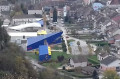
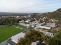
To reach the start, head towards the village of Moirans-en-Montagne. The car park is situated in front of the fire station and the Pierre Vernotte secondary school.

(S/E) Set off due north, passing in front of the fire station.

(1) At the junction, cross Avenue de Franche-Comté, turn left and then follow the forest track on the right heading north-west towards the Chazier farm.

(2) Walk past Chazier Farm and continue along the track heading north-east.

Go through the gates, closing them behind you, and carry on until you reach a concrete track.

Follow this track for about 200 metres downhill to reach a junction with a footpath.

(3) Turn right onto this path and you’ll soon come to the Discovery Trail. Walk alongside the pond and continue along the path until you reach the Mont Saint-Christophe Forest Road.

(4) Turn right onto it and walk to the right-angled junction with a forest track.

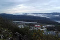
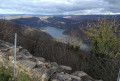
(5) Keep going straight ahead on the forest track to reach the radio masts. Take a moment here to enjoy the magnificent view from this viewpoint.

(6) Turn back to the previous junction.

(5) Leave the forest road and continue along the forest track to the right. Please note that on this section the tracks are not signposted but are clearly marked and passable.

At the top of the track, turn left and follow the edge of the woodland to the Labry barn. Walk past the barn.

(7) After the Labry barn, continue along the path on the right. Stay on this path at all times, ignoring any branches to the right or left, until you reach the Grange de Troile crossroads.

(8) Turn sharply 90° to the right onto the forest track, which is suitable for vehicles. You will then begin a gentle descent. At the Y-junction, keep to the right, following the signs for Moirans-en-Montagne.

Further on, you’ll come to the signpost for Tongea.

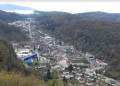
(9) Leave the forest track and turn right onto the yellow-marked path. You’ll arrive at the viewpoint overlooking Moirans.

(10) Continue to the foot of Les Antennes. At the hairpin bend, keep left on the path to complete the descent and return to the original junction with Avenue de Franche-Comté.

(1) Follow the same route as on the way there to return to the fire station car park (S/E).

Waypoints

  1. S/E : mi 0 - alt. 2,008 ft - Fire station car park
  2. 1 : mi 0.15 - alt. 2,011 ft - Crossroads at the end of the circular loop
  3. 2 : mi 0.52 - alt. 2,195 ft - Ferme du Chazier
  4. 3 : mi 1.08 - alt. 2,172 ft - Junction leading to the nature trail
  5. 4 : mi 1.62 - alt. 2,077 ft - Forest Road
  6. 5 : mi 2.36 - alt. 2,310 ft - Forest track junction
  7. 6 : mi 2.69 - alt. 2,444 ft - Branches
  8. 7 : mi 3.6 - alt. 2,415 ft - Grange Labry
  9. 8 : mi 4.17 - alt. 2,657 ft - Grange de Troile
  10. 9 : mi 5 - alt. 2,484 ft - Tongea signpost
  11. 10 : mi 5.35 - alt. 2,516 ft - Viewpoint
  12. S/E : mi 6.15 - alt. 2,008 ft - Fire station car park

Notes

To view the car park and starting point: click here

This route is not suitable for pushchairs.
There are no water points along the route.

Watch out for ticks: don’t forget to check yourself over after the walk.

Worth a visit

Toy Museum

The Lycée Pierre Vernotte, a vocational college specialising in woodworking, is renowned for its highly specialised training programmes in the field of arts and crafts. The history of Moirans-en-Montagne, whose thriving economy was based on its many woodturning workshops, has earned the town its ‘Ville et Métiers d’Arts’ (Town of Arts and Crafts) status. The Lycée Pierre Vernotte is a modern testament to this rich ancestral heritage and a beacon for the future.

Reviews and comments

4.1 / 5
Based on 3 reviews

Reliability of the description
4 / 5
Ease of following the route
3.7 / 5
Route interest
4.7 / 5
Josy BOURGEOIS
Josy BOURGEOIS

Overall rating : 5 / 5

Date of your route : Aug 08, 2024
Reliability of the description : ★★★★★ Very good
Ease of following the route : ★★★★★ Very good
Route interest : ★★★★★ Very good
Very busy route : No

A lovely walk, with no significant elevation gain.
Apart from the start and finish along the road (which was very hot), the rest of the route takes us through very pleasant deciduous woodland with magnificent trees.

Machine-translated

PROLLOT
PROLLOT

Overall rating : 4 / 5

Date of your route : Jun 13, 2024
Reliability of the description : ★★★★☆ Good
Ease of following the route : ★★★☆☆ Average
Route interest : ★★★★★ Very good
Very busy route : No

Hello, this is a very interesting route. Do bear in mind, however, that some of the paths along the route are not very well maintained and the suggested route no longer exists. The paths have been badly damaged by forestry workers. In wet weather, you need to be careful and keep your GPS on for 2 km. Nevertheless, it’s a lovely walk with varied scenery.

Machine-translated

MARTDomi
MARTDomi

Overall rating : 3.3 / 5

Date of your route : Jul 07, 2022
Reliability of the description : ★★★☆☆ Average
Ease of following the route : ★★★☆☆ Average
Route interest : ★★★★☆ Good
Very busy route : No

A lovely, varied walk with some lovely views

But
The so-called marked sections are only vaguely marked
Between points 7 and 8, logging operations and cleared tracks have completely altered the landscape. The original path no longer exists and we had to navigate with a compass through the undergrowth
At point 9, the signposts had been unscrewed.
Before point 10, the path is blocked by a red plastic cord: we startled three beautiful wild boars, which ran off!!

Machine-translated

Other walks in the area

For more walks, use our search engine .

The GPS track and description are the property of this route's author. Please do not copy them without permission.