Country:

 City:
City:


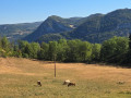
Park at the “Le Martinet” campsite (car park by the old tennis courts).
(S/E) Walk down the street towards the Gorges du Flumen.
(1) After crossing the bridge over the Flumen, take the first street on the left towards the Flumen Gorges and waterfalls.
(2) At the fork in the road, follow the riverbank along the Chemin de Foulesard until you reach a hydroelectric power station.
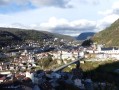
(3) Turn right and take the path which climbs steeply towards the Belvédère de la Roche Blanche (yellow markings).
(4) At the three-way junction, take the left-hand path, pass under a power line and continue to the Belvédère de la Roche Blanche, where the climb ends.
(5) Take in the view before setting off again to the right along a yellow-marked path until you reach a road.
(6) Head down this road to the left until you reach the junction with the D25 departmental road.
(7) Follow it to the right for about 300 m until you reach the D292E1.
(8) Turn left onto this road and follow it for about 400 m until you reach the junction of the GR®509 and the GRP® of the Grande Traversée du Jura.
(9) Turn right and follow the GR® towards the village of Les Moussières.
(10) At the road, continue to the right towards the centre of the village of Les Moussières and arrive at the church.
(11) Carry on to the right along the GR® to reach the hamlet of La Muras.
(12) Carry on straight ahead along the road towards Crêt Joli (yellow PR® markings) until you reach Crêt Joli.
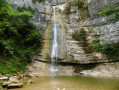
(13) Turn right towards the Flumen Waterfalls.
(14) At the 860-metre mark, leave the PR® trail and take a path that descends to the right. Follow the path and the GPS track carefully to avoid crossing private property at La Riôte.
In wet weather, the narrow path along the cliff edge between points (14) and (15) can be slippery and dangerous: if in doubt, at this junction you can continue left along the PR® route towards the hamlet of Pré Martinet to reach point (16) and avoid this difficult section.
(15) Continue to the left. The narrow path runs alongside the cliff: this section may be considered difficult. I recommend avoiding it in wet weather.
(16) Carry on straight down the slope towards the Route des Gorges du Flumen.
(2) Carry on straight ahead and, following the reverse route of the outward journey, head back to the car park at the “Le Martinet” campsite (S/E).

 Visorando Member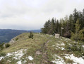

 Easy
Easy 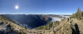
 Moderate