From the Lizon Tram Viaduct to the Pas de L’Âne

From the Lavans-lès-Saint-Claude fitness trail, you’ll reach the lower section of the Lizon Gorges by crossing the tram viaduct.
Walking alongside the Bienne, you’ll find yourself in the heart of a magnificent natural setting as you make your way to the Pas de l’Âne and the Roche Lezan.
This is also a lovely route for trail running enthusiasts.

Details

2670977
Creation:
Last update:
Last review:
  • Walking
    Activity: Walking
  • ↔
    Distance: 7.76 mi
  • ◔
    Average duration: 4h 30 
  • ▲
    Difficulty: Moderate

  • ⚐
    Back to start: Yes
  • ↗
    Ascent: + 1,027 ft
  • ↘
    Descent: - 1,027 ft

  • ▲
    Highest point: 2,051 ft
  • ▼
    Lowest point: 1,158 ft

Photos

Description of the walk

To reach the car park, from Rue de Tré la Croix in Lavans-lès-Saint-Claude, look out for the road signposted towards the fitness trail.

(S/E) From the car park, cross the road and follow the path on the left, which heads south-south-east for about 150 metres.

(1) Leave the main path and head left towards a hunting lodge, then immediately take the path on the right. Follow the signs for the Tram Viaduct (yellow markings) until you reach the tarmac road.

(2) Continue left for 150 metres and take the path leading down to the right, towards the Tram Viaduct.

(3) Turn right, then immediately left. Carry on to the Chemin de Montoiseau and turn right at a right angle onto the path across the fields.

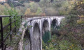
(4) Leave the path across the fields to the left, following the yellow markings. Cross the Lizon tram viaduct and carry on to the road.
Cross the road and take the small path directly opposite. Walk behind a row of houses until you reach a wider stony path. Keep following the yellow markings. The path widens and reaches a crossroads.

(5) Take the small path opposite, veering slightly to the right, and head downhill, following a wide right-hand bend, down to the road alongside the River Lizon to reach the courtyard of the Lizon craft brewery. On the road, continue to the right and follow the railway line to the junction before the level crossing.

(6) Cross the level crossing to the left, then turn right. Walk alongside the old station platforms. At the end of the street, take the path which first follows the old railway line, then heads down towards the Bienne via a path through the woodland, marked in yellow. Continue along the railway line as far as Brive d’Aval and the bend before the level crossing.

(7) At the bend, leave the small road and take the wide white track that follows the railway line and the river on the right bank. Carry on to Chassal at the junction with the Chemin de la Gare.

(8) Turn right, cross the railway line and turn left into the La Boussière housing estate. Leave the yellow markings behind and carry on straight ahead along the path running alongside the railway line until you reach the level crossing. Before heading back down towards the level crossing, do feel free to climb up to the statue of the Virgin Mary overlooking Chassal.
Walk through Marignat and continue to the road near a level crossing.

(9) At the level crossing, take the path on the right and continue along the path to the right, skirting the edge of the forest.

(10) At the signpost marked ‘Au pied dessus’, turn right towards the Pas de l’Âne.

(11) At the signpost marked “Pas de l’Âne”, turn left towards La Roche Lezan. Follow the yellow markings and the Trail 1 route to the left. The path heads west, then north. You’ll reach the signpost marked “La Roche Lezan”.

(12) Turn right towards Lavans-lès-Saint-Claude. Continue along this path on the left. Shortly after passing a high-voltage power line, you’ll reach a Fork in the road.

(13) Head slightly to the right to follow part of the fitness trail. Follow the yellow Trail1 markings to reach the car park (S/E).

Waypoints

  1. S/E : mi 0 - alt. 1,818 ft - Car park – Path to the left
  2. 1 : mi 0.09 - alt. 1,798 ft - Turn left at the fork
  3. 2 : mi 0.28 - alt. 1,644 ft - At the road, turn left
  4. 3 : mi 0.5 - alt. 1,627 ft - At the crossroads, turn right then left
  5. 4 : mi 0.86 - alt. 1,506 ft - Turn left towards the Tram Viaduct - Viaduc du Tram
  6. 5 : mi 1.53 - alt. 1,368 ft - Crossroads – path veering slightly to the right
  7. 6 : mi 2.02 - alt. 1,280 ft - Level crossing
  8. 7 : mi 3.03 - alt. 1,247 ft - White path alongside the railway line - Bienne (rivière)
  9. 8 : mi 4.46 - alt. 1,191 ft - At the crossroads, turn right then left
  10. 9 : mi 5.09 - alt. 1,175 ft - Level crossing
  11. 10 : mi 5.62 - alt. 1,243 ft - Turn right towards the Pas de l’Âne
  12. 11 : mi 5.86 - alt. 1,542 ft - Turn left towards La Roche Lezan
  13. 12 : mi 6.72 - alt. 2,041 ft - Turn right towards Lavans-lès-Saint-Claude
  14. 13 : mi 7.22 - alt. 1,982 ft - On the right, the fitness trail
  15. S/E : mi 7.76 - alt. 1,818 ft - Car park

Notes

To see the car park and the starting point: click here

To view the video of the route profile: click here
About the route profile video: I carried out a recce of this route to check that it matched the description.

  • Please note: This route is not suitable for pushchairs or young children.

  • Practical tips for starting the walk:

I strongly recommend using the app on a smartphone, which will also allow you to be geolocated at all times, enabling you to track your progress accurately.

  • I completed this route on a lovely sunny day with good walking conditions (dry ground). I cannot guarantee that it will be passable when the ground is soggy or snow-covered, or obstructed by trees felled by foresters.
  • Watch out for ticks –

a real problem in the Jura forests; ticks are voracious and can be found everywhere.
Don’t forget to check yourself over after your walk.

Worth a visit

  • Lavans-lès-Saint-Claude fitness trail between the points (13) and (S/E).
  • Lizon Craft Brewery (Jura beers) after the waypoint (5).
  • Port Sachet hydroelectric power station between the points (7) and (8).

Reviews and comments

4.3 / 5
Based on 3 reviews

Reliability of the description
4.7 / 5
Ease of following the route
4.7 / 5
Route interest
3.7 / 5
jp.cael
jp.cael

Overall rating : 4 / 5

Date of your route : Jul 01, 2024
Reliability of the description : ★★★★☆ Good
Ease of following the route : ★★★★☆ Good
Route interest : ★★★★☆ Good
Very busy route : No

At the start, heading towards the hunting lodge, it’s a bit tricky to find the path – it’s to the right of the gate.
Beautiful scenery; following the tram line is an interesting experience.
The climb up to the Pas de l’Ane is tough, especially in the heat.

Machine-translated

joss-lille
joss-lille

Overall rating : 4.3 / 5

Date of your route : Mar 02, 2024
Reliability of the description : ★★★★★ Very good
Ease of following the route : ★★★★★ Very good
Route interest : ★★★☆☆ Average
Very busy route : No

A lovely, long walk, but the stretch along the river is marred by the proximity of the road and a landscape that isn’t always pleasant (houses, factories).
Overall, though, the first two sections are definitely worth it.
Not a difficult walk.

Machine-translated

zbh0170
zbh0170
• Edited:

Overall rating : 4.7 / 5

Date of your route : Mar 13, 2021
Reliability of the description : ★★★★★ Very good
Ease of following the route : ★★★★★ Very good
Route interest : ★★★★☆ Good
Very busy route : No

The walk took place on Saturday 13 March, following a slightly different route to the one described: we set off from Molinges and turned right after the Pas de l’Âne towards Lavans-lès-Saint-Claude.

Overall, it was a pleasant route, with no real difficulties, and included a short section through a small piece of railway heritage (the old tram line from Saint-Claude to Clairvaux-les-Lacs).
At most, the return journey along the River Bienne is occasionally a little monotonous.

Thanks to the author of the route description.

Machine-translated

Other walks in the area

For more walks, use our search engine .

The GPS track and description are the property of this route's author. Please do not copy them without permission.