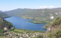
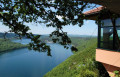
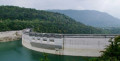
Villards-d’Héria – Rogna circular loop

This challenging route, exceptional for its elevation gain, its long, gruelling climbs and its technical descents, will take you to two of the highest points in the Jura Mountains, separated by the Bienne Valley.

Details

2651647
Creation:
Last update:
Last review:
  • Mountain biking
    Activity: Mountain biking
  • ↔
    Distance: 28.46 mi
  • ◔
    Duration according to the author: 4 hrs 
  • ▲
    Difficulty: Very difficult

  • ⚐
    Back to start: Yes
  • ↗
    Ascent: + 3,698 ft
  • ↘
    Descent: - 3,694 ft

  • ▲
    Highest point: 2,982 ft
  • ▼
    Lowest point: 1,007 ft
  • ⚐ Country: France
  • ⚐
  • ⚐ City: Villards-d'Héria (39260)
  • ⚑
    Start/End: N 46.412023° / E 5.727762°
  • ❏
    IGN map(s): Ref. 3327OT, 3328OT

  • ◶
    Type of surface:
  •  
     
     
     33% Road  34% Byway  33% Path
  • ⇧
    Bike carrying: Not specified
  • ▲
    Difficulty: Not specified
  • Hour-by-hour weather

Photos

Description of the route

Meet at the car park situated between the Moirans-en-Montagne roundabout and the Villards-d’Héria viaduct. (Car park just before the viaduct).

(S/E) Get on your bikes and head towards the roundabout; go round it and exit towards Martigna.

(1) After the roundabout, turn left onto the forest track. Continue along this track until you reach the chain indicating that you are entering private property. Step over the chain and stay on the track.
Pass in front of a farm.

(2) After the farm, at the crossroads, take the second path on the left and carry on until you reach the RD295.

(3) Turn left onto it, pass through the village of Martigna, continue past Lake Chanon and enter the hamlet of Chanon.

(4) As you leave the hamlet, take the path on the left towards Grand Serve. Continue along this path to the right. Leave this path at a place called Le Fourcha and continue to the right along the meadow until you reach a path at the end of the meadow.
Please note: the path is not visible at first.
Carry on along this descending path until you reach a circular section of a forest track.

(5) Carry on downhill, turning left, until you reach the hamlet of Douvre.
In the hamlet, carry on straight ahead to the last house.

(6) At this house, carry on along the forest track heading to the left.
At the crossroads, after a short, fairly steep climb, continue along the forest track heading to the left. You’ll come to a Y-junction by the power line.

(7) Leave this path and continue to the left around the bend.
Caution: a long, fairly technical descent.
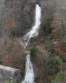
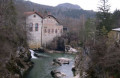
Carry on until you reach the Bienne nature trail, at the foot of the Douvre Waterfall.

(8) At the foot of the waterfall, head right onto theGRP®® Tour du Haut Jura Sud variant, marked in red and yellow. Stay on this path to reach Epercy.
Walk through the hamlet and cross the bridge over the river “La Bienne”.
After the bridge, keep to the right to pass under the road and enter the village of Lavancia-Epercy.

(9) Walk past the church in Lavancia-Epercy and continue along the GRP®®. Pass through Rhien to reach the station.

(10) Leave the forest track and join theGRP®® towards Sièges/Rogna.
Please note: you are about to start a long and strenuous climb
Stay on this path, ignoring all the turnings to the left. Cycle on until you reach the hamlet of Sièges.

(11) At the junction in the hamlet of Sièges, turn right and continue along theGRP®® which branches off to the left towards Rogna. Pass the cemetery and carry on until you reach a forest track.

(12) On this forest track, turn left and, 100 metres further on, turn right, following theGRP®® towards Rogna. Continue along this path until you reach another forest track.

(13) Stay on this forest track, which remains part of theGRP®® route, until you reach the first houses in the village of Rogna.

(14) At the junction with the D293, turn left and take the first left. Leave the GRP®® here.
Carry on along Rue du Château d’Eau, ignoring the junctions. You’ll come to a crossroads with a memorial stone.

(15) Leave this street on your left and walk past the stone marker onto the forest track that branches off to the right. After a clearly marked left-hand bend, you’ll reach the end of the forest track.

(16) Take the path on the right towards Ferme de Vaux, Vaux-lès-Saint-Claude.
Caution: a long, stony descent that is quite technical
Continue to the end of the descending path until you reach a forest road.

(17) Turn right onto this track. Walk past Ferme de Vaux and continue downhill to the village of Vaux-lès-Saint-Claude.

(18) Cross the D436. Take the first right onto Rue des Radeliers,
At the junction, carry on straight ahead to reach Rue de Charia and continue until you reach the bridge over the River Bienne.

(19) After the Bienne bridge, walk past the football ground and carry on straight ahead to rejoin theGRP®® on the forest track. Turn left onto it to reach the junction with the nature trail.

(20) Continue along theGRP®® trail, which is still marked in red and yellow, until you reach the Moulin junction.

(21) Turn right. Here, begin a steep climb leading to the hamlet of Grand Châtel.

(22) Turn left past the fountain. Continue along the forest road. Keep left after crossing the small stream on the D297. After passing under the Villards-d’Héria viaduct, you’ll reach the Petit Villard junction.

(23) Carry on to the left to cross the village, then turn slightly left onto Rue Léon Clerc to reach the car park before the viaduct (S/E).


Waypoints

  1. S/E : mi 0 - alt. 2,178 ft - Car park before the viaduct
  2. 1 : mi 0.42 - alt. 2,159 ft - Turn left onto the forest track
  3. 2 : mi 1.75 - alt. 2,152 ft - Bioux Barn
  4. 3 : mi 2.57 - alt. 2,221 ft - Turn left onto the RD295
  5. 4 : mi 4.24 - alt. 1,998 ft - Turn left towards Grand Serve
  6. 5 : mi 5.17 - alt. 1,739 ft - Turn left at the fork
  7. 6 : mi 5.56 - alt. 1,637 ft - Forest track on the left
  8. 7 : mi 6.36 - alt. 1,709 ft - Turn left at the fork
  9. 8 : mi 7.14 - alt. 1,115 ft - Turn right at the foot of the waterfall
  10. 9 : mi 9.45 - alt. 1,053 ft - Lavencia-Epercy Church
  11. 10 : mi 10.38 - alt. 1,381 ft - Turn left onto the GRP ==> Sièges
  12. 11 : mi 12.27 - alt. 2,428 ft - Turn right at Sièges
  13. 12 : mi 12.97 - alt. 2,812 ft - Forest track to the left
  14. 13 : mi 13.86 - alt. 2,887 ft - Forest track on the left
  15. 14 : mi 15.08 - alt. 2,579 ft - Turn left onto the D293
  16. 15 : mi 15.72 - alt. 2,733 ft - Turn right onto the forest track (marker post)
  17. 16 : mi 16.68 - alt. 2,552 ft - Path on the right
  18. 17 : mi 18.64 - alt. 1,703 ft - Ferme de Vaux
  19. 18 : mi 20.48 - alt. 1,125 ft - Crossing the D436
  20. 19 : mi 21 - alt. 1,079 ft - Bridge at the - Bienne (rivière)
  21. 20 : mi 21.66 - alt. 1,086 ft - Turn right at the three-way junction
  22. 21 : mi 23.37 - alt. 1,083 ft - Turn right at the fork
  23. 22 : mi 25.43 - alt. 1,969 ft - Fountain at Grand Châtel
  24. 23 : mi 27.46 - alt. 2,139 ft - Entrance to Le Petit Villard
  25. S/E : mi 28.46 - alt. 2,178 ft - Car park before the viaduct

Notes

To view the starting point: click here

- Video of the route profile here
About the profile video: I carried out a reconnaissance of this route to check that the description was accurate. When I reconnoitre a route, I do so by running, relying on the signal received by my phone when I stray from the route or take the wrong path. This allows me to correct the description.
Here, the elevation profile is correct but the route isn’t, as I had to make some corrections.
- Practical tips for getting started with mountain biking:
I strongly recommend using the app on a smartphone, which will also allow you to be geolocated at all times, so you can track your movements accurately.
-1) Check that location services and sound are enabled in your phone’s settings,
-2) On the ride summary page, tap the + icon then tap ‘Start this ride’. You’ll then hear an audible alert if you stray from the route.
-3) Once the ride is finished, tap ‘+’ and then ‘Finish this ride’.

  • Along the route, two walks to enjoy with the family:

==> 2646551
==> 2646550

  • There are a few drinking fountains along the route.

Watch out for ticks,
A very real danger in the Jura forests – ticks are voracious and can be found everywhere.
Don’t forget to check yourself over after the walk.

Please note: following timber extraction work, the section of the route between (15) and (17) has become difficult to navigate, with deep, muddy ruts. I suggest an alternative route to avoid this section (no. 14101693), part of which has become difficult to navigate due to the timber extraction.

Worth a visit

  • Douvre Waterfall
  • Interpretive trail along the Bienne.
  • Lavancia Canoe and Kayak Centre
  • Church of Lavancia-Epercy
  • The villages of Martigna, Sièges, Rogna and Vaux-lès-Saint-Claude, and numerous charming little hamlets.

Reviews and comments

5 / 5
Based on 1 review

Reliability of the description
5 / 5
Ease of following the route
5 / 5
Route interest
5 / 5
alainc5939
alainc5939

Overall rating : 5 / 5

Date of your route : Aug 29, 2021
Reliability of the description : ★★★★★ Very good
Ease of following the route : ★★★★★ Very good
Route interest : ★★★★★ Very good
Very busy route : No

Please note: due to logging operations, the track located after the waypoint (16) is severely damaged over a distance of approximately 500 metres.
Deep ruts filled with standing water mean you’ll have to dismount and continue on foot over very muddy and slippery ground.
Alain

Machine-translated

alainc5939
alainc5939

Thank you, Henri.
Have a lovely evening

Machine-translated

henri57
henri57 ★
• Edited:

Hello,

@alainc5939

This issue is currently being investigated by the validation team.

Kind regards

Machine-translated

alainc5939
alainc5939
• Edited:

Please note: there has been a problem with the validation of this walk. Three-quarters of the route is missing.

Machine-translated

Other walks in the area

For more walks, use our search engine .

The GPS track and description are the property of this route's author. Please do not copy them without permission.