Country:

 City:
City:


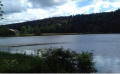
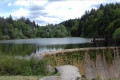
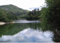
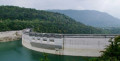
To get to the starting point, head towards Moirans-en-Montagne. On the D470, at the north-western end of the Villards d’Héria Viaduct, there is a car-sharing car park. This is the starting point
(S/E) To start the route, head towards the roundabout, take the third exit and follow signs for Martigna on the D299 for about 200 metres.
(1) Turn off the D299 to the right and follow the path that runs alongside the D470. You will arrive next to the roundabout at the Vernoire West Industrial Estate.
(2) Cross the road and continue along the path that runs alongside the D470.
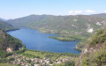
(3) At the end of the path, take a short detour to the left to admire the view over Lake Vouglans. Then continue across the car park to the left and find a small path leading downhill.
At the sign for Belvédère du Regardoir, head towards Charchilla (yellow markings). At the end of the path, alongside the D470, continue to the left.
(4) Turn left onto the small path before the D470; this is the old Roman road. Walk past the Auberge Jurassienne, cross the road and continue along the “À la Mercantine” path opposite, which runs parallel to the D301.
(5) On the Route du Lac à Charchilla, continue westwards for about 100 metres, then turn onto the path heading due south until you reach the D307.
On the D307, keep right, then head south-west at the ‘Neige et Plein Air’ holiday centre.
Head downhill and carry on to the track that continues from there. Carry on to Mercantine Beach.
(6) In front of the entrance to Mercantine Beach, head north and follow the path alongside the lake, which passes in front of the car park and continues as the footpath leading to Mercantine Harbour.
(7) At Mercantine Harbour, from the harbour master’s office, continue along the small road that climbs towards the Maisod VVF holiday centre. Pass through the VVF barrier, then walk past the VVF and go round it. Please note: there is a short stretch where you’ll need to carry your bike near the VVF swimming pool.
(8) At the crossroads, continue westwards. Stay on this path (GRP®® Tour du Lac Vouglans, marked in red and yellow), which continues as the Route Forestière de la Frate until you reach the D301. Don’t forget to stop at the Belvédère de la Frate and take a short stroll along the unspoilt beach bordering the lake.
(9) At the D301, carry on north-east for 200 m, then turn right onto theGRP®® towards the Pont de la Pyle. Follow the red and yellow markings.
Walk past the La Braise viewpoint until you reach the junction ofthe GRP®® with the Ancient Roman Road.
(10) At the junction, by the signpost marked “le Citernon”, cross the Roman road and follow the signs for Coyron/Meussia north-eastwards to Coyron. Please take care when crossing the D470!
(11) Leave Coyron via Rue de la Fraite, following theGRP®® signposts towards “La Fraite/Meussia”. Continue along the forest track, leaving Meussia behind and heading towards La Fraite. Cross the “La Cimante” stream to reach the hamlet of La Fraite.
Walk past the Moulin de la Fraite and continue to the right along Rue de la Fraite.
(12) At the signpost for “Molard du Trégelier”, leave theGRP®® trail and continue towards “Thoiria 2.4 km”. At the junction with the D149, turn north.
(13) Enter the village of Thoiria and, at the junction, carry on along the D149 towards Soucia. Continue along the Route de Soucia to the village of the same name. Cross the village on the D149, pass the church and carry on to the junction with the D27.
Cross the D27 with care and carry on until you reach the signpost for “Les Nuisières”.
(14) At Les Nuisières, turn north-west towards “Clairvaux-les-Lacs/La Rochette”. Keep heading in this direction until you reach the signpost for “La Rochetyl” and carry on towards “Clairvaux-les-Lacs 2.9 km”.
Walk past the pumping station, cross the stream “La Raillette” which links the two lakes (stop on the little bridge – there are some lovely trout!) and carry on to the Chemin du Langard.
(15) On Chemin du Langard, carry on due north until you reach the campsite gate. Go through the gate and carefully cross the campsite to rejoin Chemin du Langard.
At the “La Grisière” campsite, turn left to reach the shore of Lac de Clairvaux by crossing the campsite.
(16) After a well-deserved dip, leave the campsite and carry on along the Chemin du Langard to the D118.
Carry on north-west along the D118 for 100 m, then turn south-east onto the D145 towards Hautecour.
(17) After the sign for the Clairvaux-les-Lacs exit, leave the D145 and stay in the right-hand lane to continue along the Route des 4 Chemins, beginning the long climb towards Châtel de Joux.
At the four-way junction, continue south-east along the track until you reach the D118.
''Please note! The climb is long (around 4 km) and this track joins the D118 several times, but there are several opportunities to continue along a path through the woods.
''
(18) Once on the D118, continue along the road to Châtel-de-Joux.
In Châtel-de-Joux, turn left onto Rue de la Tuilerie, pass the wash house and the town hall, then turn right onto Rue du Lavoir heading south-east.
Carry on along this road, which becomes a forest track for about 1.8 km, until you reach the signpost indicating the direction of Étival.
(19) At the signpost indicating the direction of Étival, continue southwards to the D308 and turn eastwards to carry on to the bend.
(20) At the bend, head due south along the narrow path leading to Lac d’Étival. Walk alongside the Petit Lac before reaching the Grand Lac.
(21) Carry on due south along the small forest track running alongside the Grand Lac.
At the end of the road, carry on southwards along the forest track.
(22) At the sign for ‘À tout Froment’, follow the signs for ‘Crozets/la Panisette’ (yellow markings).
Carry on along the D118 south-west until you see the yellow markings, which will take you across the meadow.
(23) At the yellow markings, cross the meadow to the right to join a small forest track that takes you to Les Crozets via the Chemin du Clos de la Vie.
(24) In the village of Les Crozets, head south, pass the church and carry on towards Ravilloles along the road which continues southwards round the bend.
Carry on along this forest track, which descends steadily for 4.5 km.
(25) At the hairpin bend, take the small signposted path to reach Ravilloles.
Caution! The descent is quite technical.
At the bottom of the path, carry on through the housing estate, then cross the forest road to walk alongside the timber yard on Rue Courtil Coupé.
At the end of the street, turn left and carry on straight ahead to Ravilloles Lake.
(26) Cross over the dam’s footbridge.
Caution! The footbridge is narrow. How to cross: balance the bike on its rear wheel and push it upright.
Carry on along the small path on the other side of the footbridge, take the road heading south and, at the bend, carry on straight ahead along the path until you reach the D118.
On the D118, carry on south-west, then go past the junction.
(27) 150 m after the junction, turn onto the small path heading south, which leads you to Lake Cuttura. Be careful! You are on the Sentier des Savoirs Faire and may encounter pedestrians.
(28) At Lac de Cuttura, join Rue du Jura, which runs alongside the Auberge du Vieux Moulin, then continue downhill to reach Saint-Lupicin. Cross the D118 to enter the housing estate.
At the 90° bend, take the small path on the right which climbs up to join the road called “Au Commun”.
(29) Continue south-west, uphill to the junction, then turn off onto the signposted path heading south-west towards the Belvédère de Scia.
(30) At the end of the path, you’ll reach the Route Forestière de la Ragea. Turn right towards the Belvédère de Scia for a steep 2 km climb.
Pass the viewpoint and continue towards La Ragea/Lac d’Antres.
(31) Leave the forest road to the left onto the wide forest track. Caution! There are no markings at this point. Do not take the previous path which leads to Les Louvières.
(32) Leave the forest track and take the path leading into the woods. The direction to Lac d’Antre is signposted in blue, as well as with red and white markings.
Continue along this path to the lake. Caution! The descent is quite technical.
(33) At Lac d’Antre, you’ll come to a barn. Carry on along this path to rejoin the Route du Lac d’Antre and head towards Villards-d’Héria.
(34) At the bottom of the long descent, you’ll reach the village. Turn right onto the bridge crossing the Héria, then continue along the main road towards the viaduct and the car-sharing car park (S/E).

 Visorando Member
 Difficult
 Moderate