Viewpoint at Chatillon

This woodland route will take you through the woods of Chatillon to discover a little-known viewpoint over the Bienne valley and, in fine weather, a view of the Mont Jura. A fairly undulating walk along lovely woodland paths, returning via Lac d’Antre. A lovely route for trail running or mountain biking.

Details

30893189
Creation:
Last update:
Last review:
  • Walking
    Activity: Walking
  • ↔
    Distance: 7.55 mi
  • ◔
    Average duration: 4h 40 
  • ▲
    Difficulty: Moderate

  • ⚐
    Back to start: Yes
  • ↗
    Ascent: + 1,339 ft
  • ↘
    Descent: - 1,322 ft

  • ▲
    Highest point: 2,802 ft
  • ▼
    Lowest point: 1,965 ft

Photos

Description of the walk

To get to the start, head towards Villard d’Héria. In the village, look for and follow the signs for Grand Châtel on the D29. The cemetery car park is on the left before you go under the viaduct.

(S/E) Turn left to go under the viaduct and stay on the D297 for about 500 metres. At the signpost for Au Chapel, continue along the stony path towards Grand Châtel (yellow markings). Stay on this path until you rejoin the D297 at a stream.

(1) Continue along the D297 to enter the hamlet of Grand Châtel via Rue du Bief d’Espon. Walk on to the fountain, then turn left towards Petit Châtel to reach the fire water reservoir.

(2) Take the grassy path on the left, which climbs gently. Please note: from here onwards, the path is no longer signposted but is clearly visible – you cannot go wrong. Continue through the pine forest until you reach a small clearing. To the left of the main path is a Lésine. Follow this to reach a junction opposite a water reservoir.

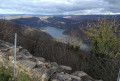
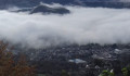
(3) Turn left to begin a steep climb through the Bois sur Chatillon. At the fork in the road, follow the path on the right, marked on the ground by a cairn, and continue climbing until you reach a viewpoint overlooking the hamlet of Petit Châtel and the Bienne valley. Please take care here; there are no safety barriers on the rocky outcrop.

(4) Continue along the single, clearly visible path and begin your descent, keeping in the same direction until you reach the D470. Turn left, then after about 300 metres, cross this road carefully and head towards the restaurant Les Louvières. Continue to the junction.

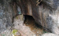
(5) Here you may spot a charming little cave situated 300 m to the right.

(6) Turn back towards the junction.

(5) Turn right towards the restaurant. Follow the stream below. Continue along the first stony path branching off to the left, keeping to the stream. Stay on this path until you see Lac d’Antre. You’ll rejoin a tarmac road and theGR®9. Carry on until you reach the signpost for “Lac d’Antre”.

(7) Follow the signs for Villards d’Héria – Les Favrettes (yellow markings). At the hairpin bend in the hamlet of Les Favrettes, carry straight on along the stony path, following the yellow markings. Head right onto the stony path. Caution: risk of slipping on the large stones in wet weather. Continue down the slope until you reach the junction on the edge of a housing estate.

(8) Turn left, leaving the yellow markings behind, and cross through the housing estate to reach the tarmac road. Head left onto the street called La Voie du Tram and continue to the junction with Rue du Petit Villard. Cross this street carefully and head towards Grand Châtel to return to the cemetery car park (S/E).

Waypoints

  1. S/E : mi 0 - alt. 2,087 ft - Cemetery car park
  2. 1 : mi 1.16 - alt. 2,001 ft - Stream
  3. 2 : mi 1.95 - alt. 1,998 ft - Fire Reserve
  4. 3 : mi 2.19 - alt. 2,169 ft - Water supply
  5. 4 : mi 2.68 - alt. 2,575 ft - Viewpoint
  6. 5 : mi 3.94 - alt. 2,379 ft - Les Louvière
  7. 6 : mi 4.11 - alt. 2,405 ft - Cave
  8. 7 : mi 6.32 - alt. 2,677 ft - Lac d’Antre
  9. 8 : mi 7.06 - alt. 2,264 ft - Housing estate
  10. S/E : mi 7.55 - alt. 2,090 ft - Cemetery car park

Notes

(S/E) See the starting point: its coordinates are: 46°24'37.2"N 5°43'58.8"E
No water points along the route.
Picnic tables at Lac d’Antre.

Worth a visit

Bois sur Chatillon viewpoint.
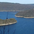
Lac d’Antre viewing point.
Caves.

Always be cautious and plan ahead when you're outdoors. Visorando and the author of this route cannot be held responsible for any accidents occurring on this route.

The GR® and PR® markings are the intellectual property of the Fédération Française de Randonnée Pédestre.

Reviews and comments

4.5 / 5
Based on 2 reviews

Reliability of the description
5 / 5
Ease of following the route
4.5 / 5
Route interest
4 / 5
User 21541600
• Edited:

Overall rating : 4 / 5

Date of your route : Feb 09, 2026
Reliability of the description : ★★★★★ Very good
Ease of following the route : ★★★★☆ Good
Route interest : ★★★☆☆ Average
Very busy route : No

From the start to point 1, stay on the road. Major logging work makes the proposed route impassable. Therefore, take the road to point 2.
From point 2 to point 3, over 500 metres, there are many fallen trees. You will need to go around them, climb over them or crawl under them. It is not impassable, but it is close.
From point 3 to point 4, there is a steep climb (see contour lines). It is entirely feasible, but difficult given the above.
Point 4: beautiful viewpoint. You have to earn it 🥵. Up to point 5, pleasant passages along the ridge in the undergrowth.
Point 5: no overflowing river to cross when in flood.
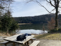
Lake Antre: continue on the tarmac road after the barns, nice view of the lake and picnic tables.

Machine-translated

PascaleB.
PascaleB.

I was inspired by this guidebook during a circular hike starting from Vaux-Les-St-Claude, more specifically the passage at the Chatillon viewpoint, which I highly recommend: the view of the snow-capped Haut-Jura mountain range was magical! Thank you very much for sharing!
(in detail: Vaux, Creuse leat, Petit Chatel, Chatillon viewpoint, La Bosse, Tré la Roche, Champied, St-Romain viewpoint 635, Vaux)

Machine-translated

mimijulien
mimijulien

Overall rating : 5 / 5

Date of your route : Apr 10, 2023
Reliability of the description : ★★★★★ Very good
Ease of following the route : ★★★★★ Very good
Route interest : ★★★★★ Very good
Very busy route : No

Thank you for this lovely walk – it was a real pleasure. We enjoyed the beautiful views, with
the added bonus of the still snow-capped peaks of the Haut-Jura and the magnificent Lac d’Antre with its rocky outcrop right in front of us. Watch out at marker no. 5 – don’t miss the path on the left!

Machine-translated

Other walks in the area

For more walks, use our search engine .

The GPS track and description are the property of this route's author. Please do not copy them without permission.