


Mickanside

 Visorando Member
 Premium user
 - Location: Guebwiller (68500)
- Gender: man
Sign up:
Published route(s)
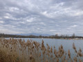
 Walk around Reiningue Lake
 1.51 mi
 +16 ft
 -16 ft
 0h 45
0h 45
 Easy
Easy
 Departure from Reiningue (Haut-Rhin)
A short walk around Lake Reiningue.
 Holtzheim–Hangenbieten–Achenheim circular loop
 6.25 mi
+95 ft
-95 ft
1 hr
Easy
Departure from Holtzheim (Bas-Rhin)
6.25 mi
+95 ft
-95 ft
1 hr
Easy
Departure from Holtzheim (Bas-Rhin)
A circular route for a very relaxed cycle ride lasting just under an hour, with a short detour (optional) to combine road cycling – via the Bruche Canal Greenway – and mountain biking.
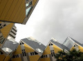
A stroll from Rotterdam city centre to the Erasmus Bridge
 2.51 mi
+52 ft
-46 ft
1h 10
Easy
Departure from Netherlands
2.51 mi
+52 ft
-46 ft
1h 10
Easy
Departure from Netherlands
Starting from Rotterdam-Blaak station, this short, leisurely route will take you past several of the city’s sights, spots well worth a visit, and plenty of shops where you can enjoy a spot of window shopping or treat yourself to a delicious Stroopwafel (a caramel-filled waffle, a local speciality).Perfect if you’re just passing through Rotterdam for a few hours or a day!
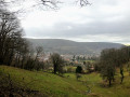
A short circular loop at the foot of the Demberg
 2.08 mi
+341 ft
-341 ft
1h 15
Easy
Departure from Buhl (Haut-Rhin) (Haut-Rhin)
2.08 mi
+341 ft
-341 ft
1h 15
Easy
Departure from Buhl (Haut-Rhin) (Haut-Rhin)
This short circular route (1 hour 10 minutes recorded on the stopwatch), starting from Buhl, will allow you to get some fresh air in the wooded areas at the foot of the Demberg and enjoy a lovely view of your starting village from the west.
In the heights of Pfingstberg
 3.22 mi
+305 ft
-318 ft
1h 45
Easy
Departure from Soultzmatt (Haut-Rhin)
3.22 mi
+305 ft
-318 ft
1h 45
Easy
Departure from Soultzmatt (Haut-Rhin)
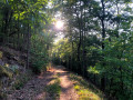
This short walk in the hills above Soultzmatt will take you to the Langenstein Menhir and a beautiful viewpoint over the Vallée Noble. You will then enjoy the peace and quiet of the forest, which you will walk through for most of this hike, as well as a beautiful meadow that you will cross.
The Schauenberg and the Table des Druides from Pfaffenheim
 4.09 mi
+971 ft
-961 ft
2h 45
4.09 mi
+971 ft
-961 ft
2h 45
 Average
Departure from Pfaffenheim (Haut-Rhin)
Average
Departure from Pfaffenheim (Haut-Rhin)
Starting from Pfaffenheim, climb up to the heights of its communal forest through the vineyards and discover places steeped in history and spirituality. You will discover the many religious statues and other curiosities of Notre-Dame de Schauenberg, magnificent views of the plain and, if you are lucky, the Alps, as well as the Table des Druides, a beautiful natural dolmen.
A visit to Saint-Ursanne
 2.35 mi
+453 ft
-433 ft
1h 30
Easy
Departure from Saint-Ursanne (Canton of Jura)
2.35 mi
+453 ft
-433 ft
1h 30
Easy
Departure from Saint-Ursanne (Canton of Jura)
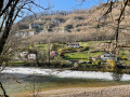
Starting from a free car park near the village, you’ll discover the town of Saint-Ursanne, the banks of the Doubs and the surrounding hills.
Above Guebwiller, between the forest and the vineyards
 10.45 mi
+1,211 ft
-1,234 ft
2 hrs
Average
Departure from Buhl (Haut-Rhin) (Haut-Rhin)
10.45 mi
+1,211 ft
-1,234 ft
2 hrs
Average
Departure from Buhl (Haut-Rhin) (Haut-Rhin)
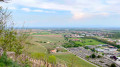
Starting from Buhl, this route takes you up to the Col de Bannstein via the village of Schweighouse, before entering the Schimberg Forest, which you’ll cross until you reach the vineyards near Bergholtz. You’ll then head back up the valley through the vineyards to the east of Guebwiller.
Thierenbach from the Gros Chêne
 2.75 mi
+554 ft
-551 ft
1h 45
Easy
Departure from Soultz-Haut-Rhin (Haut-Rhin)
2.75 mi
+554 ft
-551 ft
1h 45
Easy
Departure from Soultz-Haut-Rhin (Haut-Rhin)
A short walk through the forest before setting off to explore the Basilica of Notre-Dame de Thierenbach.
Two distinct atmospheres between the heights of the Limberg and the banks of the Rhine
 4.32 mi
+377 ft
-387 ft
2h 20
Easy
Departure from Sasbach am Kaiserstuhl (Regierungsbezirk Freiburg)
4.32 mi
+377 ft
-387 ft
2h 20
Easy
Departure from Sasbach am Kaiserstuhl (Regierungsbezirk Freiburg)
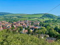
This is a hike offering a wide variety of landscapes, taking in hills, vineyards, woodland and the banks of the Rhine. A hillyfirst section on the Limberg heights gives way to a flat stretch through the Sasbach-Am-Kaiserstuhl Forest.
Bienne discovery trail
 2.00 mi
+256 ft
-240 ft
1h 10
Easy
Departure from Morez (Jura)
2.00 mi
+256 ft
-240 ft
1h 10
Easy
Departure from Morez (Jura)
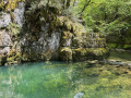
This route, starting from Morez, will take you around the banks of the Bienne and its Trou Bleu, as well as the Saillard Viaduct, crossing two Himalayan-style footbridges. Information boards are placed at various points along the route.
Through the fields between Merxheim and Gundolsheim
 2.89 mi
+36 ft
-33 ft
1h 20
Easy
Departure from Haut-Rhin
2.89 mi
+36 ft
-33 ft
1h 20
Easy
Departure from Haut-Rhin
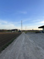
This circular walk starting from Merxheim is a leisurely stroll through the fields, with a short stretch through the village of Gundolsheim, on flat ground.
Fields and vineyards between Hartmannswiller and Berrwiller
 3.64 mi
+135 ft
-138 ft
1h 45
Easy
Departure from Hartmannswiller (Haut-Rhin)
3.64 mi
+135 ft
-138 ft
1h 45
Easy
Departure from Hartmannswiller (Haut-Rhin)
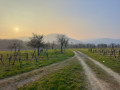
A pleasant walk to discover some of the highlights of the village of Hartmannswiller, as well as its vineyards and some of the surrounding hills.
Wuenheim and the vineyards of Ollwiller
 3.69 mi
+344 ft
-348 ft
2h 00
Easy
Departure from Wuenheim (Haut-Rhin)
3.69 mi
+344 ft
-348 ft
2h 00
Easy
Departure from Wuenheim (Haut-Rhin)
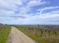
Starting from Wuenheim, this circular route will take you through the vineyards of Ollwiller after a short stretch through the forest.
From Uffholtz to Wattwiller via the Coteaux du Vieil-Armand
 3.75 mi
+390 ft
-381 ft
2h 05
Easy
Departure from Uffholtz (Haut-Rhin)
3.75 mi
+390 ft
-381 ft
2h 05
Easy
Departure from Uffholtz (Haut-Rhin)
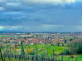
Starting from the village of Uffholtz, you will walk to Wattwiller, passing through the vineyards on the hill overlooking the two villages.
A circular loop in the Vallée Noble starting from Wintzfelden
 3.73 mi
+249 ft
-262 ft
1h 55
Easy
Departure from Soultzmatt (Haut-Rhin)
3.73 mi
+249 ft
-262 ft
1h 55
Easy
Departure from Soultzmatt (Haut-Rhin)
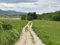
Starting from the centre of Wintzfelden, this circular walk will take you to the Soultzmatt Community Forest along quiet, open paths, amidst meadows full of flowers on fine days.
The ruins of Schwartzenthann as seen from Wintzfelden
 2.39 mi
+656 ft
-653 ft
1h 40
Easy
Departure from Soultzmatt (Haut-Rhin)
2.39 mi
+656 ft
-653 ft
1h 40
Easy
Departure from Soultzmatt (Haut-Rhin)
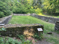
This circular route, which runs mainly through woodland, will take you to explore the ruins of the former Schwartzenthann convent, before climbing a little higher into the woods.
Linthal Chapel Trail
 2.44 mi
+505 ft
-486 ft
1h 35
Easy
Departure from Linthal (Haut-Rhin)
2.44 mi
+505 ft
-486 ft
1h 35
Easy
Departure from Linthal (Haut-Rhin)
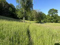
Starting from a chapel in the village of Linthal, you’ll climb through the forest overlooking the village, passing through pretty, flower-filled clearings and enjoying lovely views of the village below.
Short walk south of Jungholtz
 3.06 mi
+295 ft
-315 ft
1h 40
Easy
Departure from Jungholtz (Haut-Rhin)
3.06 mi
+295 ft
-315 ft
1h 40
Easy
Departure from Jungholtz (Haut-Rhin)
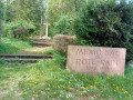
This walk between Soultz-Haut-Rhin and Jungholtz takes you along the Way of the Cross from the Rote Rain Memorial to the famous Thierenbach Basilica, before crossing the village of Jungholtz to reach Mittelbourg and its vineyards, and finally returning to the starting point near the stork park in Soultz/Wuenheim.
The Llogara Circle circular route
 8.00 mi
+1,857 ft
-1,850 ft
5h 20
Average
Departure from Albania
8.00 mi
+1,857 ft
-1,850 ft
5h 20
Average
Departure from Albania
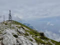
The Llogara Circle (sometimes called the Maja e Thanasit circular hike) is an iconic hike in Llogara National Park, in the heart of the Albanian Riviera. From the road pass, the route traces a large loop that skims the ridge, overlooks the Ionian Sea, then plunges back into a forest of ancient black pines. Get ready to enjoy spectacular views of the Mediterranean, nearly1,400metres below!
Loop from Mirecourt to Poussay and Mazirot: heritage and nature
 6.54 mi
+358 ft
-361 ft
3h 20
Easy
Departure from Mirecourt (Vosges)
6.54 mi
+358 ft
-361 ft
3h 20
Easy
Departure from Mirecourt (Vosges)
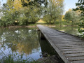
Starting from Mirecourt, this loop is an enjoyable way to discover the heritage and countryside of the Vosges. The route passes through varied landscapes: village lanes, hedged paths, open fields and rivers crossed by charming wooden footbridges. Along the way, you will reach the village of Poussay and then Mazirot. Between nature and heritage, this accessible hike offers beautiful views and a peaceful atmosphere, ideal for a half-day outing.
The Auttikönkään Luontopolku waterfall
 1.91 mi
+384 ft
-381 ft
1h 15
Easy
Departure from Finland
1.91 mi
+384 ft
-381 ft
1h 15
Easy
Departure from Finland
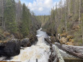
The Auttikönkään Luontopolku is a short circular walk that showcases several aspects of Finnish Lapland: a powerful waterfall, a deep-gorge river, an unspoilt boreal forest and a few traces of the history of timber floating.
Tour of Hindsgavl Deer Park
 4.03 mi
+213 ft
-210 ft
2h 00
Easy
Departure from Denmark
4.03 mi
+213 ft
-210 ft
2h 00
Easy
Departure from Denmark
This circular route is the medium-length route among the three official trails offered on the Hindsgavl peninsula, in the heart of Lillebælt Nature Park. The route runs along the wild north coast, where you can see the two Little Belt bridges, and crosses the historic grounds of Hindsgavl Castle. Its main feature is that half the route is within the wildlife park enclosure and half outside it, offering a wonderful combination of architectural heritage and the chance to observe the park’s large deer.
A stroll through Copenhagen
 4.91 mi
+33 ft
-72 ft
2h 15
Easy
Departure from Denmark
4.91 mi
+33 ft
-72 ft
2h 15
Easy
Departure from Denmark
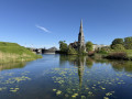
This pleasant route, accessible by metro, will guide you through the city’s most iconic landmarks. Along this route, you’ll have the chance to explore exceptional and completely free sites, such as the Copenhagen Botanical Garden,the famous picturesque harbour of Nyhavn, the unmissable Little Mermaid statue,the Copenhagen Citadel (Kastellet),the monumental Gefion Fountain andthe majestic Marble Church (Marmorkirken).
Circular route in Stenshuvud National Park
 3.12 mi
+272 ft
-295 ft
1h 40
Easy
Departure from Sweden
3.12 mi
+272 ft
-295 ft
1h 40
Easy
Departure from Sweden
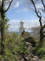
Let yourself be enchanted by the magic of Österlen on this superb circular walk in the heart of Stenshuvud National Park. This exceptional route invites you to traverse a mosaic of striking landscapes, alternating between dense woodland, a sandy shoreline and a wild rocky coast dominated by its historic lighthouse. Your walk will then take you to the three peaks of this crystalline massif, where the remains of an Iron Age fortress and the legends of the giant Sten blend with a magnificent panorama of the Baltic Sea.
The Megaliths of Ale
 1.78 mi
+105 ft
-105 ft
0h 55
Easy
Departure from Sweden
1.78 mi
+105 ft
-105 ft
0h 55
Easy
Departure from Sweden
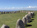
This walk begins in the charming fishing village of Kåseberga, climbs up to the majestic megalithic monument of Ales Stenar overlooking the Baltic Sea, before following the coastal ridges offering beautiful sea views. This route, both easy and wild, perfectly combines the rugged natural beauty of the coast with the mystery of Swedish history.
Röttle waterfall and old mill
 0.85 mi
+98 ft
-75 ft
0h 30
Easy
Departure from Sweden
0.85 mi
+98 ft
-75 ft
0h 30
Easy
Departure from Sweden
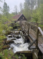
Set within the Västanå Nature Reserve, this short walk invites you to discover the charming historic village of Röttle on the shores of Lake Vättern and the River Röttleån, with its rapids and waterfall, a reminder of the importance water once held for the area’s old mills.
Ellen Key’s trail: between Lake Vättern, beech woods and the history of Omberg
 3.83 mi
+610 ft
-594 ft
2h 15
Easy
Departure from Sweden
3.83 mi
+610 ft
-594 ft
2h 15
Easy
Departure from Sweden
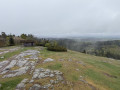
The Ellen Keys Trail is an ideal circular walk for exploring the varied landscapes of Omberg. From Stocklycke, the trail passes through forests, coastal beech woods and offers views of Lake Vättern, climbing up to Hjässan, the summit of Omberg, and passing close to Ellen Key’s house. Combining nature, history and panoramic views, this route offers a pleasant walk within the nature reserve.
Gamla Linköping: From Stadskvarteren to Valla Gård
 1.86 mi
+69 ft
-69 ft
0h 55
Easy
Departure from Sweden
1.86 mi
+69 ft
-69 ft
0h 55
Easy
Departure from Sweden
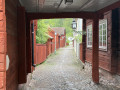
This route invites you on a journey through time in the heart of Östergötland. Linking the cobbled streets of Stadskvarteren (the historic quarter of Gamla Linköping) to the authentic barns of Valla Gård via the wooded paths of the nature reserve, this walk harmoniously combines the tranquillity of the forest with the charm of a traditional Swedish town. A perfect blend of fresh air and living heritage.
A stroll through Stockholm
 8.00 mi
+423 ft
-440 ft
4h 05
Average
Departure from Sweden
8.00 mi
+423 ft
-440 ft
4h 05
Average
Departure from Sweden
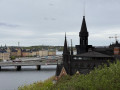
This pleasant city walk, easily accessible by metro, invites you to discover the most iconic aspects of the Swedish capital in a single day. Throughout this route, you’ll have the chance to explore exceptional sites that are entirely free to visit, ranging from the elegance of Östermalm’s market halls and the Strandvägen waterfront to the medieval alleyways of Gamla Stan, home to Stortorget Square, the Royal Palace and the cathedral. The route will also take you to the island of Södermalm to explore the trendy atmosphere of SoFo, the green spaces of Tantolunden, as well as the city’s most beautiful panoramic views from the heights of Skinnarviksberget and the Monteliusvägen trail, before ending at the Parliament.
Strolling around Uppsala
 3.10 mi
+407 ft
-400 ft
1h 45
Easy
Departure from Sweden
3.10 mi
+407 ft
-400 ft
1h 45
Easy
Departure from Sweden
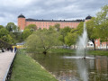
Enjoy a wonderful exploration of Uppsala, taking in its historical heritage, cultural sites and green spaces. Starting from the city centre, the route takes in the city’s major must-sees: the cathedral, the university, the botanical gardens and the castle, before winding its way back through Stadsträdgården park. A pleasant city walk, ideal for exploring Uppsala on foot with ease.
The royal burial mounds of Gamla Uppsala
 1.48 mi
+30 ft
-30 ft
0h 40
Easy
Departure from Sweden
1.48 mi
+30 ft
-30 ft
0h 40
Easy
Departure from Sweden
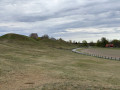
North of Uppsala, in the old town, this short route invites you to discover one of Sweden’s most iconic historical sites. With its grand royal burial mounds, open landscapes and traces of ancient Scandinavia, the route offers a peaceful immersion in a site steeped in legends and Viking history.
Bändan, between north and south on the banks of the Dalälven
 2.21 mi
+36 ft
-36 ft
1h 05
Easy
Departure from Sweden
2.21 mi
+36 ft
-36 ft
1h 05
Easy
Departure from Sweden
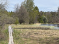
The Bändan route offers a wonderful immersion in one of the most unique landscapes of Färnebofjärden. Here, the Dalälven creates a world of water, wet forests and small islands, where the boreal atmosphere of the north meets the more southern deciduous trees: this is the Limes Norrlandicus, the biological boundary between northern and southern Sweden.
Lilla Bruksrundan, following in the footsteps of the iron industry at Axmar bruk
 1.14 mi
+7 ft
-7 ft
0h 30
Easy
Departure from Sweden
1.14 mi
+7 ft
-7 ft
0h 30
Easy
Departure from Sweden
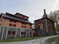
Lilla Bruksrundan invites you to discover Axmar bruk, a site steeped in Swedish industrial history set in peaceful surroundings. Amidst the remains of the forge, an English-style park and ponds, the walk reveals the unique atmosphere of a former ironworks estate. Easy and pleasant, this route offers a different perspective on the landscape, blending memories of labour, unassuming heritage and the melancholic charm of abandoned places.
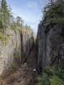
The Haute Côte and the Slåttdalsskrevan fault in Skuleskogen
 7.07 mi
+1,165 ft
-1,109 ft
4h 15
Average
Departure from Sweden
7.07 mi
+1,165 ft
-1,109 ft
4h 15
Average
Departure from Sweden
In the heart of Skuleskogen National Park, this route offers a spectacular immersion in the wild landscapes of the Swedish High Coast. Passing through boreal forests, scree slopes, tranquil lakes and panoramic views of the Baltic Sea, the route leads to the iconic sites of Slåttdalsskrevan and Slåttdalsberget. A varied and evocative hike, where every step tells the impressive geological story of a landscape that has been rising day by day since the last ice age.
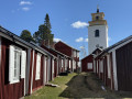
A stroll through the heart of the church village of Luleå in Gammelstad
 1.29 mi
+16 ft
-16 ft
0h 35
Easy
Departure from Sweden
1.29 mi
+16 ft
-16 ft
0h 35
Easy
Departure from Sweden
Immerse yourself in history as you wander the narrow streets of Gammelstad, the best-preserved church town in all of Scandinavia and a UNESCO World Heritage Site. This route invites you to stroll around its15th-century stone church, the focal point around which the streets developed to accommodate more than 400 picturesque wooden cottages, painted in traditional Falun red, to welcome isolated farmers who would converge on these refuges for the weekend to attend the obligatory mass.
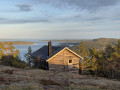
Skuleberget via Grottstigen: ascent of the Haute Côte
 2.32 mi
+896 ft
-925 ft
1h 50
2.32 mi
+896 ft
-925 ft
1h 50
 Difficult
Departure from Sweden
Difficult
Departure from Sweden
This route offers one of the most beautiful ways to explore Skuleberget: a short but intense climb via the Grottstigen, right up close to the cliffs and rocks, followed by a gentler, panoramic descent via the Höga Kusten Stigen. With its caves, steep sections, summit overlooking the Baltic Sea and visible traces of post-glacial rebound, this hike encapsulates all the scenic power of the Höga Kusten.
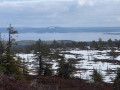
Riisin rääpäsy, the circular route around Mount Riisitunturi
 2.83 mi
+377 ft
-374 ft
1h 40
Easy
Departure from Finland
2.83 mi
+377 ft
-374 ft
1h 40
Easy
Departure from Finland
The Riisin rääpäsy circular route offers a fine overview of the iconic landscapes of Riisitunturi National Park. From the boreal forests to the open heights of the tunturi, the route alternates between viewpoints, wetlands and Lappish scenery. The park is particularly renowned for its almost surreal winter landscapes: the spruce trees are covered in a thick layer of frost and snow, forming spectacular white silhouettes.
Ölökyn ylitys, the crossing of the Julma-Ölkky canyon in Hossa
 3.43 mi
+486 ft
-512 ft
2h 00
Average
Departure from Finland
3.43 mi
+486 ft
-512 ft
2h 00
Average
Departure from Finland
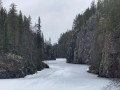
Ölökyn ylitys offers one of the finest highlights of Hossa National Park. This route runs alongside the Julma-Ölkky lake-canyon, between steep cliffs, boreal forest and rocky sections. A highlight of the route is crossing the canyon via a 45-metre-long suspension bridge.
Discover the rock paintings of Hossa (Hossan Värikalliot)
 4.66 mi
+312 ft
-322 ft
2h 25
Easy
Departure from Finland
4.66 mi
+312 ft
-322 ft
2h 25
Easy
Departure from Finland
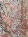
This circular forest trail leads to one of Finland’s most remarkable prehistoric sites: the Hossa rock paintings. The route winds through the peaceful landscapes of Hossa National Park, between lakes and the taiga. The highlight is at the shore of Lake Somerjärvi, where a cliff face adorned with figures dating back several millennia serves as a reminder of the ancient importance of these waterways.
The Winter War Memorial in Suomussalmi
 0.62 mi
+43 ft
-43 ft
0h 20
Easy
Departure from Finland
0.62 mi
+43 ft
-43 ft
0h 20
Easy
Departure from Finland
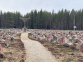
This short, highly symbolic circular route invites you to discover the Talvisodan monumentti, a key site commemorating the Winter War between Finland and the Soviet Union, where the setting helps to convey the harshness of the fighting that took place here during the winter of 1939–1940. The route crosses the memorial before turning back through the neighbouring forest.
The Sidelhorn from the Grimsel Pass, on the shores of Lake Totensee
 5.13 mi
+1,978 ft
-1,962 ft
5 hrs
5.13 mi
+1,978 ft
-1,962 ft
5 hrs
 Very difficult
Departure from Oberwald (Valais)
Very difficult
Departure from Oberwald (Valais)
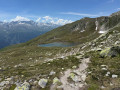
Starting from the Grimsel Pass in the Bernese Alps, this mountain hike ascends to the summit of the Sidelhorn before descending through the valley of the high-altitude lakes. The route first climbs above the Totensee and its mountain-pass hotel, along a stony path that soon overlooks the Rhône Valley and the surrounding glacial peaks. The final ascent involves scrambling up a rocky ridge to a wide viewpoint overlooking the High Bernese Alps and their glaciers. The return route runs alongside the Jostsee, a small mountain lake, before following a balcony-like path back towards the pass. A true alpine ascent, to be attempted only in the height of summer, in fine, dry weather, and reserved for seasoned walkers wishing to experience the Swiss high mountains.
Ukko-Koli, a circular route above Lake Pielinen
 2.35 mi
+486 ft
-486 ft
1h 30
Easy
Departure from Finland
2.35 mi
+486 ft
-486 ft
1h 30
Easy
Departure from Finland
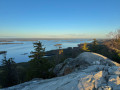
In the heart of Koli National Park, in North Karelia, this hike leads to the summit of Ukko-Koli, the park’s most famous viewpoint. Starting from the western shore of Lake Pielinen, the route first descends through the boreal forest of pine and spruce, passing white quartzite boulders and a wetland criss-crossed by footbridges, before climbing back up to the open heights. Up there, the light-coloured rock slab offers a sweeping panorama of Lake Pielinen, dotted with islands – a landscape that has inspired painters and composers and is counted amongst Finland’s national landscapes. An ideal getaway to discover one of the most iconic sites of Finnish nature.
Please note that in winter conditions, the entire route is not always accessible.
Lappeenranta, from the harbour on Lake Saimaa to the fortress
 2.60 mi
+75 ft
-82 ft
1h 15
Easy
Departure from Finland
2.60 mi
+75 ft
-82 ft
1h 15
Easy
Departure from Finland
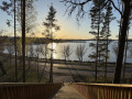
On the shores of Lake Saimaa, Finland’s largest lake, this circular walk takes you on a tour of Lappeenranta during the golden hour of evening. From the harbour, you’ll walk alongside the marina’s jetties, its boats and waterside terraces, before reaching a viewpoint overlooking the lake dotted with wooded islands. Further on, a large wooden staircase descends from a wooded headland overlooking the lake. The return route climbs up to the fortress (Linnoitus), the old fortified town with its cobbled streets and wooden houses, which is home to museums and the country’s oldest Orthodox church.
The Valkmusa bog and its bird tower
 1.41 mi
+23 ft
-56 ft
0h 40
Easy
Departure from Finland
1.41 mi
+23 ft
-56 ft
0h 40
Easy
Departure from Finland
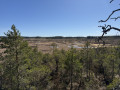
In the heart of Valkmusa National Park, in southern coastal Finland, this circular walk takes you through one of the largest peat bogs on the Finnish coast. The Simonsaari trail initially winds its way along boardwalks through a sparse birch forest, before opening out onto the vast, open expanse of the domed peat bog, dotted with pools and dwarf pines. At its centre, an observation tower offers sweeping views over the bog and its forest edge. It is a renowned spot for birdwatching, particularly for waders passing through in spring. An ideal nature outing for an easy walk, bringing you up close to a fragile and unspoilt environment.
Porvoo, the medieval old town on the banks of the Porvoonjoki
 3.37 mi
+79 ft
-79 ft
1h 35
Easy
Departure from Finland
3.37 mi
+79 ft
-79 ft
1h 35
Easy
Departure from Finland
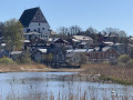
As Finland’s second-oldest town, Porvoo (Borgå) boasts one of the country’s finest clusters of wooden houses along the banks of the River Porvoonjoki. This circular walk takes you around the old town along both banks of the river. You’ll walk down the cobbled alleyways leading down from the medieval cathedral, skirt a reed-lined pond offering a picture-postcard view of the colourful houses, pass the old railway museum and its railcar, then reach a panoramic rock overlooking the river. After crossing the bridge, you’ll follow the quay and its marina before heading back up to the higher parts of the old town. An ideal stroll to take your time exploring one of Finland’s most iconic sites.
Keila-Joa Park circular walk: waterfall, manor house and chapel
 1.81 mi
+141 ft
-141 ft
0h 55
Easy
Departure from Estonia
1.81 mi
+141 ft
-141 ft
0h 55
Easy
Departure from Estonia
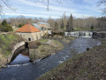
To the west of Tallinn, on the banks of the River Keila and very close to the Gulf of Finland, Keila-Joa Manor Park unfolds its paths and lawns beneath tall trees. This circular walk first takes you to the foot of Keila Juga Waterfall, one of Estonia’s widest waterfalls, which can be viewed from both banks via a series of footbridges. It then crosses the park and its stone-lined canal, winds its way up the wooded valley to the ruins of Meremõisa Manor, before reaching the Benckendorff Chapel-Mausoleum, nestled in a pine forest on Kabelimägi Hill. An ideal walk combining the power of a waterfall with the charm of a park steeped in history.
Haapsalu: from the medieval castle to the seafront and the railway museum
 4.54 mi
+33 ft
-39 ft
2h 05
Easy
Departure from Estonia
4.54 mi
+33 ft
-39 ft
2h 05
Easy
Departure from Estonia
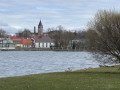
On Estonia’s west coast, Haapsalu’s wooden houses and promenades stretch along the edge of a shallow bay; this former seaside resort was once prized for its therapeutic mud. This circular walk takes in the main sights. You’ll first reach the medieval bishop’s castle and its cathedral, then head to the seafront and its wooden viewing platforms overlooking the bay. You then walk along vast coastal meadows where, in spring, huge flocks of migratory geese gather, before skirting the bay along its tranquil shores, from where the picture-postcard view of the castle rising above the water comes into view. The return journey takes you past the historic railway station and its railway museum, renowned for its very long covered wooden platform. An ideal getaway combining heritage, the seaside and birdwatching.
The Rannametsa–Tolkuse trail, between dunes and peat bogs
 1.36 mi
+69 ft
-82 ft
0h 40
Easy
Departure from Estonia
1.36 mi
+69 ft
-82 ft
0h 40
Easy
Departure from Estonia
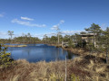
In Pärnu County, in south-western Estonia, this nature trail winds its way along a boardwalk through one of the country’s most unique landscapes. It first climbs a pine-covered sand dune – one of the highest in the country – where a tall wooden tower offers sweeping views over the Tolkuse bog and its mosaic of pools. The circular route then heads into the heart of the marsh, to a viewing platform situated on the edge of the largest pool, before returning through a damp birch forest.
The Kirkilai Karst Lakes and their observation tower
 0.53 mi
+7 ft
-7 ft
0h 15
Easy
0.53 mi
+7 ft
-7 ft
0h 15
Easy
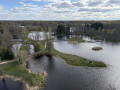
In the heart of Biržai Regional Park, in northern Lithuania, this short circular walk takes you around a unique geological site: the Kirkilai Karst Lakes. Here, the dissolution of underground gypsum has carved out a multitude of small basins – known as dolines – which are now filled with water and surrounded by grassy strips of land. The path leads from one basin to the next via wooden footbridges, winding through reeds and birch trees. At the start stands a tall wooden tower, shaped like a boat or a crescent moon, whose viewing platform offers a panoramic view of the entire mosaic of lakes and the surrounding countryside. An ideal walk for an easy family outing, bringing you up close to a rare natural wonder.