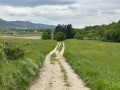
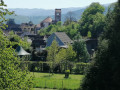
The ruins of Schwartzenthann as seen from Wintzfelden

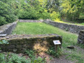
This circular route, which runs mainly through woodland, will take you to explore the ruins of the former Schwartzenthann convent, before climbing a little higher into the woods.

Details

34416992
Creation:
Last update:
Last review:
  • Walking
    Activity: Walking
  • ↔
    Distance: 2.39 mi
  • ◔
    Average duration: 1h 40 
  • ▲
    Difficulty: Easy

  • ⚐
    Back to start: Yes
  • ↗
    Ascent: + 656 ft
  • ↘
    Descent: - 653 ft

  • ▲
    Highest point: 1,926 ft
  • ▼
    Lowest point: 1,227 ft

Photos

Description of the walk

Park in the small car park at the entrance to the forest, at the top of Rue des Vosges in Wintzfelden.

(S/E) With your back to the car park, turn right, enter the village and walk down Rue des Vosges until you reachthe third speed bump.

(1) Take a hairpin bend to the right to continue along the Chemin du Klosterrain. Once you’ve entered the forest, a junction offers you the choice of reaching the ruins ‘by the path’ or ‘by the trail’.
Both options take the same amount of time and involve the same elevation gain; the first goes through the vineyards via a wide, accessible path, whilst the second goes through the forest via a more rugged footpath.
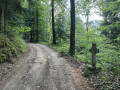
This route follows the footpath, which also offers views of more ruins.

(2) After passing the church ruins, turn right and then right again (Blue Triangle signpost).

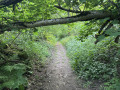
(3) Take the path that winds to the left of the track.

(4) Walk behind the chalet and continue along the connecting path marked with a Red Disc. Ignore the first junction (thisfirst path does not appear on maps) and, at the top, turn right to begin the descent. Halfway down, at the junction withthe first forest track, the path continues slightly to the right. At the bottom of the path, turn right onto the Chemin du Thannhurstel (marked with a Blue Ring) and continue to the car park (S/E).

Waypoints

  1. S/E : mi 0 - alt. 1,365 ft - Car park
  2. 1 : mi 0.27 - alt. 1,250 ft - Exit from Wintzfelden
  3. 2 : mi 0.97 - alt. 1,490 ft - Ancien couvent du Schwartzenthann
  4. 3 : mi 1.32 - alt. 1,562 ft - Winding path
  5. 4 : mi 1.47 - alt. 1,732 ft - Petit Chalet
  6. S/E : mi 2.39 - alt. 1,368 ft - Car park

Notes

You will mainly be walking along paths and tracks.
A quarter of this walk is in the sun, three-quarters in the shade.

Alternatives
You can adjust the difficulty of the route with these easier versions of the circular route:
- 3.6 km, 160 m elevation gain: at (4), turn right onto the forest track to reach the end of the circular route.
- 3.4 km, 120 m elevation gain: at (3), turn right onto the forest track to reach the end of the circular route.
- 3.4 km, 120 m elevation gain: at (2), turn left to head back in the opposite direction along the path.

Worth a visit

Reviews and comments

4.7 / 5
Based on 3 reviews

Reliability of the description
5 / 5
Ease of following the route
4.7 / 5
Route interest
4.3 / 5
Elderberry
Elderberry

Overall rating : 5 / 5

Date of your route : Aug 10, 2026
Reliability of the description : ★★★★★ Very good
Ease of following the route : ★★★★★ Very good
Route interest : ★★★★★ Very good
Very busy route : No

A lovely, shaded walk for families. The ruins are very well presented, with information boards and a QR code. So, for those who are interested, you should allow about 45 minutes to explore the site. Thank you for this walk.

Machine-translated

schtroumfette85
schtroumfette85

Overall rating : 4.7 / 5

Date of your route : Mar 09, 2025
Reliability of the description : ★★★★★ Very good
Ease of following the route : ★★★★★ Very good
Route interest : ★★★★☆ Good
Very busy route : No

A chalet just over halfway along the path, where there’s a camping table outside for eating if you wish

Machine-translated

JMBPFAFF
JMBPFAFF

Overall rating : 4.3 / 5

Date of your route : Sep 22, 2024
Reliability of the description : ★★★★★ Very good
Ease of following the route : ★★★★☆ Good
Route interest : ★★★★☆ Good
Very busy route : No

A lovely little walk

Machine-translated

Other walks in the area

For more walks, use our search engine .

The GPS track and description are the property of this route's author. Please do not copy them without permission.