Trzy Korony from Sromowce Niżne via the Wąwóz Szopczański

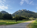
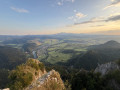
Starting from Sromowce Niżne, in Lesser Poland, this circular route takes you to the Trzy Korony, the ‘Three Crowns’, whose limestone peaks rise up in the heart of the Pieniny National Park. The ascent begins in the Wąwóz Szopczański, a deep gorge flanked by two high white cliffs, then continues through the forest along a long path of steps to the Przełęcz Szopka pass, where the view already stretches as far as the Tatra Mountains. A final rocky outcrop leads to Okrąglica and its metal walkway clinging to the rock face, suspended above the Dunajec gorge, its villages and its patchwork of fields. The return route winds down the other side, through the Polana Kosarzyska clearing, before plunging back into the forest and returning to the village.

Details

104216135
Creation:
Last update:
Last review:
  • Walking
    Activity: Walking
  • ↔
    Distance: 4.26 mi
  • ◔
    Average duration: 3h 30 
  • ▲
    Difficulty: Moderate

  • ⚐
    Back to start: Yes
  • ↗
    Ascent: + 1,736 ft
  • ↘
    Descent: - 1,736 ft

  • ▲
    Highest point: 3,215 ft
  • ▼
    Lowest point: 1,476 ft

Photos

Description of the walk

Park in the large paid car park on Trzech Koron Street in Sromowce Niżne, at the foot of the mountain range. There are also free parking spaces along the road, about 400 metres further back.

Yellow markings

(S/E) From the car park, head north-west along the paved path that runs alongside Trzech Koron Street, between the fenced-off meadows. Join the road and follow it to its end, in front of the Pieniny National Park visitor centre.

(1) At the T-junction, turn right and continue uphill along the small road.

(2) In front of the restaurant, turn left to continue climbing and pass to the left of the building. The path then leaves the tarmac. Continue uphill.

(3) At the crossroads, marked by the Święta Joanna Beretta Molla memorial, leave the path leading into the forest on your right (the one you’ll take on the way back) and carry on straight ahead. Further up, pass a map sign and a bench. Stay on the same path, which climbs steadily. Enter the Wawoz Szopcanski.

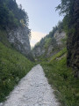
(4) Wind your way along the bottom of the ravine, between two high limestone cliffs, on a wide path of white gravel. Further on, the slope becomes steeper, a few steps appear and the path narrows as it runs alongside the stream on your right. Cross the stream via a small wooden staircase: the path then runs to your left. Continue up a series of long earthen and log steps, followed by another wooden staircase, then more steps.

Finally, leave the stream – which continues straight ahead – by turning left to cross it again and take another flight of steps. The steps zigzag through the forest along a single path. Finish with a few stone steps and emerge into a small clearing, where the slope levels out. Follow the path uphill to the pass.

Blue markings

(5) At the Col de la Przełęcz Szopka, at the crossroads of paths lined with numerous benches, turn right to continue climbing. The view then opens up widely to the right.

The steps resume shortly afterwards, some made of wood, others of stone, and the slope becomes noticeably steeper. At the end of this steep climb, you’ll reach a picnic area with a log shelter. Pass to the left of the shelter: the main climb is now over. The path levels out, then climbs slightly again after crossing a clearing, before entering the forest once more along a path lined with benches. You’ll emerge at the summit junction, where an amphitheatre of log benches faces the ticket office for the viewpoint. Take the metal footbridge to the right, then the metal stairs clinging to the rock face.

(6) At the summit of Okrąglica, the panoramic gallery overlooks the Dunajec Gorge. Then head back down via the same stairs and footbridge to the junction, then continue straight on to begin the descent.

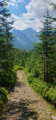
You’ll quickly lose altitude through the forest, via long flights of steps, until you reach a clearing.

Green signposting

(7) At the junction at Polana Kosarzyska, on the edge of the clearing, turn right to continue the descent. Follow the single path, which descends steadily, passes through the Wyżny Łazek Pass and alternates between steps and rocky sections. Further down, descend a final flight of steps and cross the Szopczański Potok to rejoin the path you took on the ascent.

(3) At the crossroads, return to the starting point by following the route in reverse (S/E).

Waypoints

  1. S/E : mi 0 - alt. 1,480 ft - Car park – Trzech Koron Street
  2. 1 : mi 0.19 - alt. 1,519 ft - T-junction
  3. 2 : mi 0.35 - alt. 1,575 ft - Restaurant
  4. 3 : mi 0.48 - alt. 1,594 ft - Crossroads of the circular loop
  5. 4 : mi 0.75 - alt. 1,788 ft - Entrance to the - Wąwóz Szopczański
  6. 5 : mi 1.51 - alt. 2,572 ft - Pass - Przełęcz Szopka
  7. 6 : mi 2.09 - alt. 3,215 ft - Summit - Trzy Korony / Okrąglica (982 m)
  8. 7 : mi 2.51 - alt. 2,707 ft - Crossroads at Polana Kosarzyska
  9. S/E : mi 4.26 - alt. 1,480 ft - Car park – Trzech Koron Street

Notes

Sturdy walking shoes are essential. Both the ascent and descent involve long flights of wooden, earthen and stone steps, as well as sections over rock, which can be slippery in wet weather. Out of season, in icy or snowy conditions, these steps and limestone slabs make the circular route considerably more challenging.

Take plenty of water and snacks with you: there are no water points or places to buy refreshments along the trail. The restaurant at (2) is the only one on the route, situated at both the very start and the very end. This is the Schronisko PTTK Trzy Korony, a mountain refuge open for meals from 8 am to 8 pm in August 2026. Pay-to-use toilets are located near the start, next to the Pieniny National Park’s educational centre.

(5) The pass is the main rest stop on the route, with plenty of benches. Between (5) and (6), a picnic area with a simple, open log shelter provides basic shelter.

The car park at the start of the route is pay-and-display: expect to pay around 7 to 10 zł (~€1.65 to €2.35) per hour or part thereof, and around 30 zł (~€7) for the whole day (2026 rates). The free parking spaces on Trzech Koron Street are in high demand in summer.

Entry to the Pieniny National Park is free. Only access to the panoramic gallery at the summit (6) is subject to a charge: 10 zł (~€2.35) full price and 5 zł (~€1.20) reduced price, payable from1 April to 15 November; access is free from 16 November to 31 March (2026 prices). The ticket is also valid on the same day for the summit of Sokolica. Make sure you have cash to hand, and be prepared for queues during peak season or on fine weekends, as the viewing platform can only accommodate around thirty people. Opening times and prices can be found at piepn.gov.pl. As prices are revised annually, please check them before setting off.

(7) At the Polana Kosarzyska junction, the blue-marked trail continues – separate from the green markings on the rest of the descent – and leads in about ten minutes to the ruins of Zamek Pieniński and the Grota św. Kingi, some 300 metres away. You’ll need to descend via steep steps and then climb back up to the junction.

Access is via the road to Sromowce Niżne, at the foot of the mountain range.

Worth a visit

(S/E) The Pieniny National Park educational centre, near the start of the trail. Established on1 June 1932, this park, covering approximately 2,346 ha, is one of Poland’s smallest national parks. Sromowce Niżne, on the banks of the Dunajec, is one of the starting points for the descent through the gorge on traditional log-drifters’ rafts.

(4) The gorge carved into the limestone, where the white gravel path winds its way between two high, vertical cliffs.

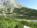
(5) The pass, a spacious clearing with benches at a crossroads, from where the view stretches over the meadows and hills, all the way to the Tatra Mountains on the horizon.

(6) Okrąglica (982 m) is the highest of the massif’s five limestone peaks and the only one still accessible; the other four have been closed to the public since the park was established in 1932. From the metal walkway clinging to the rock face, the view plunges down to the Dunajec Gorge and Sromowce Niżne, then takes in the monastery at Červený Kláštor in Slovakia, the Spiš Pieniny, the Beskid Sądecki, the Gorce and the Tatra Mountains.

For more walks, use our search engine .

The GPS track and description are the property of this route's author. Please do not copy them without permission.