The fortified hills of Kernavė, the former capital of Lithuania

Set on a high terrace overlooking the Pajauta Valley and the River Neris, in the heart of Lithuania, this route takes you around one of the country’s most iconic archaeological sites, a UNESCO World Heritage Site. Kernavė was one of the first Lithuanian towns and a medieval capital of the Grand Duchy, which no longer exists. All that remains of the ancient city are five fortified hills – large, grassy mounds with flat summits, separated by deep ravines and linked by wooden stairways. The trail then descends into the Pajauta Valley, follows a reconstructed log road and passes through a medieval timber-framed village, before returning via the heights overlooking the meandering Neris.

Details

101888939
Creation:
Last update:
Last review:
  • Walking
    Activity: Walking
  • ↔
    Distance: 1.45 mi
  • ◔
    Average duration: 0h 55 
  • ▲
    Difficulty: Easy

  • ⚐
    Back to start: Yes
  • ↗
    Ascent: + 253 ft
  • ↘
    Descent: - 272 ft

  • ▲
    Highest point: 377 ft
  • ▼
    Lowest point: 230 ft

Photos

Description of the walk

Park in the car park at the junction of Ruseckų gatvė and Kerniaus gatvė, opposite the entrance to the Kernavė Archaeological Museum.

(S/E) From the car park, head towards Kerniaus gatvė and turn left. Opposite Kernavė Church, turn left towards the ticket booth marking the entrance to the site.

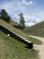
(1) Pass the ticket booth (entrance fee by voluntary donation) and continue straight ahead along Kunigaikščių takas, the Dukes’ Path. Walk past the Vytautas the Great Memorial, then head slightly to the left towards the viewing platform a few dozen metres further on. From this vantage point, the view takes in the fortified hills, the Pajauta Valley and the River Neris below in a single sweep. Return to the path, descend the first few steps and follow it, veering slightly to the left between the hillocks. At the three-way junction, turn left and then climb the staircase immediately on the left to reach the summit of this first hill.

(2) At Mindaugas’ Throne, turn back, go down the same wooden staircase and immediately climb the staircase opposite.

(3) At the top of Altar Hill – the oldest and most central hill on the site, which once stood the ducal castle – head back down the way you came. At the bottom of the steps, turn right, then, a little further on, climb the long wooden staircase on the left.

(4) Make your way to the top of Lizdeika Hill. Head back down, still retracing your steps. Back on the Kunigaikščių takas, turn right, then immediately left at the three-way junction to head down into the Pajauta valley. At the three-way junction, continue to the right along the Medgrinda, a reconstructed log track, then climb the wooden staircase leading back up towards the village. After the climb through the forest, turn left at the junction facing the village.

(5) Pass through the wooden gate of the reconstructed medieval village and explore its artisans’ courtyards. On leaving, continue to the right at the three-way junction and follow the return path that runs along the edge of the terrace, above the Neris. It offers sweeping views of the river’s meanders and the valley. Join the Kunigaikščių takas to the left, leave the site, then rejoin Kerniaus gatvė and finally the car park (S/E).

Waypoints

  1. S/E : mi 0 - alt. 367 ft - Kerniaus gatvė car park
  2. 1 : mi 0.08 - alt. 374 ft - Entrance - Site archéologique de Kernavė
  3. 2 : mi 0.35 - alt. 361 ft - Throne of Mindaugas
  4. 3 : mi 0.44 - alt. 295 ft - Altar Hill / Aukuras - Neris
  5. 4 : mi 0.56 - alt. 348 ft - Lizdeika Hill
  6. 5 : mi 0.97 - alt. 377 ft - Reconstructed medieval village
  7. S/E : mi 1.45 - alt. 367 ft - Kerniaus gatvė car park

Notes

Entry to the site is free. At the entrance, a ticket machine offers an entry ticket for a voluntary contribution of approximately €1.20 (€1 + €0.20 in fees).

In wet or frosty weather, the grassy slopes and wooden steps can be slippery. In winter, they may be covered in snow or ice. Sturdy footwear is recommended.

Please stay on the paths and steps: the hills are a protected monument, and trampling the grass is prohibited.

Access is by road, via Kerniaus gatvė, in the village of Kernavė, where the car park is located. There are cafés and restaurants in the village.

Worth a visit

The Kernavė archaeological site has been a UNESCO World Heritage Site since 2004. Formerly the capital of the Grand Duchy of Lithuania during the reign of Grand Duke Traidenis, the town – one of the oldest in the country (first mentioned in 1279) – was destroyed in 1390 by the Teutonic Order.

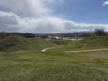
The fortified hills (piliakalniai) can be seen from the terrace above the Pajauta Valley. Altar Hill, the oldest and most central of these, was the site of the ducal castle.

(4) In the Pajauta Valley, a log road has been reconstructed: the Medgrinda, considered to be the oldest known paved road in Lithuania. Dating from themid-1st millennium, it was discovered buried in peat.

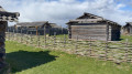
(5) The reconstructed medieval village evokes the craftsmen’s quarters of the 13th and 14th centuries, with its wooden palisade, shingle-roofed gate and log houses.

Near the car park, the Kernavė Archaeological and Historical Museum rounds off a visit to the site.

For more walks, use our search engine .

The GPS track and description are the property of this route's author. Please do not copy them without permission.