Country:

 City:
City:


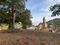
Park in the car park on Place du Marché, opposite the Maurice Koechlin School.
(S/E) With your back to the school and its miniature replica of the Eiffel Tower, head straight along Rue du Marché, a narrow pedestrianised lane that winds its way between the houses. At the end, cross Rue du Florival at the pedestrian crossing, then walk along it to the left on the opposite pavement, towards the town hall with its blue façade.
(1) Walk past the town hall and continue straight on along Rue de la Gare. At the next junction, turn right down Rue de la Fabrique. About twenty metres further on, cross the road at the pedestrian crossing and continue along the pavement on the left.
(2) Walk past the Maison Koechlin and continue down this pavement for about 700 metres, until you reach the junction near the Collège du Hugstein. Turn left here, staying on the left-hand pavement, and cross the Lauch via the small wooden footbridge. Immediately afterwards, at the entrance to the roundabout, turn right to cross Rue de la Fabrique at the pedestrian crossing, then cross Route de Colmar at the next crossing and head towards the replica of the Eiffel Tower.
(3) Cross the small Rue de la Porte de Buhl at the pedestrian crossing, then head straight on along the cycle path on Rue du Trottberg, which runs alongside the main road, and follow it straight on for about 700 m. At the entrance to the residential area, continue for a few dozen metres along Rue du Trottberg, which has become a narrow street.
(4) Turn right onto Rue de la Liberté and follow it upwards. At the small junction, carry on straight ahead, then straight ahead again at the ‘give way’ sign.
Blue Disc signposting
At the end of Rue de la Liberté, turn right onto Rue de la Carrière, towards Lautenbach, and immediately follow it to the left. At the junction with Rue du Réservoir, carry on straight ahead.
Blue Disc and Red Ring signposting
Leave Buhl via a small tarmac road that climbs. Pass a small car park on your right and head into the forest. At the three-way junction, turn left towards Saint-Gangolphe and Col du Bannstein, and begin a gentle descent. Pass a small flight of steps on your left and reach the edge of the forest.
Red Ring signposting
(5) Turn left for a steep but short descent towards Schweighouse. Enter the village and continue straight on along Rue Saint-Michel. At the junction by the wash house, head slightly left onto Route de Soultzmatt, towards the church.
(6) Walk past the church and head for the T-junction.
End of signposting
Cross to the opposite side at the pedestrian crossing situated slightly to the right, then head down Rue de la Vallée on the pavement to the left, towards Buhl and Guebwiller. About 150 m further down, let Rue de la Vallée continue to the left and stay on the main road, which curves to the right and becomes Rue des Prés, until you reach the D430 at the bottom.
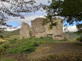
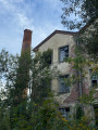
(7) Carefully cross the D430 to reach the street opposite, Rue du Colonel Bouvet. Leave this street immediately, in the middle of its left-hand bend, and continue straight on along a small, inconspicuous path between a stone wall and a wire fence. At the end of the path, you’ll come out at a right angle onto Rue du Colonel Bouvet; follow it to the right. At the T-junction, turn right to enter the Parc de la Vallée neighbourhood. Walk past a riding centre and continue straight on to the bridge leading to the old spinning mill, opposite its ruins.
(8) Turn round in front of the bridge and return to the T-junction, then carry on straight ahead at the ‘give way’ sign to follow Rue du Colonel Bouvet, which gradually runs alongside the River Lauch on your right. At the end of the street, turn right to cross the River Lauch via the small bridge with pink-and-purple railings on Rue du Florival. Immediately afterwards, head slightly to the right onto Rue des Vosges, which climbs uphill. At the junction, carry on straight ahead onto Rue de la Paroisse. Just after the left-hand bend, leave the street to the right by climbing a small flight of three steps, followed by a path that climbs steeply. At the three-way junction (not shown on the map), take the right-hand path. The path leads onto Rue du Ballon, which winds round a hillock: follow it straight ahead and, just before the next junction, head left up the hillock to the wayside cross.
(9) Head back down the hill via the same route to the nearby junction.
Red Triangle markings
Take Rue du Schrangen, which winds sharply to the left and descends to the old wash house on Place de la Fontaine.
End of signposting
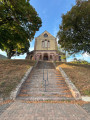
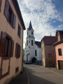
(10) Continue straight on along the narrow lane leading to Place de l’Église. Walk round Saint-Jean-Baptiste Church and return to the old washhouse.
(10) In front of the washhouse, turn left down Rue de l’Église. About a hundred metres further down, leave this street and turn left onto Rue Saint-Pirmin, which runs just below the church and cuts across its monumental staircase halfway up. Follow it to the ‘Stop’ sign.
Red Triangle signposting
Take the sharp right-hand bend into Rue de l’École, which leads down towards Place du Marché. Stay on this street until you reach the school to return to the car park (S/E).
 Visorando Member

 Tourist office
 Moderate
 Association / Club / Walk leader