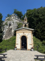
Caves and valleys of Ojców National Park from Złota Góra

To the north of Kraków, Ojców National Park unfolds its limestone valleys amongst white cliffs, rocky spires and beech forests. Starting from the Złota Góra plateau, this circular route descends into the Prądnik Valley, passes at the foot of the ruins of Ojców Castle and crosses the village before reaching Jaskinia Ciemna, which opens out like a balcony above the valley. The route then takes in the viewing points on Góra Koronna, passes through the rocky gateway of Brama Krakowska and climbs up to Jaskinia Łokietka. The return journey takes you through the coolness of the Dolina Sąspowska, where the path follows the stream from footbridge to footbridge until it reaches a long wooden boardwalk.

Details

104553830
Creation:
Last update:
Last review:
  • Walking
    Activity: Walking
  • ↔
    Distance: 7.40 mi
  • ◔
    Average duration: 4h 40 
  • ▲
    Difficulty: Moderate

  • ⚐
    Back to start: Yes
  • ↗
    Ascent: + 1,470 ft
  • ↘
    Descent: - 1,476 ft

  • ▲
    Highest point: 1,522 ft
  • ▼
    Lowest point: 1,001 ft

Photos

Description of the walk

Park in the pay-and-display car park at Złota Góra, on the edge of the Ojcowska Road, on the plateau overlooking the village of Ojców. The parking meter is located at the entrance to the car park.

White-green-white markings

(S/E) Join Route Ojcowska and follow it to the left for a few dozen metres until you reach the pedestrian crossing. Cross the road carefully and turn right onto the path running on the other side, towards Ojców Centrum. Follow this path along the ridge, keeping the road on your right. At the junction, carry on straight ahead, taking the small flight of steps leading down. Further down, rejoin the road and walk along it carefully, as it is very busy. Pass a first paved entrance on your left and continue along the road.

Markings: White-Red-White and White-Blue-White

(1) The entrance to the castle and its ticket office are just on the right, on the other side of the road. Carry on straight ahead along the road, then shortly afterwards turn left onto the path that climbs above it. Follow it through the woods, past the small benches. At the three-way junction leading back to the road, leave the signposted path and turn right.

End of signposting

A chapel then comes into view on the other side of the road. Cross carefully to go and see it.

(2) After the chapel, continue along the road, staying on the same side. At the junction, leave the main road by continuing straight on, towards the rock faces visible on the left. Then cross carefully and turn right to enter a car park; cross it, keeping close to the right-hand side. Exit on the other side, go straight on, then turn left at the three-way junction and enter a small park, heading towards the bridge visible opposite.

(3) Cross the Prądnik via the footbridge and continue straight on through the park. Walk past the stalls and terraces in the centre of Ojców, then cross a restaurant terrace to reach the small concrete road. Follow it in the same direction. It crosses the Prądnik and winds down the valley.

(4) At the junction just before the large left-hand bend, leave the wide path on your right that climbs up the Dolina Sąspowska – which you’ll take on the way back – and continue down the road. Cross the Sąspówka via the bridge, then immediately leave the road via the path that veers left to cross the Prądnik via a wooden footbridge.

White-Green-White markings

Then turn right onto the wide road, which has almost no traffic, and head up the valley floor.

(5) Leave the road to the left, just before the cave ticket office, and climb the path that winds its way to the left of a very large rock. The climb is steep. Follow the zigzagging stone steps, then pass a first viewpoint and continue climbing.

(6) In front of the cave entrance, turn left to continue the climb up earth and wooden steps. Pass a second and then a third viewing point.

(7) Carry on climbing the steps. At the end of a short level stretch, turn right and head back down via further steps; the descent alternates between short flights of steps and flat sections. After a brief climb of a few steps, take a few steps to the right to stop at the large viewpoint, then return to the junction and continue to the right.

(8) Follow the same path up the hill, alternating between short ascents and short descents. Pass a final small viewpoint on the right and begin the long descent. Run down a zigzagging flight of steps, cross a rocky slab, then continue the descent without steps.

(9) At the end of the descent, after a short climb, leave the main path by heading down to the right along the earth and wood staircase which plunges towards the valley floor.

Markings: White-Yellow-White and White-Red-White

At the bottom, turn right onto Route Ojcowska, cross the Prądnik and head up the valley floor of the Dolina Prądnika. Continue through meadows and past limestone cliffs, then turn left to enter the small valley after about 1 km.

Markings: White-Blue-White

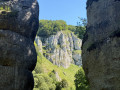
(10) Pass through the rocky gateway and head up the Wąwóz Ciasne Skałki, a narrow gorge flanked by limestone spires. The path levels out and follows a series of stone steps and short wooden footbridges, before climbing into the forest.

White-Black-White markings

(11) At the junction with two benches, continue straight on uphill. Further up, at a second junction with benches, keep going straight uphill. Pass the cave ticket office, reach the highest point of the route, then descend slightly.

(12) At the cave, turn around and head back down the same path.

(11) Back at the three-way junction with the two benches, turn left at the three-way junction. Continue almost level across the plateau, then descend along a wide path. The path becomes very stony and is punctuated by a few stone steps.

(13) At the Jonaszówka rock, at a bend overlooking the ponds, turn left and descend the stone steps that wind their way down to the bottom of the valley. Cross the first stream via a large stone slab, continue straight ahead along the gravel path, then cross the Sąspówka via the wooden bridge.

White-Yellow-White markings

(4) Back at the junction, turn left onto the small road, then immediately turn left again to resume the climb along a wide path. This path overlooks the Sąspówka on the left and leads into a cool, shady forest. Pass two isolated graves on the right-hand side of the path.

(14) Cross the Sąspówka via the wooden footbridge at the foot of a huge rock. Pass the rest area and its shelter, then continue along the stream – now on your right – between the high valley walls.

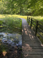
(15) Cross the Sąspówka again and set off along the long wooden boardwalk that crosses the meadow. At its end, continue along the white gravel path, running alongside a pond on your left. Cross the stream flowing from the Filipowski Spring over a small paved bridge. The path narrows but remains easy to follow.

White-Green-White markings

(16) Just past the shelter, turn right onto the path leading uphill towards Złota Góra. Climb steadily through the forest, go up a final flight of steps and reach the car park (S/E).

Waypoints

  1. S/E : mi 0 - alt. 1,470 ft - Złota Góra car park
  2. 1 : mi 0.73 - alt. 1,181 ft - Entrance to the - Château d'Ojców
  3. 2 : mi 0.99 - alt. 1,099 ft - Chapelle Na Wodzie d'Ojców
  4. 3 : mi 1.35 - alt. 1,073 ft - Bridge - Prądnik (rivière)
  5. 4 : mi 1.86 - alt. 1,063 ft - Crossing the Dolina Sąspowska
  6. 5 : mi 2.31 - alt. 1,063 ft - Ticket office at the - Jaskinia Ciemna (Grotte obscure)
  7. 6 : mi 2.52 - alt. 1,260 ft - Entrance to the - Jaskinia Ciemna (Grotte obscure)
  8. 7 : mi 2.58 - alt. 1,286 ft - Viewpoint - Góra Koronna (438 m)
  9. 8 : mi 3.11 - alt. 1,263 ft - Grodzisko na górze Okopy (site fortifié de la colline d'Okopy)
  10. 9 : mi 3.4 - alt. 1,070 ft - Stairway to the Prądnik Valley
  11. 10 : mi 4.08 - alt. 1,073 ft - Entrance to the valley - Brama Krakowska (Porte de Cracovie)
  12. 11 : mi 4.53 - alt. 1,411 ft - Crossroads of the benches
  13. 12 : mi 4.85 - alt. 1,516 ft - Entrance to the - Jaskinia Łokietka (Grotte du Roi Łokietek)
  14. 13 : mi 5.71 - alt. 1,112 ft - Rocher Jonaszówka
  15. 14 : mi 6.31 - alt. 1,145 ft - Footbridge - Sąspówka (ruisseau)
  16. 15 : mi 6.73 - alt. 1,165 ft - Wooden walkway - Sąspówka (ruisseau)
  17. 16 : mi 6.92 - alt. 1,168 ft - Shelter in the clearing
  18. S/E : mi 7.4 - alt. 1,470 ft - Złota Góra car park

Notes

Sturdy walking shoes are essential. The route features a succession of earth, wooden and stone steps, very stony paths and a few rocky slabs, which can be slippery in wet weather. It is not suitable for pushchairs.

(3) The centre of Ojców is the only place along the route where you can buy refreshments. There are restaurants, outdoor terraces and numerous food stalls (ice cream, hot dogs, obwarzanki…), as well as picnic tables behind the main building. Elsewhere, be sure to bring plenty of water and snacks.

(14) (16) Two sheltered rest areas are located along the Dolina Sąspowska. There are also numerous benches dotted along the climb to Jaskinia Łokietka, between (10) and (12).

The park is very busy, particularly at weekends in summer and in fine weather. Parking can then be difficult throughout the valley. It is best to arrive early.

Opening hours and prices

The Złota Góra car park charges a fee all year round, every day from 8 am to 8 pm: 8 zł (~€1.85) per hour or part thereof for a car, 5 zł (~€1.15) for a motorbike, 12 zł (~€2.80) for a campervan or minibus, and 30 zł (~€7) for a coach (60 zł (~€14) for 4 hours). The parking meter does not give change, and driving without a ticket costs 300 zł (~€70), reduced to 90 zł (~€21) if paid within two days (rates as at August 2026).

Entry to Ojców National Park is free. Only the developed sites charge an admission fee, with a full price and a reduced price (prices for July–August 2026):
- (1) Ojców Castle: 22 zł (~€5.10) and 15 zł (~€3.50). Self-guided tour; last admission at 5.30 pm from Monday to Friday and at 6.30 pm at weekends and on public holidays.
- (3) Ekspozycja Przyrodnicza, the park’s nature exhibition: 20 zł (~€4.65) and 14 zł (~€3.25), or 14 zł (~€3.25) and 10 zł (~€2.30) without the 3D film. Monday to Saturday, last admission at 3.00 pm.
- (6) Jaskinia Ciemna: 20 zł (~4.65€) and 14 zł (~3.25€). Guided tours depart on the hour. Tickets can be purchased at the ticket office at (5), just over 300 m further down the hill.
- (12) Łokietka Cave: 30 zł (~€7) and 21 zł (~€4.90). Guided tours every 30 minutes, open daily, last admission at 6.30 pm. Queues can exceed an hour on sunny weekends.

Opening times and prices at opn.gov.pl. These are revised annually, so please check them before you set off.

Access

Access is by road from Kraków, about 20 kilometres to the south. The Ojców Złota Góra bus stop is next to the car park. In high season, buses run between Kraków and Ojców, with more frequent services on Saturdays and public holidays.

Alternative route

At (4), you can shorten the circular route to around 5.6 km by turning right straight away onto the wide path that climbs up the Dolina Sąspowska. This is the return route, described after the second pass at (4): it runs in one go all the way to the footbridge at (14). This alternative route stays at the bottom of the valleys but misses out on the two caves, the viewpoints on Góra Koronna, Grodzisko na górze Okopy, Brama Krakowska and Jonaszówka.

Worth a visit

(S/E) Established in 1956, Ojców National Park is the smallest of Poland’s national parks. It protects some twenty square kilometres of limestone plateau, cut through by the Prądnik Valley and the Sąspowska Valley, and dotted with several hundred caves. The bat, which inhabits these caves, is the park’s emblem. Information boards line the trail, providing details about the park’s bats, beavers and birds.

(1) Ojców Castle, built on its rocky outcrop by Casimir III the Great between 1354 and 1370, guarded the route from Kraków to Silesia as part of the Eagles’ Nests network. Dismantled by its owner after 1829, only its gate tower, an octagonal tower and sections of the ramparts remain, which were restored between 2016 and 2019.

(2) The Na Wodzie Chapel, dedicated to Saint Joseph the Craftsman, spans the Prądnik River on concrete piers. It was built in 1901 on the site of the former spa baths. Local tradition has it that, as the Tsar had forbidden the building of a chapel ‘on Ojców’s land’, the inhabitants built it on the water. Its wooden décor blends local motifs with Alpine influences.

(3) The centre of Ojców and its large wooden hotels. The Ekspozycja Przyrodnicza showcases the park’s natural environment. The small park along the banks of the Prądnik is planted with labelled tree species, ranging from spindle trees to yews.

Between (3) and (4), along the small road, a ‘deskal’ by Arkadiusz Andrejkow, a mural painted on wooden planks.

Between (4) and (5), the valley opens out between high white cliffs. The Igła Deotymy, a slender limestone spire, looms over the valley floor.

(5) Skała Krukowskiego, the first viewpoint on the ascent.

(6) Jaskinia Ciemna, the ‘dark cave’, is one of Poland’s richest Palaeolithic sites. Neanderthals frequented it from around 115,000 years ago, as demonstrated by a child’s phalanges unearthed in 2018 – the oldest known human remains in the country. Excavations there have yielded thousands of flint tools. Visits are by candlelight, accompanied by a guide, as the cave is unlit. A Neanderthal camp has been reconstructed nearby, below the Rękawica rock.

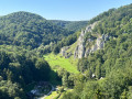
(7) Góra Koronna features three viewing points from which the view plunges down into the Prądnik Valley, with its meadows and limestone spires. A fourth, larger viewing point overlooks the valley a little further on.

(8) Okopy Hill bears the remains of a fortified site built of wood and earth, the Grodzisko na górze Okopy, blocked to the east by two earthworks now hidden beneath the forest. Excavations have revealed evidence of Neolithic and then medieval occupation, and the site is generally identified as the gród of Wyszogród, built in 1231 by Duke Konrad of Masovia and abandoned in the early14th century. Two cave entrances open up nearby: the Jaskinia Okopy Wielka Dolna and the Jaskinia Okopy Wielka Górna.

(10) The Brama Krakowska, a large rock gateway whose name recalls the ancient trade route from Kraków to Silesia. It marks the entrance to the Wąwóz za Krakowską Bramą, a steep-sided valley between the Chełmowa and Rusztowa hills, where a path climbs the Ciasne Skałki ridge up to the plateau.

(12) Jaskinia Łokietka is the largest cave in the park, with around 320 metres of passages and two large chambers. Legend has it that King Władysław Łokietek hid there for six weeks to escape the troops of Wenceslaus II of Bohemia, with a spider’s web stretched across the entrance having led his pursuers astray.

(13) Jonaszówka, a rock face surrounded by railings, towers some twenty metres above the mouth of the Dolina Sąspowska. It offers one of the best views of the Dolina Prądnika, Ojców and the trout ponds below.

Between (4) and (14), two graves line the path. The first contains the remains of around twenty Jews from the Ojców area, aged between 12 and 50, who were shot by the Germans in 1943; it was marked in 1993 to mark the fiftieth anniversary. The second, a little further up, is marked by a wooden cross adorned with flowers: it is the grave of an anonymous Polish partisan, a captain in the Polish Army and a liaison officer for the Armia Krajowa, a former Auschwitz prisoner, who was murdered by the Germans during the Second World War. A third grave, that of Feliks Weinzauer, is marked on the map a little further back, about twenty metres from the path.

(14) (15) The Dolina Sąspowska, a cool, wooded valley where the Sąspówka winds its way at the foot of high cliffs dotted with caves. The long wooden boardwalk crosses a damp meadow, leading to a pond fed by the Filipowski Spring.

For more walks, use our search engine .

The GPS track and description are the property of this route's author. Please do not copy them without permission.