
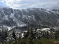
Śnieżka and the peaks of the Krkonoše Mountains from Karpacz

Starting from Karpacz in Lower Silesia, this long mountain hike leads to Śnieżka, the highest peak in the Sudetes, on the border between Poland and the Czech Republic. You’ll first climb through the wild Sowia Dolina valley, passing over footbridges and past the Kaskada Joanna waterfall, before reaching the long ridge of the Karkonosze Mountains and following its peaks all the way to Śnieżka. The descent runs alongside the Kocioł Małego Stawu glacial cirque and its lake nestled beneath the rock faces, then heads down through the forest towards Karpacz, in the heart of the Karkonosze National Park. Please note that the high ridge remains snow-covered and windswept for much of the year.

Details

102425324
Creation:
Last update:
Last review:
  • Walking
    Activity: Walking
  • ↔
    Distance: 12.31 mi
  • ◔
    Average duration: 8h 45 
  • ▲
    Difficulty: Difficult

  • ⚐
    Back to start: Yes
  • ↗
    Ascent: + 3,593 ft
  • ↘
    Descent: - 3,586 ft

  • ▲
    Highest point: 5,249 ft
  • ▼
    Lowest point: 1,965 ft

Photos

Description of the walk

Park in the car park on Mikołaja Kopernika Street, in the centre of Karpacz.

(S/E) From the car park, head towards the Muzeum Sportu i Turystyki, then keep immediately to the left at the three-way junction. Join Obrońców Pokoju Street and follow it to the right. Cross the Łomniczka, then turn left to stay on Obrońców Pokoju Street until you reach the bend at the end of the street, opposite the Ośrodek Krucze Skały building. Turn right onto Wilcza Street and you’ll soon reach a junction.

(1) Turn left to enter the Sowia Dolina valley and begin the long climb alongside the Płomnica, which you’ll cross several times via footbridges.

(2) At the T-junction, turn right, cross the Szeroki Most footbridge and turn left to continue the ascent through the wooded valley. A little further up, walk alongside the Kaskada Joanna waterfall on a path that soon becomes stone-paved and then wooden-planked, passing over footbridges across the Płomnica.

(3) At the top of Sowia Dolina, continue straight ahead through the clearing to reach the pass.

(4) At the Sowia Przełęcz (Soví sedlo) pass, on the Czech-Polish border, turn right to continue climbing along the border ridge path, over the Średnia Kopa ridge.

(5) Pass the Bouda Jelenka mountain hut and its Emmin pramen spring. Continue climbing along the border ridge to reach Czarna Kopa (Svorová hora).

(6) Continue along the Giants’ Ridge (Obří hřeben), which offers sweeping panoramic views, towards Śnieżka, which becomes increasingly visible. From the path, join a wider track at a T-junction; take this to the left up to the summit.

(7) At the summit of Śnieżka (Sněžka), the highest point in the Sudetes, cross to the other side of the dome and begin the steep descent via the Polish-Czech Friendship Trail (Droga Przyjaźni Polsko-Czeskiej), then via the Jubilee Trail (Droga Jubileuszowa).

(8) At the Dom Śląski mountain hut, continue straight on along the paved path Na Śnieżkę, which crosses the vast Równia pod Śnieżką plateau for over 1.5 km.

(9) At the three-way junction, turn right to stay on the Na Śnieżkę paved path and begin the descent.

(10) About 1.4 km further on, at the hotel, leave the Na Śnieżkę path and turn left to go round the building. Continue the descent.

(11) At the Samotnia Mountain Hut, take in the view of the glacial cirque and its lake, nestled beneath the rock faces, then head right at the three-way junction to continue the descent towards the forest.

(12) Return to the paved Na Śnieżkę path and continue the descent. Cross the Łomnica via the Kozi Mostek bridge, then another bridge, followed a little further on by the Pląsawa via the Biały Potok.

(13) Keep to the right on the ‘Na Śnieżkę’ path to cross the Polana clearing. Back in the forest, leave the path via the track that descends to the right.

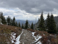
(14) Pass a small, hidden viewpoint on the right, then continue the descent through the forest, crossing the Wapniak stream.

(15) Join Strażacka Street. Turn right and walk slightly uphill along it, cross at the pedestrian crossing, continue over the bridge spanning the Łomnica, and carry on straight ahead along Olimpijska Street for about 700 m.

(16) After a right-hand bend, when you see the Orlinek ski jump directly ahead of you, turn onto the path on the left. At the bottom of the path, carefully cross Olimpijska Street, then immediately leave the road and take the path on the right, followed straight away by the path on the right. Continue downhill along Świerkowa and Stefana Żeromskiego Streets.

(17) Cross Konstytucji 3-ego Maja at the pedestrian crossing and continue down the path opposite. Cut across the cobbled Adama Mickiewicza Street and complete the descent via a small passageway followed by a flight of steps leading onto Rybacka Street.

(18) Turn right and follow Rybacka Street to the end.

(19) Keep heading towards Konstytucji 3 Maja Street until you reach Karpacz Church. Then turn right onto Mikołaja Kopernika Street to return to the car park (S/E).


Waypoints

  1. S/E : mi 0 - alt. 2,011 ft - Car park – Mikołaja Kopernika Street
  2. 1 : mi 0.61 - alt. 2,077 ft - Entrance to Sowia Dolina
  3. 2 : mi 1.31 - alt. 2,372 ft - T-junction, Szeroki Most bridge - Kaskada Joanna
  4. 3 : mi 2.77 - alt. 3,743 ft - Clearing at the top of Sowia Dolina
  5. 4 : mi 2.89 - alt. 3,832 ft - Col - Sowia Przełęcz (Soví sedlo)
  6. 5 : mi 3.33 - alt. 4,117 ft - Mountain hut - Bouda Jelenka
  7. 6 : mi 3.73 - alt. 4,629 ft - A small peak - Czarna Kopa / Svorová hora (1411 m)
  8. 7 : mi 5.37 - alt. 5,240 ft - Summit - Śnieżka / Sněžka (1602 m)
  9. 8 : mi 5.99 - alt. 4,587 ft - Mountain hut - Dom Śląski
  10. 9 : mi 7.02 - alt. 4,692 ft - Crossroads - Spalona Strażnica
  11. 10 : mi 7.88 - alt. 4,140 ft - T-junction in front of the hotel
  12. 11 : mi 8.28 - alt. 3,927 ft - Cirque Kocioł Małego Stawu et lac Mały Staw
  13. 12 : mi 8.57 - alt. 3,848 ft - Back on the Na Śnieżkę trail
  14. 13 : mi 9.48 - alt. 3,504 ft - Polana Clearing
  15. 14 : mi 9.93 - alt. 3,202 ft - Viewpoint
  16. 15 : mi 10.68 - alt. 2,602 ft - Strażacka Street - Łomnica
  17. 16 : mi 11.21 - alt. 2,546 ft - A short shortcut through the forest
  18. 17 : mi 11.77 - alt. 2,133 ft - Cross Konstytucji 3-ego Maja
  19. 18 : mi 11.9 - alt. 2,041 ft - Rybacka Street
  20. 19 : mi 12 - alt. 2,041 ft - Konstytucji 3 Maja Street
  21. S/E : mi 12.32 - alt. 1,995 ft - Car park – Mikołaja Kopernika Street

Notes

This is a long and fairly demanding high-altitude hike, suitable only for well-trained and properly equipped walkers, and only in good visibility conditions.

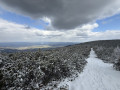
The high border ridge is exposed to the wind and covered in snow for much of the year, including in spring. In snowy or icy conditions, the route becomes tricky and should only be attempted if you are well equipped. The weather changes quickly at the summit of Śnieżka.

Good mountain boots, a windbreaker and warm clothing are strongly recommended. The paved paths in Sowia Dolina and along the ridge can be slippery in wet or icy conditions.

Take plenty of water and snacks with you. Refreshments and shelter are available along the way at the Bouda Jelenka mountain hut (5), the Dom Śląski mountain hut (8), as well as at the summit of Śnieżka (7) and at the Samotnia mountain hut, on the shores of Mały Staw (11).

Karpacz is accessible by car, with several pay-and-display car parks in the resort, managed by the local council and open day and night. Expect to pay around 8 zł per hour (~€1.90) or 40 zł per day (~€9.50) (2026 rates), with some car parks offering 30 minutes’ free parking. During the season, buses run between Jelenia Góra and Karpacz. There is also a cable car linking Karpacz to Kopa, below Śnieżka.

The route enters the Karkonosze National Park (Karkonoski Park Narodowy), for which an entry fee applies. A day ticket costs around 10 zł (~€2.30) at the full rate and 5 zł (~€1.15) at the reduced rate (2026 prices, the highest among Polish national parks), payable at the ticket offices located at the park entrances. Entry is free for children under 7 and on certain dates throughout the year. As prices change every year, please check them before you set off.

Worth a visit

(S/E) Karpacz, a mountain resort in Lower Silesia. Near the start of the trail, the hornfels outcrop (Odsłonięcie hornfelsów).

(2) The Kaskada Joanna waterfall, nestled in the wooded Sowia Dolina valley.

(4) The Sowia Pass (Przełęcz, Soví sedlo), on the Czech-Polish border, the gateway to the main ridge.

(5) The Jelenka Hut, a Czech chalet, and the Emmin Spring.

(6) Czarna Kopa (Svorová hora) and the Giants’ Ridge (Obří hřeben): sweeping panoramic views across both sides of the border.

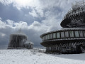
(7) The summit of Śnieżka (Sněžka, 1,602 m), the highest point in the Sudetes, crowned by its Baroque St Lawrence Chapel, the meteorological observatory and the border markers. A vast panorama on a clear day.

(11) Kocioł Małego Stawu, a glacial cirque carved out above Lake Mały Staw, dominated by the Samotnia Mountain Hut. Nearby is the memorial dedicated to Waldemar Siemaszko.

(15) The Karpacz Gravitational Anomaly (Anomalia grawitacyjna), a curiosity where a slope seems to defy logic.

Between (19) and (S/E) the Skwer Śladów Zdobywców, a memorial dedicated to those who have conquered the great peaks, and the Church of the Visitation (Nawiedzenia Najświętszej Maryi Panny) in Karpacz.

For more walks, use our search engine .

The GPS track and description are the property of this route's author. Please do not copy them without permission.