Linthal Chapel Trail

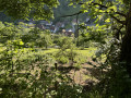
Starting from a chapel in the village of Linthal, you’ll climb through the forest overlooking the village, passing through pretty, flower-filled clearings and enjoying lovely views of the village below.

Details

34550844
Creation:
Last update:
Last review:
  • Walking
    Activity: Walking
  • ↔
    Distance: 2.44 mi
  • ◔
    Average duration: 1h 35 
  • ▲
    Difficulty: Easy

  • ⚐
    Back to start: Yes
  • ↗
    Ascent: + 505 ft
  • ↘
    Descent: - 486 ft

  • ▲
    Highest point: 2,231 ft
  • ▼
    Lowest point: 1,709 ft

Photos

Description of the walk

Park near Rue du Hilsenfirst, close to the chapel.

Follow the ‘Red Ring’ markings throughout the walk

(S/E) At the junction of Rue du Hilsenfirst and Rue du Tilleul, take the latter. Just after the bridge, take the path on the right.

(1) After afirst steep climb, the path leads onto a forest track. Turn left, heading due north.

(2) After asecond climb, a path branches off steeply downhill to the left of the track. Take this path. Cross the hamlet, keeping to the left at the junction.

(3) A little further down, keep right at the three-way junction.

(4) Back in the village, turn left onto Rue du Petit Ballon and head downhill to the car park (S/E).

Waypoints

  1. S/E : mi 0 - alt. 1,755 ft - Junction of Rue du Hilsenfirst and Rue du Tilleul
  2. 1 : mi 0.87 - alt. 2,037 ft - Forest track
  3. 2 : mi 1.76 - alt. 2,231 ft - Start of the descent
  4. 3 : mi 2.05 - alt. 1,949 ft - Three-Way Junction
  5. 4 : mi 2.24 - alt. 1,844 ft - Return to the village
  6. S/E : mi 2.44 - alt. 1,755 ft - Junction of Rue du Hilsenfirst and Rue du Tilleul

Notes

Watch out for ticks – there are plenty of them – so take precautions!
You will mainly be walking along paths and trails.
This walk is one-quarter in the sun and three-quarters in the shade.

Worth a visit

Reviews and comments

4.6 / 5
Based on 3 reviews

Reliability of the description
4.7 / 5
Ease of following the route
4.7 / 5
Route interest
4.3 / 5
User 29651741

Overall rating : 4 / 5

Date of your route : Jul 23, 2026
Reliability of the description : ★★★★☆ Good
Ease of following the route : ★★★★☆ Good
Route interest : ★★★★☆ Good
Very busy route : No

This is my first time using Visorando and I find the app easy to use. I find the local hike suggestions very handy, with plenty of filters to help us find the one best suited to our fitness levels.

Machine-translated

bonpied bonoeil
bonpied bonoeil

Overall rating : 5 / 5

Date of your route : Jun 08, 2026
Reliability of the description : ★★★★★ Very good
Ease of following the route : ★★★★★ Very good
Route interest : ★★★★★ Very good
Very busy route : No

A lovely, easy, shaded walk with magnificent views of the Linthal valley on the way up.

Machine-translated

boubou6855
boubou6855
• Edited:

Overall rating : 4.7 / 5

Date of your route : Aug 05, 2024
Reliability of the description : ★★★★★ Very good
Ease of following the route : ★★★★★ Very good
Route interest : ★★★★☆ Good
Very busy route : Yes

A lovely walk – it’s a shame there aren’t any benches in the shade where you can have a picnic

Machine-translated

Other walks in the area

For more walks, use our search engine .

The GPS track and description are the property of this route's author. Please do not copy them without permission.