
The Rannametsa–Tolkuse trail, between dunes and peat bogs

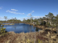
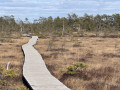
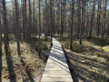
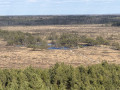
In Pärnu County, in south-western Estonia, this nature trail winds its way along a boardwalk through one of the country’s most unique landscapes. It first climbs a pine-covered sand dune – one of the highest in the country – where a tall wooden tower offers sweeping views over the Tolkuse bog and its mosaic of pools. The circular route then heads into the heart of the marsh, to a viewing platform situated on the edge of the largest pool, before returning through a damp birch forest.

Details

101704253
Creation:
Last update:
Last review:
  • Walking
    Activity: Walking
  • ↔
    Distance: 1.36 mi
  • ◔
    Average duration: 0h 40 
  • ▲
    Difficulty: Easy

  • ⚐
    Back to start: Yes
  • ↗
    Ascent: + 69 ft
  • ↘
    Descent: - 82 ft

  • ▲
    Highest point: 128 ft
  • ▼
    Lowest point: 20 ft

Photos

Description of the walk

Park in the car park by the side of Road 4 (Tallinn–Pärnu–Ikla), in front of the trail information board.

(S/E) Facing the information board, head down to the left and follow the boardwalk into the pine forest. At the junction, continue straight ahead, climb the steps and follow the boardwalk to the dune.

(1) Make your way to the observation tower at the top of the dune. Climb to the top of the tower to take in a sweeping panorama of the Tolkuse bog, its pools and the boardwalk that crosses it. Come back down, then leave the dune by continuing along the boardwalk through the sparse pine forest.

(2) Emerge from the pine forest onto the open bog, amongst the small pines and tufts of reddish-brown grass. Follow the boardwalk as it winds its way between the pools.

(3) Reach the platform situated at the edge of the bog’s largest pool, the furthest point on the circular loop. At the junction, continue along the boardwalk to the right, pass the rest benches and return to the shelter of a damp forest of birches and pines.

(4) Climb the final slope and return to the car park (S/E).

Waypoints

  1. S/E : mi 0 - alt. 66 ft - Rannametsa-Tolkuse trail car park
  2. 1 : mi 0.34 - alt. 118 ft - Rannametsa Dune and Observation Tower
  3. 2 : mi 0.64 - alt. 33 ft - Entrance to the bog
  4. 3 : mi 0.8 - alt. 33 ft - Platform at the large pond - Tourbière de Tolkuse (Tolkuse raba)
  5. 4 : mi 1.05 - alt. 30 ft - Exit from the bog
  6. S/E : mi 1.36 - alt. 56 ft - Rannametsa-Tolkuse trail car park

Notes

The boardwalk can be slippery in wet or icy conditions. In winter, the planks may be covered in snow or ice. Sturdy footwear is recommended.

The direct route between the car park and the large pond ((S/E) → (4) → (3) → (4) → (S/E)) is accessible to wheelchairs and pushchairs. The alternative route via the observation tower involves stairs and is not accessible.

Access is via Route 4 (Tallinn–Pärnu–Ikla). A campfire site and dry toilets are located near the car park.

Bring your own water: there are no refreshment points along the route.

Worth a visit

(1) The Rannametsa observation tower (Rannametsa vaatetorn) stands atop Tornimägi dune, a former coastal dune covered in pine trees and one of the highest in Estonia. From the top of its viewing platform, the view takes in the Tolkuse bog and its mosaic of pools on one side, and the coastal meadows and Pärnu Bay on the other.

The Tolkuse bog (Tolkuse raba) is a vast, domed bog dotted with pools (laukad), situated within the Luitemaa Nature Reserve. At the edge of the largest pool, a viewing platform juts out over the water. In summer, the small white water lily (Nymphaea candida), bog bean (Menyanthes trifoliata) and the small yellow water lily (Nuphar pumila) bloom there.

The site is designated as a Wetland of International Importance (Ramsar) and an Important Bird Area (IBA) within the Natura 2000 network.

For more walks, use our search engine .

The GPS track and description are the property of this route's author. Please do not copy them without permission.
