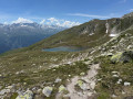
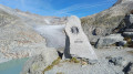
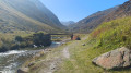
The Sidelhorn from the Grimsel Pass, on the shores of Lake Totensee

Starting from the Grimsel Pass in the Bernese Alps, this mountain hike ascends to the summit of the Sidelhorn before descending through the valley of the high-altitude lakes. The route first climbs above the Totensee and its mountain-pass hotel, along a stony path that soon overlooks the Rhône Valley and the surrounding glacial peaks. The final ascent involves scrambling up a rocky ridge to a wide viewpoint overlooking the High Bernese Alps and their glaciers. The return route runs alongside the Jostsee, a small mountain lake, before following a balcony-like path back towards the pass. A true alpine ascent, to be attempted only in the height of summer, in fine, dry weather, and reserved for seasoned walkers wishing to experience the Swiss high mountains.

Details

100992587
Creation:
Last update:
Last review:
  • Walking
    Activity: Walking
  • ↔
    Distance: 5.13 mi
  • ◔
    Duration according to the author: 5 hrs 
  • ▲
    Difficulty: Very difficult

  • ⚐
    Back to start: Yes
  • ↗
    Ascent: + 1,978 ft
  • ↘
    Descent: - 1,962 ft

  • ▲
    Highest point: 8,996 ft
  • ▼
    Lowest point: 7,067 ft

Photos

Description of the walk

Park in the car park at the Grimsel Pass (Grimselpass), on the shores of Lake Totensee, in front of the Hotel Alpenrösli.

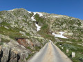
(S/E) From the car park, follow a narrow, single-lane tarmac road for about 600 m, lined with stone markers, which leaves the pass towards the rocky slope (the Oberaar panoramic road, temporarily closed to traffic from 26 June 2026). Walk carefully.

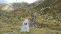
(1) Just before the Sidelhornbahn station, leave the road to the left via an inconspicuous stone staircase and climb up above the Totensee.

White-red-white markings, trail 370

(2) Pass the bench and the stone table. Enjoy the beautiful view over the valley and the surrounding peaks. Below, you can just make out the Räterichsbodensee. Continue the steady climb, following the markings painted on the rocks, keeping heading towards the Sidelhorn.

End of Trail 370

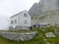
(3) At the Husegghütte, turn left towards the Sidelhorn / Trübtenseelücke / Oberaar. Then follow the mountain path for about 1.3 km to the foot of the ridge.

(4) At the foot of the summit ridge, begin a very steep rocky section: use your hands to help you climb, following the white-red-white markings painted on the rock.

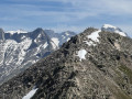
(5) At the summit of the Sidelhorn (2,764 m), take in the panoramic views of the Bernese Alps and their glaciers. Continue along the ridge towards the pylon, a little further on, heading straight on towards Trübtenseelücke / Grimsel Pass at the junction. This section between the summit and the pylon is the trickiest part of the route, and a snowfield may still remain there even in the height of summer: the utmost caution is required.

(6) At the pylon, the second highest point of the route, leave the ridge and begin the descent down the rocks.

(7) At the bottom of the rocky section, veer slightly to the left to cross the scree slope. Immediately afterwards, at a junction of several paths, before the large boulders, head slightly to the right towards Jostsee (25 mins). Here too, snowfields may remain even in summer: remain cautious. Descend between the large boulders, then follow an easier path that loses altitude. Before the large rock, turn right to reach the lakeshore.

(8) At the edge of the Jostsee, head towards Nassbode / Obergesteln on the left. Continue the descent, cross the four streams, then veer to the right. Carry on along the beautiful balcony path overlooking the Rhône valley.

(9) About 1.2 km after the last junction, at a further junction, turn left and climb a short slope. Cross the stream that cuts across the path, then stay on the signposted path until you reach the Grimsel Pass car park (S/E).

Waypoints

  1. S/E : mi 0 - alt. 7,073 ft - Car park - Col du Grimsel
  2. 1 : mi 0.4 - alt. 7,280 ft - Stone steps near the Sidelhornbahn
  3. 2 : mi 0.84 - alt. 7,835 ft - Viewpoint and stone bench
  4. 3 : mi 1 - alt. 8,022 ft - Husegghütte
  5. 4 : mi 1.82 - alt. 8,684 ft - Foot of the summit ridge
  6. 5 : mi 1.97 - alt. 8,990 ft - Summit - Sidelhorn (2764 m)
  7. 6 : mi 2.27 - alt. 8,878 ft - Pylône, second summit
  8. 7 : mi 2.37 - alt. 8,711 ft - Bottom of the descent
  9. 8 : mi 3.3 - alt. 7,917 ft - Jostsee (2419 m)
  10. 9 : mi 4.43 - alt. 7,530 ft - Last junction
  11. S/E : mi 5.13 - alt. 7,067 ft - Car park - Col du Grimsel

Notes

A high-altitude hike suitable only for experienced walkers, in dry weather and with good visibility.

The route is only accessible in summer. During the rest of the year, the route is covered in snow and the Grimsel Pass road is only open during the summer months (generally from June to October, depending on snow conditions).

The most exposed section runs from the foot of the summit ridge (4) to the bottom of the descent after the pylon (7): a very steep rocky ridge requiring the use of hands, downclimbing, followed by unstable scree and a scree slope. Snowfields may block this section even in the height of summer, particularly between the summit and the pylon: take extra care on hard snow.

High-altitude terrain (between 2,140 and 2,760 m) with a sustained elevation gain on both the ascent and descent. The weather can change quickly: take a windbreaker and something to keep you warm.

Good mountain boots and walking poles are strongly recommended.

There are no water points along the route: take sufficient water and snacks with you. Refreshments and shelter are available at the start, at the Hotel Alpenrösli on the pass.

The pass is also served by the PostBus (line 161), which runs from Meiringen to Oberwald via the Grimsel.

Worth a visit

(S/E) The Grimsel Pass (2,165 m) and Lake Totensee, overlooked by the Hotel Alpenrösli and its terrace. The old sections of the pass’s winding road attract motorcyclists and cyclists.

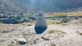
(2) A viewing point featuring a bench and a table carved from the rock, offering views across the valley and the surrounding glacial peaks.

(5) At the summit of the Sidelhorn (2,764 m), a panoramic view in all directions over the high glacial Bernese Alps, towards the Oberaar massif.

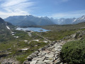
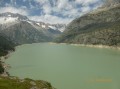
(8) The Jostsee (2,419 m), a high-altitude lake surrounded by the snow-capped peaks of the Valais side. A pleasant spot for a break by the water’s edge.

Between (8) and (9), a balcony trail offering sweeping views of the snow-capped mountains of the Rhône Valley.

Other walks in the area

For more walks, use our search engine .

The GPS track and description are the property of this route's author. Please do not copy them without permission.