The Llogara Circle circular route

The Llogara Circle (sometimes called the Maja e Thanasit circular hike) is an iconic hike in Llogara National Park, in the heart of the Albanian Riviera. From the road pass, the route traces a large loop that skims the ridge, overlooks the Ionian Sea, then plunges back into a forest of ancient black pines. Get ready to enjoy spectacular views of the Mediterranean, nearly1,400metres below!

Details

n°76635137
Creation:
Last update:
Last review:
  • Walking
    Activity: Walking
  • ↔
    Distance: 8.00 mi
  • ◔
    Average duration: 5h 20 
  • ▲
    Difficulty: Average

  • ⚐
    Back to start: Yes
  • ↗
    Ascent: + 1,857 ft
  • ↘
    Descent: - 1,850 ft

  • ▲
    Highest point: 4,537 ft
  • ▼
    Lowest point: 2,680 ft

Photos

Description of the walk

It is easy to find a parking space at the Qafa e Llogarasë Pass.

The walk begins with the least pleasant section, along a fairly busy road. Keep well to the left of the carriageway.

(S/E) Start walking carefully alongside the road, heading north-west, with the car park on your left. Pass the few hairpin bends until a path appears on the left, about 500 m further on.

Red signpost LK09

(1) Turn left, then right. After passing a building, turn left.

(2) Cross the campsite and join the path on the other side, passing through the wooden archway opposite. Then turn left, and left again at the large information sign.

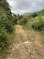
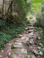
(3) Start the climb along this forest path. Reach the moorland and continue to the small pond.

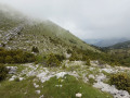
(4) Turn left about fifty metres further on (the grassy path is hard to see, but it becomes clearer again a few dozen metres later). Just before the ridge, the path becomes a bit overgrown again. Cairns have sometimes been erected to help with navigation.

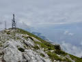
(5) After the ridge, descend gently along the southern slope of Maja Gjipalit to the radio masts on Maja Thanasit.

(6) Descend via the path to the left, down to the car park at the Qafa e Llogarasë Pass (S/E).

Waypoints

  1. S/E : mi 0 - alt. 3,366 ft - Qafa e Llogarasë Pass
  2. 1 : mi 1.19 - alt. 2,841 ft - Junction on the path
  3. 2 : mi 1.6 - alt. 2,707 ft - Campsite
  4. 3 : mi 1.78 - alt. 2,684 ft - Start of the ascent
  5. 4 : mi 3.99 - alt. 3,921 ft - Water basin
  6. 5 : mi 4.5 - alt. 4,390 ft - Ridge
  7. 6 : mi 5.91 - alt. 4,416 ft - Maja Thanasit
  8. S/E : mi 8 - alt. 3,366 ft - Qafa e Llogarasë Pass

Reviews and comments

4.5 / 5
Based on 2 reviews

Reliability of the description
5 / 5
Ease of following the route
4 / 5
Route interest
4.5 / 5
User 28556607

Overall rating : 4.3 / 5

Date of your route : Sep 18, 2026
Reliability of the description : ★★★★★ Very good
Ease of following the route : ★★★★☆ Good
Route interest : ★★★★☆ Good
Very busy route : No

Something to watch out for on this walk: as for us, we came across four dogs on their own (perhaps they were herding the nearby cows, but we couldn’t be sure), which came running towards us, barking, and sniffed us. By staying calm and continuing slowly on our way, they left us alone, but to be honest, we were really scared. This happened on the descent after the ridge, near a cluster of abandoned buildings.

Incidentally, we set off on the hike at around midday. The problem is that, with the sea at the foot of the mountain, the ridge and the peaks are often shrouded in mist. In our case, the mist rolled in just as we reached the summits, and we were unable to enjoy the views, as the mist lingers once it has settled. We imagine that in the morning the fog is less prevalent – not yet fully formed – so we recommend timing this hike to reach the summits before 2 pm (as we did). I should point out that the mist didn’t make our hike dangerous; we could see well enough to carry on, but that might be the case under different conditions?

The path towards the ridge is indeed hard to make out, but with the Viso map you can manage quite easily, especially as the terrain is generally quite easy to navigate.

Machine-translated

Passeio
Passeio

Overall rating : 4.5 / 5

Date of your route : Jul 10, 2025
Reliability of the description : Not used / Not applicable
Ease of following the route : ★★★★☆ Good
Route interest : ★★★★★ Very good
Very busy route : No

I confirm that there is no clearly marked path between the water basin (point 4) and the ridge. However, the route on the map gives a good idea of the direction to take. Once you reach the summit, the path along the ridge becomes clearly marked again until point 5.

That said, this hike is very pleasant, in the forest, and the view from the ridge is magnificent. I recommend doing it in an anti-clockwise direction, as indicated in the description, for two reasons:
- the main climb is on section 4-5, which is quite rocky (easier to climb than to descend) and mainly in the shade of the forest
- the descent (after point 6) is on a clear, well-maintained track with a beautiful view of the sea but in full sun (so it's better to do it downhill than uphill...)

Machine-translated

For more walks, use our search engine .

The GPS track and description are the property of this route's author. Please do not copy them without permission.