


Park in the car park at the Dzūkija National Park visitor centre on Miškininkų gatvė in Marcinkonys.
Signposting: White square with a blue diagonal line (Girinio pažintinis takas)
(S/E) From the car park, walk between the visitor centre and Miškininkų gatvė, then cross Kliūčių gatvė. Continue straight ahead along the starting path, which is somewhat hidden, not far from Miškininkų gatvė. Cross another path and continue straight ahead, to the right of the two wooden chalets. Go round the first pond on the right and, at the three-way junction (not shown on the map), turn right. At the next junction, carry on straight ahead until you reach a road.
(1) Carefully cross Čepkelių Road and continue straight on. Cross a ditch in the forest, then, at the three-way junction (not shown on the map), turn left. A little further on, turn left to cross a stream, then turn right. Pass the picnic area and start skirting the pond on the left until you reach a footbridge.
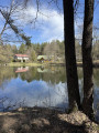
(2) Cross the wooden footbridge over the Duobupis, then turn right and cross another stream. Then walk along the long pond to its other end.
(3) When you reach the first houses, leave the pond by turning left. Join Naujalių gatvė and turn left at the junction.
Signposting: White square with a red diagonal line (Zackagirio pažintinis takas)
(4) A little further on, turn left and walk straight through the hamlet. Cross a footbridge and, at the hamlet’s crossroads, turn right, then left at the next junction. Take the path branching off to the right; continue for about 500 metres until you reach a junction of paths (not shown on the map).
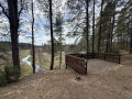
(5) Head down to the right, reach the footbridge over the Dorupis and cross it. Head back up, then turn left (unmarked junction) and follow the path for a long stretch through the pine forest until you reach the Šaudyklos viewpoint, a wooden platform set on the edge of the hill.
(6) From here, the view looks down over the meandering Grūda as it winds through the meadow below. Return to the path and go down the steps. The bridge, which will be out of use in spring 2026, can be bypassed on the right. Join the track, follow it to the left, cross the bridge over the Grūda, then turn immediately right until you reach the next junction.
(7) Head down to the right, cross the Grūda again and cross a peat bog via a footbridge. Pass through a more rugged area, then at the junction (not shown on the map), head up to the left.
(8) Just before a power line, continue to the right to pass underneath it. About 500 m further on, carefully cross Čepkelių Road.
(9) Enter the village via Miškininkų gatvė, and leave the road to climb the steps on the left.
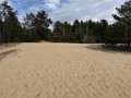
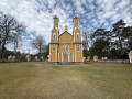
(10) Once you reach the church, go back down the steps and turn left onto the path. At the second junction, turn right and follow Smėlio gatvė straight on. You will soon see the sand dune on your left; head towards it.
(11) Cross the dune to reach the path that runs alongside the forest. Follow it for a long stretch, entering the forest for a while.
(12) Leave the forest for a short while and cross a small stream; then, after a marshy clearing, turn left at the three-way junction. A little further on, turn left again.
(13) At the three-way junction, take the path branching off to the right, then immediately turn right again at the next three-way junction, and finally turn right once more. Further on, at the next three-way junction, turn left.
(14) Walk alongside the railway line, below it, and cross the Dorupis on a wooden plank. Continue along the path as it moves away from the railway line. At the junctions, carry on straight ahead until you reach a small hamlet.
(15) Just after this, turn right and follow Šaltinių gatvė. Just before a house, veer slightly to the right, then pass through a final hamlet. Then continue along the path on the left to return to the car park (S/E).

