
Ukko-Koli, a circular route above Lake Pielinen

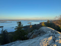
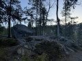
In the heart of Koli National Park, in North Karelia, this hike leads to the summit of Ukko-Koli, the park’s most famous viewpoint. Starting from the western shore of Lake Pielinen, the route first descends through the boreal forest of pine and spruce, passing white quartzite boulders and a wetland criss-crossed by footbridges, before climbing back up to the open heights. Up there, the light-coloured rock slab offers a sweeping panorama of Lake Pielinen, dotted with islands – a landscape that has inspired painters and composers and is counted amongst Finland’s national landscapes. An ideal getaway to discover one of the most iconic sites of Finnish nature.

Please note that in winter conditions, the entire route is not always accessible.

Details

101539364
Creation:
Last update:
Last review:
  • Walking
    Activity: Walking
  • ↔
    Distance: 2.35 mi
  • ◔
    Average duration: 1h 30 
  • ▲
    Difficulty: Easy

  • ⚐
    Back to start: Yes
  • ↗
    Ascent: + 486 ft
  • ↘
    Descent: - 486 ft

  • ▲
    Highest point: 1,102 ft
  • ▼
    Lowest point: 797 ft

Photos

Description of the walk

Park in the Ylä-Kolintie car park, at the foot of the funicular.

(S/E) From the car park, head up to the hotel’s viewing point via the funicular (free, open to all) or along the small path that runs alongside it (approximately 35 m climb).

(1) At the viewpoint, which overlooks Lake Pielinen, near the hotel and the nature centre, take the path that runs between the chairlift and the steps (the one you’ll use to descend from the summit on the way back). It heads into the forest and descends southwards, following the quartzite slabs.

(2) Pass the Pieni-Koli plateau, where a large erratic boulder rests on the rocky slab amongst the pine trees, and continue the descent.

(3) You’ll reach a wetland area crossed by several wooden footbridges. Cross it and continue to lose altitude until you reach the lowest point of the route.

(4) At the large junction marked by a National Park map sign, turn right and begin the climb back up towards the heights.

(5) At the summit of Ukko-Koli, you’ll emerge onto the large slab of white quartzite with its triangulation point. Take in the iconic view of Lake Pielinen, dotted with islands, to the east. Then head back down the long wooden steps to the viewpoint junction.

(1) Return to the car park via the funicular or the path running alongside it (S/E).

Waypoints

  1. S/E : mi 0 - alt. 909 ft - Ylä-Kolintie car park, at the foot of the funicular
  2. 1 : mi 0.17 - alt. 1,014 ft - Crossroads and viewpoint, near the hotel
  3. 2 : mi 0.83 - alt. 896 ft - Erratic boulder - Pieni-Koli (280 m)
  4. 3 : mi 1.11 - alt. 863 ft - Wetland area and footbridges
  5. 4 : mi 1.25 - alt. 801 ft - Crossroads with the park map sign
  6. 5 : mi 2 - alt. 1,099 ft - Summit - Ukko-Koli (347 m)
  7. S/E : mi 2.35 - alt. 912 ft - Ylä-Kolintie car park, at the foot of the funicular

Notes

In early May, patches of snow remain. In winter conditions, the circular path is not always fully accessible (icy slabs and steps). Check accessibility and what equipment is required before setting off out of season.

Access is by road from the village of Koli. In season, buses run between Koli and Joensuu, and a ferry crosses Lake Pielinen from Lieksa.

Sturdy footwear is recommended. The quartzite slabs and steps can be slippery in wet weather or when frozen.

(S/E) A free, open-access funicular links the car park to the hotel. At the viewpoint, the Ukko Nature Centre (Kolin luontokeskus Ukko) offers a reception, information, toilets and refreshments. A panoramic chairlift operates in summer.

Bring water with you: there are no water points once you’re on the trail.

Worth a visit

(1) The viewpoint near the Ukko Nature Centre and the Break Sokos Hotel Koli offers the first sweeping view of Lake Pielinen.

(2) Pieni-Koli and its erratic boulder, deposited by glaciers on the quartzite slab. The Koli hills are the eroded remains of the ancient Karelian mountain range. Their white quartzite, once marine sand dating back some two billion years, has been polished and rounded by the ice, which also carried enormous boulders and carved out rock caves.

(3) to (4) A wetland area at the lowest point of the trail, crossed by footbridges, and a large map panel for the national park.

(5) Ukko-Koli (347 m) is the highest of the Koli peaks, ahead of Akka-Koli (339 m), Paha-Koli (334 m) and Pieni-Koli (280 m). The names are linked to Ukko, the god of the sky; Akka, the female spirit; the spirit of evil; and the ‘little hill ’. The panoramic view eastwards across Lake Pielinen is one of Finland’s national landscapes and inspired painters and composers at the turn of the 20th century: Jean Sibelius, Juhani Aho and Eero Järnefelt, whose 1911 painting adorns the restaurant at Helsinki Central Station.

For more walks, use our search engine .

The GPS track and description are the property of this route's author. Please do not copy them without permission.
