


Denis26

 Visorando Member
 Moderator
 Premium user
- Location: Truinas (26460)
- Gender: man
Sign up:
Published route(s)
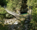
 Trou Bleu or Doye Gabet
 0.52 mi
 +167 ft
 -194 ft
 0h 25
 Easy
 Departure from Morbier (Jura)
Starting from the ‘Bienne Space-Time Gate’ sculpture, discover the Trou Bleu resurgence – also known as Doye Gabet – and the Himalayan footbridge over the Bienne, set in magnificent surroundings.
Please note: the starting point is not accessible to motor vehicles on Saturdays, Sundays and public holidays.
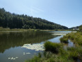
Walk around Lake Lamoura via its viewpoint and peat bogs
 1.18 mi
+157 ft
-157 ft
0h 40
Easy
Departure from Lamoura (Jura)
A route circling the highest lake in the Jura, largely accessible to pushchairs, on compacted paths or wooden boardwalks to cross the fragile peat bog without damaging it.
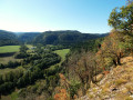
Trois Vallées Viewpoint
 3.41 mi
+358 ft
-358 ft
1h 55
Easy
Departure from Le Vaudioux (Jura)
Access to a viewpoint offering a view of the confluence of three valleys: the Lemme, the Saine and the Ain. Along the way, you’ll notice the remarkable work carried out to build the ‘Ligne des Hirondelles’ railway line and a somewhat mystical section through the forest, between boulders covered in moss.
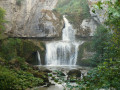
Billaude Waterfall or Saut Claude Roy
 0.43 mi
+243 ft
-253 ft
0h 25
Easy
Departure from Le Vaudioux (Jura)
A short walk offering easy access to two viewing points providing views, from above and below, of the magnificent Billaude Waterfall. A footpath and metal staircases lead to these points.
Pertes de l’Ain
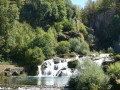 1.22 mi
+190 ft
-200 ft
0h 45
Easy
Departure from Bourg-de-Sirod (Jura)
A short walk that allows you to explore a magnificent site via a well-maintained path. The River Ain plunges into a very narrow gorge and disappears beneath a jumble of rocks. After a few metres, the river re-emerges and, following a large waterfall, reaches the site of some old forges.
From La Roche Devant to the Balcon des Crottes via Les Trois Commères
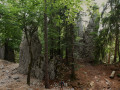 6.30 mi
+1,076 ft
-1,066 ft
3h 50
 Moderate
Departure from Morbier (Jura)
A varied route, alternating between meadows and forests, leading to La Roche Devant with its viewpoint offering a view over the Bienne valley. The route then passes the Trois Commères site – rocks resembling huge menhirs – and on to the Balcon des Crottes, withviews of the viaducts of the Ligne des Hirondelles railway line and the town of Morez.
Lake Bellefontaine and Lake des Mortes via Roche Bernard and Roche Champion
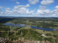 8.72 mi
+1,122 ft
-1,122 ft
5h 00
Moderate
Departure from Chapelle-des-Bois (Doubs)
Starting from Lac de Bellefontaine and Lac des Mortes, which straddle the border between the Doubs and the Jura, this circular route takes you past magnificent viewpoints on the Swiss border, notably those at La Roche Bernard, Le Gît de l’Échelle and La Roche Champion.
Bief de la Chaille Waterfall
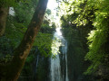 0.66 mi
+167 ft
-167 ft
0h 25
Easy
Departure from Les Rousses (Jura)
Close to the village of Les Rousses and its famous fort, this route offers quick access to a small, secluded spot featuring the magnificent Bief de la Chaille waterfall, nestled at the back of the Gorges de la Chaille.
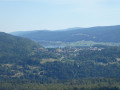
Mont Fier
 4.21 mi
+495 ft
-495 ft
2h 20
Easy
Departure from Longchaumois (Jura)
A quick route to the Mont Fier viewpoint, which overlooks the village of Prémanon. The viewpoint offers a 270° view of the Orbe Valley, taking in the surrounding peaks of La Dôle and Le Noirmont via the Fort des Rousses.
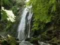
Leat of the Chaille Waterfall via the Perroud Bridge
 4.31 mi
+751 ft
-755 ft
2h 40
Easy
Departure from Prémanon (Jura)
Starting from the Belvédère des Maquisards, the route takes you along a path that runs largely through the undergrowth, allowing you to discover the old Pont Perroud and the magnificent Bief de la Chaille waterfall, nestled at the bottom of the Gorges de la Chaille.
 From Marsanne to the Col du Devès via the wind farm and the Pierre Sanglante
 16.71 mi
+1,824 ft
-1,818 ft
3 hrs
Moderate
Departure from Marsanne (Drôme)
A route mainly following idyllic forest tracks and paths that offer lovely views over the Andrans plain. Starting from Marsanne, the route follows the Sentier des Fileuses to the Col de la Grande Limite, then heads towards the wind farm and passes by the Pierre Sanglante. It continues along the ridge to the Col du Devès and a magnificent viewpoint located at the paragliding launch site. A short loop around this plateau through wild woodland, then back to Marsanne via a balcony trail.
Citelles valley and its hamlet, via the wind farm
 11.33 mi
+1,047 ft
-1,050 ft
2 hrs
Easy
Departure from Rochefort-en-Valdaine (Drôme)
A route mainly following tracks and forest paths offering lovely 360° views, passing through the wind farm and its numerous wind turbines, from the Rhône Valley to Mont Ventoux, as well as a chance to discover the pretty little hamlet of Cîtelles and its valley.
 Mont Rachas via the track
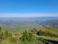 11.22 mi
+1,975 ft
-1,978 ft
2 hrs
Moderate
Departure from Le Poët-Laval (Drôme)
Situated between the Rhône Valley, the Diois and the gateway to Provence, Mont Rachas, thanks to its central location, offers a superb 360° view, from the Trois Becs to Mont Ventoux in the east and over the Tricastin, the Rhône Valley and the foothills of the Ardèche in the west. This route follows a small road, a tarmac track (in poor condition) and finally a narrow path.
Mont Rachas via Les Plaines
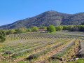 11.24 mi
+2,005 ft
-2,014 ft
2 hrs
Moderate
Departure from Le Poët-Laval (Drôme)
Situated between the Rhône Valley, the Diois and the gateway to Provence, Mont Rachas, thanks to its central location, offers a superb 360° view, from the Trois Becs to Mont Ventoux in the east and over the Tricastin, the Rhône Valley and the foothills of the Ardèche in the west. This route follows a small road, a tarmac track (in poor condition) and forest paths.
Montagne de Saint-Maurice via the track and the valley
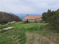 9.64 mi
+1,749 ft
-1,755 ft
2 hrs
Moderate
Departure from Dieulefit (Drôme)
Montagne de Saint-Maurice is famous for its chapel and ridges. This route takes you there via a track suitable for vehicles and offers a lovely view with a magnificent 360° panorama, with the Trois Becs, Grand Delmas and Montagne de Couspeau to the north, Montagne de la Lance to the south and, on a clear day, Mont Ventoux. The return journey follows a path through a beech forest, at the bottom of a wild valley.
Montagne de Saint-Maurice via the track
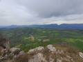 11.80 mi
+1,752 ft
-1,759 ft
2 hrs
Moderate
Departure from Dieulefit (Drôme)
Montagne de Saint-Maurice is famous for its chapel and ridges. This route takes you there via a track suitable for vehicles, allowing you to enjoy a lovely viewpoint with a magnificent 360° panorama: to the north, the Trois Becs, the Grand Delmas and Montagne de Couspeau; to the south, Montagne de la Lance; and on a clear day, Mont Ventoux.
From Rochefort-en-Valdaine Castle to the ruins of Notre-Dame la Brune
 17.45 mi
+1,352 ft
-1,355 ft
3 hrs
Moderate
Departure from Rochefort-en-Valdaine (Drôme)
Route mainly following tracks and forest paths offering beautiful 360° views, from the Rhône Valley to Mont Ventoux. Circular route that circles the catchment area of the Citelles stream, from the Château de Rochefort-en-Valdaine to the ruins of Notre-Dame la Brune, passing through the wind farm and its numerous wind turbines.
Comps, around the Montagne des Ventes
 13.71 mi
+1,893 ft
-1,886 ft
3 hrs
Moderate
Departure from Comps (Drôme)
A walk along small roads, tracks and paths, offering a chance to explore the varied landscapes surrounding the village of Comps, at the head of the Jabron valley, via its church and a circuit around the Montagne des Ventes.
Comps, tour of the Jabron Valley
 11.03 mi
+1,499 ft
-1,486 ft
2 hrs
Easy
Departure from Comps (Drôme)
A route taking in small roads and paths that allow you to discover the varied landscapes surrounding the village of Comps and the upper reaches of the Jabron Valley, from the Col de Ventebrun to the church at Comps via the Col de Boutière and the Col de Vesc.
Tour of the Poët and Saint-Maurice Mountains
 20.32 mi
+2,717 ft
-2,717 ft
4 hrs
Moderate
Departure from Rochebaudin (Drôme)
This route takes you along small roads, forest tracks and footpaths, allowing you to discover different landscapes and villages. Starting from Rochebaudin, the route passes through the Col du Perthuis, the Col de Ventebrun, Dieulefit, Poët-Laval, the Grand Pas quarry and Eyzahut.
Geodetic chimney of Spiémont
 1.99 mi
+315 ft
-331 ft
1h 10
Easy
Departure from Champdray (Vosges)
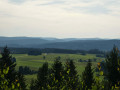
This walk provides quick access to a beautiful viewpoint at the summit of Spiémont, where you can enjoy a panoramic view of the Vosges and the Vologne valley. The presence of a geodesic chimney and an orientation table complete the hike.
Tour of Lac des Corbeaux
 0.92 mi
+23 ft
-23 ft
0h 25
Easy
Departure from La Bresse (Vosges)
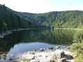
A peaceful walk around a 10-hectare glacial lake surrounded by forest, along a path accessible to pushchairs. Lac des Corbeaux, with its reflections, brings a pleasant feeling of tranquillity and calm, allowing you to savour the moment.
Tour of Lake Gérardmer via the Tête and Mérelle Waterfall
 5.07 mi
+771 ft
-771 ft
3h 00
Moderate
Departure from Gérardmer (Vosges)
This hike goes around Lake Gérardmer, the largest natural lake in the Vosges, via the Tête de Mérelle, which offers a magnificent view of the lake and the town of Gérardmer from its belvedere at the top of the tower, then past the small Mérelle Waterfall, hidden among moss-covered rocks.
Tour of Lake Gérardmer
 3.18 mi
+20 ft
-20 ft
1h 30
Easy
Departure from Gérardmer (Vosges)
This hike goes around Lake Gérardmer, the largest natural lake in the Vosges. Covering an area of 115 hectares, it is surrounded by forests and lies at the foot of the town of Gérardmer, known for its ski resort and also for its many water sports attractions.
Mérelle peak and waterfall
 3.06 mi
+768 ft
-768 ft
2h 05
Moderate
Departure from Gérardmer (Vosges)
The Tête de Mérelle offers a magnificent view of the lake and the town of Gérardmer from its belvedere at the top of the tower. The small Mérelle waterfall, hidden among moss-covered rocks, is well worth a visit.
Tour of Lake Lispach
 1.19 mi
+33 ft
-36 ft
0h 35
Easy
Departure from La Bresse (Vosges)
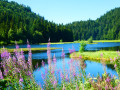
Walk around this mountain lake located at the foot of the ski slopes of a family resort. The floating bog, which covers part of the water's surface, offers magnificent views in a unique setting.
Retournemer waterfall and lake
 1.01 mi
+43 ft
-43 ft
0h 30
Easy
Departure from Xonrupt-Longemer (Vosges)
This walk takes you around Retournemer Lake and to its outlet, a waterfall about ten metres high, then makes a short detour to the statue of Our Lady of the Snows, which stands in front of the lake, looking towards the peaks. This wild lake is located at the foot of the Hohneck massif and is the first in the Vologne valley.
Tour of Lake Blanchemer
 1.03 mi
+49 ft
-49 ft
0h 30
Easy
Departure from La Bresse (Vosges)
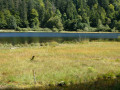
A short walk that allows you to discover a magnificent lake covering an area of approximately 6 hectares, with a floating bog, in a majestic setting at the foot of Rainkof and the ridges that mark the border between the Vosges and Alsace.
La Colline au Loup (Laleu Colline) via the Spiémont geodesic chimney
 5.90 mi
+843 ft
-856 ft
3h 25
Easy
Departure from Champdray (Vosges)
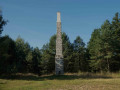
The hike begins at the Spiémont geodesic chimney with its orientation table, then takes you to discover "sacrificial stones" with magnificent cup marks that are said to have been used in ancient rituals. The route then heads to Laleu Colline (Colline au Loup), a small hill with a rocky summit which offers panoramic views of the Middle Vosges from its footbridge. On the way back, the route passes through the Bouyère peat bog before reaching the village of Champdray.
Chambre du Loup and Falaise de Lyris in Haut-du-Tôt
 0.84 mi
+125 ft
-125 ft
0h 30
Easy
Departure from Sapois (Vosges) (Vosges)
Set off to explore a small cavity in the rock, called the Chambre du Loup (Wolf's Chamber), at the foot of the small Lyris cliff, the Pyramid, and various other features on this site, which was used for the construction of the church and presbytery of the hamlet of Haut-du-Tôt. All this can be explored via a somewhat mystical path through a magnificent coniferous forest with moss-covered rocks.
Rudlin Waterfall
 1.47 mi
+404 ft
-404 ft
1h 00
Easy
Departure from Plainfaing (Vosges)
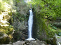
By making a loop from the Étang des Dames, you can quickly reach the Rudlin Waterfall. This is a pretty waterfall about ten metres high, accessible via a path through the woods from the bottom of the valley.
Canyon des Gueulards via the seven hairpin bends
 4.84 mi
+1,060 ft
-1,063 ft
3h 10
Moderate
Departure from Omblèze (Drôme)
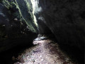
This unusual spot offers a complete change of scenery, with a crevice that plunges into nowhere and a calm, dark atmosphere among rocky outcrops, lichens and ferns. Access to the canyon is via a track with seven hairpin bends that demonstrate the art of building passages carved into the rock on the mountain side and masonry on the side facing the void.
Guercy Greenhouse, Soyons Leaning Tower via Nero's Cave
 1.17 mi
+528 ft
-502 ft
1h 00
Moderate
Departure from Soyons (Ardèche)
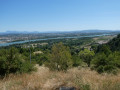
This walk allows you to explore caves (admission fee), then enjoy a magnificent view from the Serre de Guercy and see a feudal ruin, the Tour Penchée, built on an ancient Gallic oppidum.
Les Oules du Diable
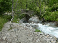 0.75 mi
+69 ft
-69 ft
0h 25
Easy
Departure from La Chapelle-en-Valgaudemar (Hautes-Alpes)
Near La Chapelle-en-Vagaudémar, in the hamlet of Les Portes, a quick detour takes you to the Navette torrent and, beyond the Roman bridge, to the Oules du Diable with their bubbling giant's kettles.
Cabane du Sellar via the Chalets du Prentiq
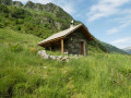 6.49 mi
+2,106 ft
-2,110 ft
4h 50
Moderate
Departure from Saint-Maurice-en-Valgodemard (Hautes-Alpes)
A wild trail leads you up a gentle slope following the Prentiq valley to the Cabane du Sellar. Surrounded by mountains, this place is a true haven of peace, where only the sounds of nature welcome you.
Prentiq chalets
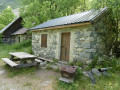 4.45 mi
+1,273 ft
-1,276 ft
3h 10
Moderate
Departure from Saint-Maurice-en-Valgodemard (Hautes-Alpes)
An enriching hike to discover the traditions and history of this small valley. Follow a path along the stream to reach Prentiq (near the old houses), a haven of wild beauty with traces of pastoral life. Discover a hamlet where only two huts remain, along with ruins and dry stone walls that bring to mind the traditions of yesteryear. On the way back along the track, you will be treated to beautiful views of the valley.
Montagne d'Éson
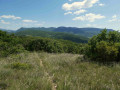 2.74 mi
+1,152 ft
-1,152 ft
2h 15
Moderate
Departure from Pont-de-Barret (Drôme)
This wild route offers beautiful views of the village of Pont-de-Barret, the meanders of the Roubion, the Montagne de Sainte-Euphémie, the Marsanne plain, Miélandre, Saint-Maurice and the Eysahut rocks.
Mont Gerbier de Jonc - Sources of the Loire
 2.15 mi
+597 ft
-594 ft
1h 30
Moderate
Departure from Sainte-Eulalie (Ardèche)
Climb the most famous knoll in the Ardèche, which offers a magnificent spectacle from its summit thanks to its 360° panorama of the surrounding volcanic landscape, then cross the River Loire and discover its various sources.
Canyon des Gueulards, via the Sept Lacets
 4.81 mi
+1,270 ft
-1,299 ft
3h 20
Moderate
Departure from Omblèze (Drôme)
This unusual spot offers a complete change of scenery, with a crevasse that plunges into nowhere and a calm, sombre atmosphere among rocky outcrops, lichens and ferns. The return route takes you along a track with seven hairpin bends that illustrate the art of building passages carved into the rock on the mountain side and masonry on the side facing the void.
The ruins of "Chastelas" and the Font Vive resurgence
 4.08 mi
+797 ft
-771 ft
2h 35
Easy
Departure from Grospierres (Ardèche)
The easiest and authorised route to reach the ruins of "Chastelas" and the Font Vive resurgence is via a superb ridge line above the village.
Dolmens, ruined castle and resurgence at Grospierres
 7.64 mi
+1,555 ft
-1,545 ft
4h 50
Moderate
Departure from Grospierres (Ardèche)
This hike allows you to discover the Combe Fille Dolmen, then the Sous-Planas Dolmen, different views of the Ardèche foothills to the Lozère Mountains, a small drystone shelter in a magnificent holm oak undergrowth, the Chapel of Notre-Dame des Songes, the ruins of the "Chastelas" and finally the Font Vive Resurgence.
Ruined castle and the ridges of Montagne de Crussol
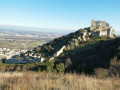 3.63 mi
+692 ft
-696 ft
2h 15
Easy
Departure from Saint-Péray (Ardèche)
A walk that allows you to explore the historic site of Crussol Castle before continuing along the ridge through scenery alternating between holm oak woodland and views of the Rhône Valley, Crussol Mountain and the foothills of the Vercors and Ardèche.
Antraigues-sur-Volane, Jean Ferrat’s adopted village
 2.60 mi
+407 ft
-407 ft
1h 35
Easy
Departure from Antraigues-sur-Volane (Ardèche)
Adopted by the famous singer Jean Ferrat, who made his home here, this charming little village overlooks the Volane Valley and offers an experience rich in history and emotion. A route that allows you to stroll through picturesque narrow streets, discover various geological sites, and pay your respects at the grave of this singer-songwriter.
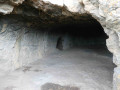
Châteauneuf Caves, Freydefont Menhir, La Pineyre Dolmen
 2.95 mi
+732 ft
-732 ft
2h 00
Moderate
Departure from Saint-Nectaire (Puy-de-Dôme)
This route takes you to the Châteauneuf Caves, ancient cave dwellings, then the small Freydefond Menhir, with its viewpoint, and the Dolmen de la Pineyre burial mound. The return journey follows a wild and steep path through the undergrowth.
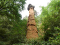
The Fairy Chimney of Cotteuge
 0.70 mi
+43 ft
-43 ft
0h 20
Easy
Departure from Saint-Diéry (Puy-de-Dôme)
A geological curiosity, the Cheminée des Fées is a ‘demoiselle coiffée’ (a rock formation resembling a lady with a headdress) formed as a result of volcanic eruptions. A mass of lava fell onto the clay soil and, over thousands of years, erosion washed away the clay except beneath the enormous volcanic bomb, which now stands perched on top.
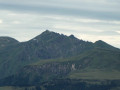
La Banne d'Ordanche and Puy Loup via the Borne des Quatres Seigneurs
 3.68 mi
+778 ft
-768 ft
2h 20
Easy
Departure from Murat-le-Quaire (Puy-de-Dôme)
An unmissable viewpoint over the surrounding mountains, the Banne d'Ordanche, with its orientation table, allows you to locate yourself in relation to the Monts Dore and the surrounding massifs. Don't forget to take a detour through the summer pastures to the Borne des Quatre Seigneurs and then on to Puy Loup with its renovated circular shelter.
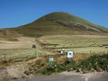
Puy de l’Angle
 2.26 mi
+968 ft
-978 ft
1h 55
Moderate
Departure from Mont-Dore (Puy-de-Dôme)
From the Col de la Croix Saint-Robert, the short, fairly steep climb up to the Puy de l’Angle is rewarded with a magnificent panoramic view stretching from the Puy de Sancy massif to the Monts du Forez, via the Puy de Dôme.
Bois de Chaux Waterfall
 0.50 mi
+62 ft
-62 ft
0h 15
Easy
Departure from Égliseneuve-d'Entraigues (Puy-de-Dôme)
Starting from Lac d’Entraigues, this walk offers a quick glimpse of a magnificent little waterfall that cascades over an ancient lava flow.
The Cirque de la Fontaine Salée
 4.90 mi
+489 ft
-486 ft
2h 40
Easy
Departure from Chastreix (Puy-de-Dôme)
A trail with informative signs (August 2024) allowing you to discover the Fontaine Salée glacial valley, with views of the south face of Puy de Sancy and Cézallier.
Roc de Courlande via the ‘Three Virgins’ trail
 1.40 mi
+584 ft
-584 ft
1h 10
Easy
Departure from Chastreix (Puy-de-Dôme)
The Roc de Courlande is a peak offering a magnificent panoramic view. Dedicated to the Virgin Mary, the site was once a destination for pilgrimages, which is why three statues of the Virgin Mary are positioned along the path leading to the cross at the summit.