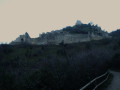
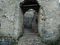
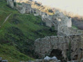
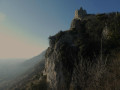
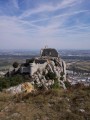
Ruined castle and the ridges of Montagne de Crussol

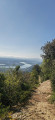
A walk that allows you to explore the historic site of Crussol Castle before continuing along the ridge through scenery alternating between holm oak woodland and views of the Rhône Valley, Crussol Mountain and the foothills of the Vercors and Ardèche.

Details

68002166
Creation:
Last update:
Last review:
  • Walking
    Activity: Walking
  • ↔
    Distance: 3.63 mi
  • ◔
    Average duration: 2h 15 
  • ▲
    Difficulty: Easy

  • ⚐
    Back to start: Yes
  • ↗
    Ascent: + 692 ft
  • ↘
    Descent: - 696 ft

  • ▲
    Highest point: 1,335 ft
  • ▼
    Lowest point: 705 ft

Photos

Description of the walk

Start from the Château de Crussol car park, at the end of Chemin de Beauregard.

Marked with white-and-redGR® signs, apart from sections within the castle ruins.

(S/E) At the end of the access road to the car park, turn left onto the path leading to the ruins. At the building, turn right and continue along the path. Note the open-air theatre below on the left, then head straight on to the entrance gate of the enclosure.

(1) Before entering, do not hesitate to walk along the ramparts there and back to reach thefirst viewpoint.

(1) On your return, go through the gate and carry on, keeping the main signposted path as your guide. Feel free to take detours to explore the ruins and reach different viewpoints.
After visiting the lower part, continue climbing towards the summit and look out for a stone staircase on the left.

(2) Take this staircase to reach the ruins of the stately home perched on its rocky outcrop. After taking in the site and its surroundings, return to the foot of the staircase.

(2) Turn left and you’ll soon find a gate on your right leading out of the castle. Continue along the path which descends and then climbs again close to the cliff. Don’t hesitate to turn round to enjoy the view of the castle. You’ll reach an area where the track is very wide; look out for a path branching off to the right.

(3) Carry on straight ahead, almost right at the edge of the cliff, mostly through woodland, with magnificent clearings and lovely views.
Keep to the left at the next three junctions, marked by signposts, and carry on until you find an inconspicuous path on the right (return route).

(4) Go straight on and you’ll reach an area of heathland.

Unmarked

(5) Leave theGR®, marked in white and red, which heads off to the left, and take the small path opposite, which follows the top of the cliff, to go round the plateau. Walk along the edge of the rocks until you reach the remains of a small ruin on your right.

(6) Continue along the path, which descends for about ten metres before turning right. Pass through an open area and reach a fork with a path leading down to the left.

(7) Ignore this and take the path on the right, which is less clearly marked and somewhat hidden by vegetation. The path then follows the edge of the cliff at the Roman quarries and runs along the edge of the precipice. Although there are no technical difficulties, caution is advised on these short sections. Continue until you rejoin the route you have already taken.

GR® white-and-red markings

(4) Turn left and retrace your steps along the path you took on the way there until you reach the fork just before the descent to the castle ruins.

No markings

(3) Turn left and take the small descending path that follows the crest of the ridge to the bottom of the slope.

(8) At the cross-country path, turn left and head towards a fork.

(9) Turn right, then left a few metres further on, and head for the car park at Crussol Castle (S/E).

Waypoints

  1. S/E : mi 0 - alt. 709 ft - Crussol Castle car park - Gare de St-Peray
  2. 1 : mi 0.29 - alt. 863 ft - Entrance gate
  3. 2 : mi 0.89 - alt. 1,066 ft - Stairs - Chateau de Crussol
  4. 3 : mi 1.25 - alt. 1,237 ft - A/R junction
  5. 4 : mi 1.91 - alt. 1,276 ft - A/R junction
  6. 5 : mi 1.96 - alt. 1,299 ft - Junction, end of the GR
  7. 6 : mi 2.12 - alt. 1,332 ft - Ruins
  8. 7 : mi 2.19 - alt. 1,322 ft - A discreet path to the right
  9. 8 : mi 3.35 - alt. 810 ft - Cross-country path
  10. 9 : mi 3.48 - alt. 751 ft - Junction
  11. S/E : mi 3.63 - alt. 709 ft - Car park - Chateau de Crussol

Notes

Slippery walk in wet weather.

Between (7) and (4), the path runs along the top of the cliff face of the ancient Roman quarries. Caution is advised on the short sections near the drop-off.

Allow an hour to wander through the castle ruins.

Worth a visit

Always be cautious and plan ahead when you're outdoors. Visorando and the author of this route cannot be held responsible for any accidents occurring on this route.

The GR® and PR® markings are the intellectual property of the Fédération Française de Randonnée Pédestre.

Reviews and comments

4.6 / 5
Based on 3 reviews

Reliability of the description
4.3 / 5
Ease of following the route
4.3 / 5
Route interest
5 / 5
Francine84
Francine84

Overall rating : 5 / 5

Date of your route : Mar 18, 2026
Reliability of the description : ★★★★★ Very good
Ease of following the route : ★★★★★ Very good
Route interest : ★★★★★ Very good
Very busy route : Yes

Thank you for sharing this; it allowed us to discover the castle and the Crussol plateau. The circular walk starting from point 4 is an excellent idea and offers a varied panorama of the Ardèche mountains. We were able to enjoy a peaceful picnic there, far removed from the hustle and bustle of the Rhône Valley. A magnificent ridge walk!
There were quite a few people, mainly children and teenagers on school trips at the open-air theatre and the castle, but far fewer along the rest of the route. We plan to return to explore the quarries outside the busy periods of Wednesdays and weekends.

Machine-translated

Xav26D
Xav26D

Overall rating : 5 / 5

Date of your route : Sep 27, 2025
Reliability of the description : ★★★★★ Very good
Ease of following the route : ★★★★★ Very good
Route interest : ★★★★★ Very good
Very busy route : Yes

A pleasant walk leading to the castle ruins. Magnificent views.
On the way back, you can take the paths on the other side before point 3. This will take you to the lower part of the climbing site.
Wear sturdy shoes.

Machine-translated

Du26
Du26

Overall rating : 3.7 / 5

Date of your route : Mar 10, 2025
Reliability of the description : ★★★☆☆ Average
Ease of following the route : ★★★☆☆ Average
Route interest : ★★★★★ Very good
Very busy route : No

Up to the castle, no problem; then, to complete the circular route, you exit through the “ramparts” near the iron staircase, which provides the final access to the castle, and indeed, you follow the markings heading due south as you climb. Once on the “plateau”, not far from the cliff overlooking Valence, look out for the small sign on the right marked “Top secret”, which marks a climbing site in the old Roman quarry. You’ve now changed sides and are looking down over the Ardèche valley; all you have to do is follow the path back to the car park at the foot of the castle.

Machine-translated

Other walks in the area

For more walks, use our search engine .

The GPS track and description are the property of this route's author. Please do not copy them without permission.