Bief de la Chaille Waterfall

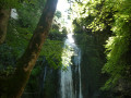
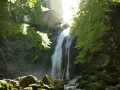
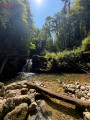
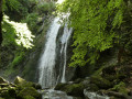
Close to the village of Les Rousses and its famous fort, this route offers quick access to a small, secluded spot featuring the magnificent Bief de la Chaille waterfall, nestled at the back of the Gorges de la Chaille.

Details

n°108573356
Creation:
Last update:
–
Last review:
–
  • Walking
    Activity: Walking
  • ↔
    Distance: 0.66 mi
  • ◔
    Average duration: 0h 25 
  • ▲
    Difficulty: Easy

  • ⚐
    Back to start: Yes
  • ↗
    Ascent: + 167 ft
  • ↘
    Descent: - 167 ft

  • ▲
    Highest point: 3,438 ft
  • ▼
    Lowest point: 3,271 ft

Photos

Description of the walk

Start from the large car park on the edge of the Route du Leat de la Chaille, near no. 2400 and the Leat de la Chaille.

(S/E) From the car park, take the Route du Bief de la Chaille downhill. Walk past No. 2400 and you’ll soon come to a path on the left.

(1) Follow this path down to the next fork.

(2) Turn left and you’ll soon reach the Cascade du Bief de la Chaille.

(3) After taking in the view, head down the narrow path that runs alongside the stream on the right bank until you reach the fork with a footbridge on the left.

(4) Carry on to the right and you’ll soon reach a fork. Keep to the right and return to a junction you’ve already passed.

(2) Turn left and head back up the path you came down, following the route in reverse, until you reach the car park (S/E).

Waypoints

  1. S/E : mi 0 - alt. 3,438 ft - Car park
  2. 1 : mi 0.11 - alt. 3,409 ft - Path on the left
  3. 2 : mi 0.2 - alt. 3,337 ft - Junction of the circular loop
  4. 3 : mi 0.27 - alt. 3,343 ft - Cascade du bief de la Chaille
  5. 4 : mi 0.39 - alt. 3,278 ft - Junction - Bief de la Chaille (cours d'eau) - Affluent de la Bienne
  6. S/E : mi 0.66 - alt. 3,438 ft - Car park

Notes

The path may be slippery in wet weather.

The forest is criss-crossed by numerous logging tracks. As a result of bark beetleinfestations , many spruce trees are dying; duringlogging operations – which are common in the Jura Mountains – some paths may change.

Hike undertaken in late August 2026.

Worth a visit

Other walks in the area

For more walks, use our search engine .

The GPS track and description are the property of this route's author. Please do not copy them without permission.