Pertes de l’Ain

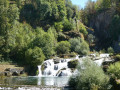
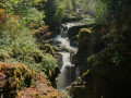
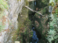
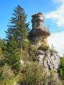
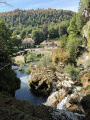
A short walk that allows you to explore a magnificent site via a well-maintained path. The River Ain plunges into a very narrow gorge and disappears beneath a jumble of rocks. After a few metres, the river re-emerges and, following a large waterfall, reaches the site of some old forges.

Details

n°109297769
Creation:
Last update:
Last review:
–
  • Walking
    Activity: Walking
  • ↔
    Distance: 1.22 mi
  • ◔
    Average duration: 0h 45 
  • ▲
    Difficulty: Easy

  • ⚐
    Back to start: Yes
  • ↗
    Ascent: + 190 ft
  • ↘
    Descent: - 200 ft

  • ▲
    Highest point: 1,952 ft
  • ▼
    Lowest point: 1,762 ft

Photos

Description of the walk

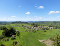
Start from the car park at Place de la Mairie in the village of Bourg-de-Sirod, on the edge of the D277.

(S/E) Head towards the Town Hall and, at the corner, go down to the right until you reach the D277. Turn left onto the track and carry on straight ahead until you reach the water intake for the hydroelectric power station.

(1) Continue along the path that crosses over the intake and carry on along the mountainside until the next junction.

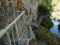
(2) Turn right and head down to the footbridge over the River Ain. Cross it, then turn right immediately and continue to the next fork. Take the hairpin bend to the right onto the stony path, then carry on along the footbridges to the end.

(3) Return to the previous junction and continue downhill to a path.

(4) Follow it to the right and head for the picnic area on the banks of the Ain.

(5) Then cross the bridge over the river and take the path on the right, running alongside the road, until you come to a path on the right. Take this path and, after a steep climb, you’ll reach the water intake for the hydroelectric power station.

(1) Continue to the left and, following the route back in the opposite direction to the outward journey, head for the Town Hall car park (S/E).

Waypoints

  1. S/E : mi 0 - alt. 1,923 ft - Town Hall car park
  2. 1 : mi 0.23 - alt. 1,913 ft - T-junction (out and back)
  3. 2 : mi 0.36 - alt. 1,939 ft - Junction
  4. 3 : mi 0.53 - alt. 1,814 ft - Developed viewing point - Perte de l'Ain
  5. 4 : mi 0.71 - alt. 1,785 ft - Path
  6. 5 : mi 0.85 - alt. 1,768 ft - Bridge over the - Ain (rivière)
  7. S/E : mi 1.22 - alt. 1,923 ft - Town Hall car park

Notes

The site is well-maintained and safe. The route leads to footbridges overlooking the gorges and offers magnificent views. Along the way, information boards explain the industrial and natural history of the area.

Hike completed in late August 2026.

Worth a visit

Other walks in the area

For more walks, use our search engine .

The GPS track and description are the property of this route's author. Please do not copy them without permission.