Roc de Courlande via the ‘Three Virgins’ trail

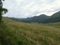
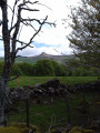
The Roc de Courlande is a peak offering a magnificent panoramic view. Dedicated to the Virgin Mary, the site was once a destination for pilgrimages, which is why three statues of the Virgin Mary are positioned along the path leading to the cross at the summit.

Details

n°61908743
Creation:
Last update:
Last review:
  • Walking
    Activity: Walking
  • ↔
    Distance: 1.40 mi
  • ◔
    Average duration: 1h 10 
  • ▲
    Difficulty: Easy

  • ⚐
    Back to start: Yes
  • ↗
    Ascent: + 584 ft
  • ↘
    Descent: - 584 ft

  • ▲
    Highest point: 4,892 ft
  • ▼
    Lowest point: 4,308 ft

Photos

Description of the walk

To reach the starting point, from the village of Chastreix, take the D615 towards the Chastreix-Sancy resort. Follow it for about 5 km, ignore the first car park before a hairpin bend, and park at the next one, just after it.

(S/E) From the car park, take the path that climbs uphill. At the next fork, turn left and you’ll reach a picnic area.

(1) Enter the park through the gate and turn left straight away. Walk past a small stone structure (an altar?) then head straight up the slope until you reach the first statue, which is clearly visible.

(2) Then continue towards the second statue before turning left. Pass the third statue and you’ll reach a fork in the path.

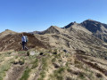
(3) Turn right and head for the ridge at the small pass, to the right of the Roc de Courlande.

(4) Carry on to the left and, via a steep but technically straightforward path, reach the cross by skirting the summit to the left.

(5) After taking in the view, return along the same route to the fork at the third cross you passed on the way up.

(3) Ignore this junction and carry on straight ahead to the picnic area.

(1) Take the path on the left and, following the route back along the same path as on the way there, head back to the D615 and the car park (S/E).

Waypoints

  1. S/E : mi 0 - alt. 4,308 ft - D615 Road – Car park
  2. 1 : mi 0.14 - alt. 4,390 ft - Picnic area
  3. 2 : mi 0.22 - alt. 4,469 ft - Statue
  4. 3 : mi 0.46 - alt. 4,633 ft - Junction on the circular loop
  5. 4 : mi 0.64 - alt. 4,800 ft - Small, unnamed pass
  6. 5 : mi 0.72 - alt. 4,885 ft - Roc de Courlande (1496 m)
  7. S/E : mi 1.4 - alt. 4,308 ft - D615 Road – Car park

Notes

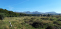
The grassy paths cross mountain pastures and, in August 2024, these were barely visible up to the small pass (4). However, there are no difficulties with navigation as the waypoints are clear.

(1) There are also a few parking spaces at the picnic area.

This route passes through the Chastreix-Sancy and/or Chaudefour Valley nature reserves._
Dogs are not permitted, even on a lead, except on the signposted GR® 30 trails.
Mountain biking, picking wild plants, lighting fires and camping are prohibited.
Pleasestay on the signposted paths.
Thank you for your understanding.
The team at the Chastreix-Sancy National Nature Reserve.
Contact: 04 73 21 41 74 / contact@reservechastreix-sancy.fr

This route passes through a protected area, which may be subject to special regulations:

Worth a visit

Always be cautious and plan ahead when you're outdoors. Visorando and the author of this route cannot be held responsible for any accidents occurring on this route.

The GR® and PR® markings are the intellectual property of the Fédération Française de Randonnée Pédestre.

Reviews and comments

5 / 5
Based on 1 review

Reliability of the description
5 / 5
Ease of following the route
5 / 5
Route interest
5 / 5
User 18266157

Overall rating : 5 / 5

Date of your route : Jul 13, 2025
Reliability of the description : ★★★★★ Very good
Ease of following the route : ★★★★★ Very good
Route interest : ★★★★★ Very good
Very busy route : No

A rather steep climb. Stunning scenery. Perhaps add a description of the statues (the Virgin’s name, explaining her attire).

Machine-translated

Other walks in the area

For more walks, use our search engine .

The GPS track and description are the property of this route's author. Please do not copy them without permission.