Puy de l’Angle

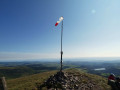
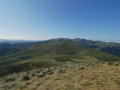
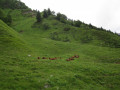
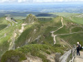
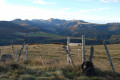
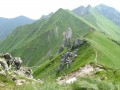
From the Col de la Croix Saint-Robert, the short, fairly steep climb up to the Puy de l’Angle is rewarded with a magnificent panoramic view stretching from the Puy de Sancy massif to the Monts du Forez, via the Puy de Dôme.

Details

61973357
Creation:
Last update:
Last review:
  • Walking
    Activity: Walking
  • ↔
    Distance: 2.26 mi
  • ◔
    Average duration: 1h 55 
  • ▲
    Difficulty: Moderate

  • ⚐
    Back to start: Yes
  • ↗
    Ascent: + 968 ft
  • ↘
    Descent: - 978 ft

  • ▲
    Highest point: 5,696 ft
  • ▼
    Lowest point: 4,715 ft

Photos

Description of the walk

To reach the start from Chambon-sur-Lac, take the D36 to the Col de la Croix Saint-Robert. Park 500 m below the pass, heading towards Mont-Dore. There is space for around ten cars to park at the side of the road.

GR® markings: white and red

(S/E) Follow the road towards Mont-Dore for a few metres and take the path on the right which climbs straight up the slope.

(1) At the small pass, head right and continue climbing along the path, which winds in a series of wide hairpin bends. Pass a cross and reach the summit, marked by a wind sock.

(2) After taking in the view, head back the way you came and rejoin the D36 (S/E).

Waypoints

  1. S/E : mi 0 - alt. 4,728 ft - Car park D36 - Col de la Croix Saint Robert
  2. 1 : mi 0.49 - alt. 5,020 ft - Small, unnamed pass
  3. 2 : mi 1.13 - alt. 5,696 ft - Puy de l'Angle
  4. S/E : mi 2.26 - alt. 4,728 ft - Car park D36

Notes

(S/E) If the car park near the start is full, park at the Col de la Croix Saint-Robert car park, which adds about 1 km to the walk there and back; please take care when walking along the edge of the main road.

You can combine this walk with the one described by stjo: Le Puy de l’Angle via the ridges south of the Col de la Croix Morand.

This walk is classified as ‘Moderate’ in difficulty as the path, whilst steep and continuous but without any technical difficulty, is very physically demanding.

Worth a visit

Always be cautious and plan ahead when you're outdoors. Visorando and the author of this route cannot be held responsible for any accidents occurring on this route.

The GR® and PR® markings are the intellectual property of the Fédération Française de Randonnée Pédestre.

Reviews and comments

5 / 5
Based on 2 reviews

Reliability of the description
5 / 5
Ease of following the route
5 / 5
Route interest
5 / 5
User 14921853

Overall rating : 5 / 5

Date of your route : Sep 02, 2026
Reliability of the description : ★★★★★ Very good
Ease of following the route : ★★★★★ Very good
Route interest : ★★★★★ Very good
Very busy route : Yes

A short but intense walk.
Your efforts will be rewarded with a stunning view: good weather is essential

Machine-translated

User 3480458

Overall rating : 5 / 5

Date of your route : Aug 04, 2025
Reliability of the description : ★★★★★ Very good
Ease of following the route : ★★★★★ Very good
Route interest : ★★★★★ Very good
Very busy route : Yes

Yes, it is busy but quite reasonable.
Leave early in the morning, around 9 a.m., if you want to be alone.
You really feel like you're on top of the world

Machine-translated

Other walks in the area

For more walks, use our search engine .

The GPS track and description are the property of this route's author. Please do not copy them without permission.