Country:

 City:
City:


Starts from the Belvédère des Maquisards car park, on the edge of the D25, between Pémanon and La Doye.
PR® or GR® signposts
(S/E) Cross the D25 with care, take the path that climbs and reach the junction at the signpost marked‘Sur le Belvédère’.
(1) Turn left, cross the D25 again – taking care – and follow the path to a clearing in the woods with a house a little further on.
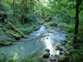
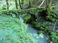
(2) At the signpostmarked ‘Sur le Bief’, takethe path on the left and begin the descent towards the Bief de la Chaille. At the cross-cutting forest track, climb up the path opposite and continue along it as it heads left. The path is almost level at first, then, after a steep descent, rejoins the track you left earlier. Continue to the right and reach the Pont Perroud at the bottom of the gorge.
(3) After taking in the view, follow the mule track which climbs up the other side. Carry on straight ahead until you reach a four-way junction.
(4) Turn left and proceed to the next junction, at the Bonzon signpost.
(5) Keep to the right here and at the three-way junction that follows, and carry on, generally following the contour line, until you reach a junction of forest tracks at the ‘Sous le Saut’ signpost.
(6) Continue to the right until you reach the next fork, at the ‘la Passerelle’ signpost.
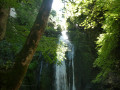
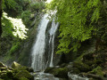
(7) Head up to the left, then turn right to reach the Cascade du Leat de la Chaille.
(8) After taking in the view, take the narrow path that runs alongside the stream on the right bank, then cross the footbridge spanning it. Continue along the forest track, keeping to the right until you reach a three-way junction in the path on a level stretch of ground.
(9) Take the left-hand fork and continue until you come to a small path on the right, at the signpost marked ‘Prémanon d’Amont’.
(10) Carry on to the right, leave the forest, walk past a house and head downhill to a road. Follow it to the left (Chemin Château le Pin) until you reach the end.
(11) Cross the D25 with care and take the path opposite. Keep left at the three-way junction and you’ll soon reach a track, at gas pipeline marker no. 12 and the ‘Chez Jeankessis’ signpost. Turn right and carry on straight ahead until you rejoin the route you took at the start.
(1) Continue straight on and you’ll soon reach the Belvédère des Maquisards (S/E).
 Visorando Member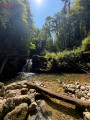

 Difficult
 Very difficult
 Moderate