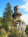
Trois Vallées Viewpoint

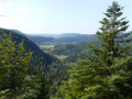
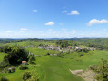
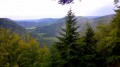
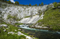
Access to a viewpoint offering a view of the confluence of three valleys: the Lemme, the Saine and the Ain. Along the way, you’ll notice the remarkable work carried out to build the ‘Ligne des Hirondelles’ railway line and a somewhat mystical section through the forest, between boulders covered in moss.

Details

n°109391906
Creation:
Last update:
–
Last review:
–
  • Walking
    Activity: Walking
  • ↔
    Distance: 3.41 mi
  • ◔
    Average duration: 1h 55 
  • ▲
    Difficulty: Easy

  • ⚐
    Back to start: Yes
  • ↗
    Ascent: + 358 ft
  • ↘
    Descent: - 358 ft

  • ▲
    Highest point: 2,208 ft
  • ▼
    Lowest point: 1,870 ft

Description of the walk

Start from the car park situated between the hamlet of La Billaude and the village of Syam, alongside the D279.

PR® signposting

(S/E) From the car park, head towards the D279 and take the small path that starts with a gentle climb to the left of the road; follow it straight on until the next junction. Turn right and you’ll soon reach the next junction, with a bridge on the left.

(1) Turn left and cross the bridge over the railway line. Note the work carried out to create this deep cutting. Continue along the path until you reach a track on the right, about fifty metres before the main road.

(2) Take this path to the right and follow it to a track suitable for vehicles, near a telecoms mast.

(3) Carry on to the right until you reach a three-way junction.

(4) Keep left and carry on straight ahead. The path curves to the right and passes through a magnificent wooded area amongst moss-covered rocks before reaching a fork. Turn left for a round trip to the viewpoint.

(5) After enjoying the view, return to the previous fork and continue to the left. Follow the path until you come to a track on the left.

(6) Take this and follow it until you reach a three-way junction.

(7) Turn left, heading downhill. Go through the tunnel under the railway line, then turn right and you’ll reach a three-way junction.

(8) Turn left, then continue straight ahead along the path until you reach the road.

(9) Cross the road carefully, walk about 50 metres to the right, and, at the bend in the road, take the gently sloping path on the left. Continue along this path, which then begins to climb. Pass the start of the path on the left that leads to the foot of the Cascade de la Billaude and continue climbing until you reach the car park beside the D279 (S/E).

Waypoints

  1. S/E : mi 0 - alt. 2,018 ft - Car park
  2. 1 : mi 0.41 - alt. 2,083 ft - Junction with a bridge on the left
  3. 2 : mi 0.8 - alt. 2,142 ft - Path on the right
  4. 3 : mi 1.03 - alt. 2,159 ft - Track
  5. 4 : mi 1.17 - alt. 2,185 ft - Three-way junction
  6. 5 : mi 1.92 - alt. 2,152 ft - Trois Vallées Viewpoint - Saine (rivière)
  7. 6 : mi 2.23 - alt. 2,169 ft - Path on the left
  8. 7 : mi 2.58 - alt. 2,149 ft - Three-way junction
  9. 8 : mi 2.85 - alt. 1,955 ft - Three-way junction
  10. 9 : mi 3.06 - alt. 1,900 ft - Route - Lemme (rivière)
  11. S/E : mi 3.41 - alt. 2,018 ft - Car park

Notes

This walk can be combined with the hike to the Waterfall de la Billaude or Saut Claude Roy. Allow for an additional 70 m of elevation gain.

From (S/E) to the viewpoint (5), the route is almost flat; however, after (7), the path passes through sections with steep gradients and may be slippery in wet weather.

There are numerous signposts along the route.

The forest is criss-crossed by numerous logging tracks. Due to bark beetleinfestations , many spruce trees are dying; as a result oflogging operations, which are common in the Jura Mountains, some paths may change.

Hike undertaken in late August 2026.

Worth a visit

Always be cautious and plan ahead when you're outdoors. Visorando and the author of this route cannot be held responsible for any accidents occurring on this route.

The GR® and PR® markings are the intellectual property of the Fédération Française de Randonnée Pédestre.

Other walks in the area

For more walks, use our search engine .

The GPS track and description are the property of this route's author. Please do not copy them without permission.