From La Roche Devant to the Balcon des Crottes via Les Trois Commères

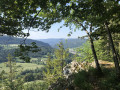
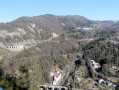
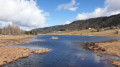
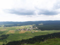
A varied route, alternating between meadows and forests, leading to La Roche Devant with its viewpoint offering a view over the Bienne valley. The route then passes the Trois Commères site – rocks resembling huge menhirs – and on to the Balcon des Crottes, withviews of the viaducts of the Ligne des Hirondelles railway line and the town of Morez.

Details

n°109042601
Creation:
Last update:
Last review:
–
  • Walking
    Activity: Walking
  • ↔
    Distance: 6.30 mi
  • ◔
    Average duration: 3h 50 
  • ▲
    Difficulty: Moderate

  • ⚐
    Back to start: Yes
  • ↗
    Ascent: + 1,076 ft
  • ↘
    Descent: - 1,066 ft

  • ▲
    Highest point: 3,757 ft
  • ▼
    Lowest point: 2,789 ft

Description of the walk

Starts from the car park at the Morbier swimming pool, 13 Rue Germain Paget.

GR® and PR® signposting.

(S/E) From the car park, head down to the junction near the roundabout and turn right onto Rue Germain Paget. Ignore Rue des Pontets on the right and continue to a three-way junction.

(1) Turn right, continue along the track suitable for vehicles and then onto the track that enters the forest. Follow it until you reach the tarmac at the edge of the woods.

(2) Turn right and head downhill to the next junction, at the end of Chemin des Sellières.

(3) Carry on to the right and head straight on until the tarmac ends, at No. 60.

(4) Take the forest track on the right and you’ll come to a fork with a footpath at the end of the climb.

(5) Take this footpath, which runs almost level, until you reach the next fork.

(6) Carry on almost straight ahead and you’ll soon reach the Roche Devant viewpoint.

(7) After enjoying the view – and perhaps the deckchair – return to the previous fork.

(6) Carry on to the left along the path and, via a series of gentle ascents and descents, reach a four-way junction.

(8) Turn onto the path on the left, which leads downhill. This path soon turns right, then runs alongside a fault line and cliffs on your right before curving right into a hollow. A few metres further on, you’ll see the Trois Commères rocks on your right.

(9) Don’t hesitate to leave the marked path to explore this unique spot. Continue along the path which runs below the cliff on your right, then joins a road.

(10) Follow it to the left and head down to the hairpin bend.

(11) Take the path opposite, keep left a few metres further on and carry on to the next junction.

(12) Turn onto a small path on the left and head down to the Balcon des Crottes viewing point.

(13) Carry on along the path which overlooks and then runs alongside the railway line, and head straight on until you emerge from the woods.

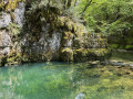
(14) Head down to the left and, at the corner of the lake, join the path that goes round it.

(15) Take this path to the right, walk alongside the lake on your left, then turn right past the swimming pool building and head for the car park (S/E).

Waypoints

  1. S/E : mi 0 - alt. 2,844 ft - Morbier swimming pool car park
  2. 1 : mi 0.22 - alt. 2,927 ft - Three-way junction
  3. 2 : mi 1.13 - alt. 3,133 ft - Route
  4. 3 : mi 1.35 - alt. 3,054 ft - End of the Chemin des Sellières
  5. 4 : mi 2.19 - alt. 3,350 ft - End of the tarmac
  6. 5 : mi 2.71 - alt. 3,720 ft - Path on the right
  7. 6 : mi 3.13 - alt. 3,724 ft - T-junction (out and back)
  8. 7 : mi 3.17 - alt. 3,757 ft - Roche Devant
  9. 8 : mi 3.85 - alt. 3,553 ft - Four-way junction
  10. 9 : mi 4.27 - alt. 3,432 ft - Les Trois Commères
  11. 10 : mi 4.48 - alt. 3,428 ft - Route
  12. 11 : mi 4.73 - alt. 3,268 ft - Hairpin bend
  13. 12 : mi 5.33 - alt. 3,028 ft - Junction
  14. 13 : mi 5.47 - alt. 2,897 ft - Balcon des Crottes
  15. 14 : mi 5.98 - alt. 2,897 ft - Junction
  16. 15 : mi 6.05 - alt. 2,854 ft - Lake
  17. S/E : mi 6.3 - alt. 2,844 ft - Morbier swimming pool car park

Notes

There are numerous signposts along the route.

The forest is criss-crossed by numerous logging tracks. As a result of bark beetleinfestations , many spruce trees are dying; duringlogging operations – which are common in the Jura Mountains – some paths may change.

Hike undertaken in late August 2026.

This route passes through a protected area, which may be subject to special regulations:

Worth a visit

Always be cautious and plan ahead when you're outdoors. Visorando and the author of this route cannot be held responsible for any accidents occurring on this route.

The GR® and PR® markings are the intellectual property of the Fédération Française de Randonnée Pédestre.

Other walks in the area

For more walks, use our search engine .

The GPS track and description are the property of this route's author. Please do not copy them without permission.