Mont Fier

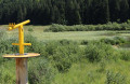
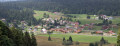
A quick route to the Mont Fier viewpoint, which overlooks the village of Prémanon. The viewpoint offers a 270° view of the Orbe Valley, taking in the surrounding peaks of La Dôle and Le Noirmont via the Fort des Rousses.

Details

107038586
Creation:
Last update:
Last review:
  • Walking
    Activity: Walking
  • ↔
    Distance: 4.21 mi
  • ◔
    Average duration: 2h 20 
  • ▲
    Difficulty: Easy

  • ⚐
    Back to start: Yes
  • ↗
    Ascent: + 495 ft
  • ↘
    Descent: - 495 ft

  • ▲
    Highest point: 4,196 ft
  • ▼
    Lowest point: 3,701 ft

Description of the walk

Start from the car park, at the hairpin bend on theD69E1, near the Chemin de la Combe de Crozet.

Yellow markings

(S/E) Head away from the road and take the path that starts to the left of the cattle pen. At the next fork, keep to the right, go round a right-hand bend through the woodland and climb up to the crossroads in the middle of a meadow.

(1) Continue straight ahead along the sunken track and climb up to a track suitable for vehicles.

(2) Follow it to the left until you reach a three-way junction.

(3) Keep to the right, go through the gate, then turn left (signpost for the Vieux Bois) and you’ll soon reach a three-way junction.

(4) Leave the track and take the path leading uphill to the right. Follow it to the junction at the signpost for the Combe du Mont Fier.

(5) Carry on to the left; at the next fork, turn right and continue to the Mont Fier viewpoint.

(6) After taking in the view, return to the car park on the side of theD69E1 by retracing your steps (S/E).

Waypoints

  1. S/E : mi 0 - alt. 3,701 ft - Car park
  2. 1 : mi 0.31 - alt. 3,766 ft - Junction
  3. 2 : mi 0.54 - alt. 3,875 ft - Vehicle track
  4. 3 : mi 0.9 - alt. 3,914 ft - Three-way junction
  5. 4 : mi 1.05 - alt. 3,940 ft - Three-way junction
  6. 5 : mi 1.56 - alt. 4,114 ft - Junction - Bienne (rivière)
  7. 6 : mi 2.1 - alt. 4,170 ft - Mont Fier
  8. S/E : mi 4.21 - alt. 3,701 ft - Car park

Notes

You can set off from Le Poteau and take the track to reach (2).

The forest is criss-crossed by numerous logging tracks. As a result of bark beetleinfestations , many spruce trees are dying; duringlogging operations – which are common in the Jura Mountains – some paths may change course.

Hike undertaken in late August 2026.

This route passes through a protected area, which may be subject to special regulations:

Worth a visit

Other walks in the area

For more walks, use our search engine .

The GPS track and description are the property of this route's author. Please do not copy them without permission.