Tour of Lake Gérardmer

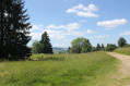
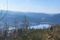
This hike goes around Lake Gérardmer, the largest natural lake in the Vosges. Covering an area of 115 hectares, it is surrounded by forests and lies at the foot of the town of Gérardmer, known for its ski resort and also for its many water sports attractions.

Details

n°85679109
Creation:
Last update:
Last review:
  • Walking
    Activity: Walking
  • ↔
    Distance: 3.18 mi
  • ◔
    Average duration: 1h 30 
  • ▲
    Difficulty: Easy

  • ⚐
    Back to start: Yes
  • ↗
    Ascent: + 20 ft
  • ↘
    Descent: - 20 ft

  • ▲
    Highest point: 2,188 ft
  • ▼
    Lowest point: 2,165 ft

Photos

Description of the walk

Depart from the car park at Stade Henri Millan, 17 Chemin du Tour du Lac.

(S/E) Go to the corner of the car park and take the track that is closed to all vehicles except residents and emergency services. Enter the woods and take the stony path that runs along a fence on the right-hand side. When you leave the woods, go to the restaurant on the lake shore.

(1) Continue along the edge of the lake. Out of season, walk between the lake and the restaurant; otherwise, walk around behind the restaurant. Walk over the duckboards that protect the dyke from erosion and continue to follow the shore as closely as possible until you reach the road (D417).

(2) Continue along the path that runs alongside the road until you reach the Union Nautique building at 21 Route d'Épinal.

(3) Descend towards the lake and continue along its shore. Pass the harbour with its various water sports activities and then head for the car park at the Stade Henri Millan (S/E)

Waypoints

  1. S/E : mi 0 - alt. 2,169 ft - Car park, 17 Chemin du Tour du Lac - Lac de Gérardmer
  2. 1 : mi 0.58 - alt. 2,169 ft - Restaurant
  3. 2 : mi 1.11 - alt. 2,188 ft - Road
  4. 3 : mi 2.11 - alt. 2,175 ft - Union Nautique building - Jamagne (rivière)
  5. S/E : mi 3.18 - alt. 2,169 ft - Car park, 17 Chemin du Tour du Lac

Notes

The path that runs along the fence between (S/E) and (1) is difficult, narrow and stony, so make sure you have good footwear. Someone broke their ankle there when I was passing through.

Worth a visit

Reviews and comments

4 / 5
Based on 3 reviews

Reliability of the description
4.7 / 5
Ease of following the route
4.7 / 5
Route interest
2.7 / 5
bon30
bon30

Overall rating : 3.7 / 5

Date of your route : Sep 13, 2026
Reliability of the description : ★★★★☆ Good
Ease of following the route : ★★★★☆ Good
Route interest : ★★★☆☆ Average
Very busy route : Yes

It’s a route that’s very popular with tourists in the summer and with locals at the weekends. There’s nothing particularly special about this route.

Machine-translated

User 12766656
• Edited:

Overall rating : 4 / 5

Date of your route : Oct 09, 2026
Reliability of the description : ★★★★★ Very good
Ease of following the route : ★★★★★ Very good
Route interest : ★★☆☆☆ Disappointing
Very busy route : No

I was able to follow this route after popping into the tourist information centre to check it was feasible (bad weather, rain and wind).
You must wear sturdy footwear as the first section is indeed rugged but perfectly manageable.
In fact, this is the best part of the walk, amongst the trees and the lake… However, once you reach the opposite bank, it’s a completely different story. The route follows the county road… We’re separated from the vehicles by a safety barrier;
cars and lorries drive just 2 metres away from you!
THERE IS ABSOLUTELY NO POINT in this second part of the walk. Walking alongside a road is the exact opposite of what you’re looking for on a hike.
It’s better to turn back once you’ve left the rugged sections behind.
In short, I recommend doing the first half of the walk and then turning back to ensure you’re left with fond memories and some lovely photos of the lake.

Machine-translated

bon30
bon30

Overall rating : 4.3 / 5

Date of your route : Sep 14, 2026
Reliability of the description : ★★★★★ Very good
Ease of following the route : ★★★★★ Very good
Route interest : ★★★☆☆ Average
Very busy route : Yes

A lovely walk

Machine-translated

Other walks in the area

For more walks, use our search engine .

The GPS track and description are the property of this route's author. Please do not copy them without permission.