


bouvierjr

 Visorando Member
 Proofreader
 Premium user
 - Location: Grenoble (38000|38100)
- Gender: man
- Website: https://sites.google.com/view/2020-wishes/2020-wishes
Sign up:
Published route(s)
 A loop through the Serre-Brion and Morta passes starting from Bourgmenu
 7.89 mi
 +4,350 ft
 -4,350 ft
 6 hrs
6 hrs
 Very difficult
 Departure from Saint-Andéol (Isère) (Isère)
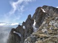
A vertiginous and rarely-taken loop, where you come across ibexes and chamois at every hairpin bend. Make sure you always have a helmet (ibexes love to send stones flying), as well as crampons and an ice axe until late in the season, as névés remain in place fairly long within the steep Serre-Brion couloir. It is best to start your hike early in the morning so that snow is still hard when reaching this couloir.
Col des 2 Sœurs - Grande Moucherolle - Sophie - Pas de l'Œille circular
 10.08 mi
+5,528 ft
-5,531 ft
8 hrs
10.08 mi
+5,528 ft
-5,531 ft
8 hrs
 Extremely difficult
Departure from Château-Bernard (Isère)
Extremely difficult
Departure from Château-Bernard (Isère)
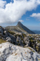
This magnificent figure-eight route combines the ascent of Grande Moucherolle, the second highest peak in the Vercors, with the crossing of two challenging passes and the discovery of the Rocher des Deux Sœurs ridges.
This hike includes two short climbing sections (less than 5 metres each), which are not particularly difficult but are exposed. A good quarter of the route is on poorly marked paths, requiring a good sense of direction even though orientation is easy.
Marmots and ibex are on the menu.
Rocks of Ranc des Agnelons and Roc Cornafion from Prélenfrey
 9.83 mi
+4,216 ft
-4,216 ft
8 hrs
Very difficult
Departure from Le Gua (Isère) (Isère)
9.83 mi
+4,216 ft
-4,216 ft
8 hrs
Very difficult
Departure from Le Gua (Isère) (Isère)
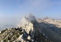
This is an aerial hike, partly off-trail on the ridge extending from the Gerbier to Roc Cornafion, where you can encounter the wildlife of the Vercors, particularly ibex and chamois.
The difficulty of the hike is due to its length, the absence of a trail for a good quarter of the route, and the short climb leading to Roc Cornafion.
Tour du Ferrouillet via the Trois Laux and the Crop and Coche lakes
 8.54 mi
+4,498 ft
-4,472 ft
7h 50
8.54 mi
+4,498 ft
-4,472 ft
7h 50
 Difficult
Departure from Laval (Isère)
Difficult
Departure from Laval (Isère)
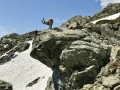
This wild hike takes place in spectacular, uncrowded locations, with a good third of the route on a faint but obvious trail that presents no technical difficulties. There are many ibex and chamois as soon as you leave the marked trails, and it is easy to observe them if you set off early enough.
A recommended alternative is to climb to the Pointe Centrale du Ferrouillet from the Col de la Brêche, which does not increase the difficulty (allow 30 minutes there and back).
Unusual Chamechaude via L'Arche, Le Jardin, La Brêche Arnaud and Le Canyon
 5.99 mi
+3,868 ft
-3,865 ft
5 hrs
Extremely difficult
Departure from Sarcenas (Isère)
5.99 mi
+3,868 ft
-3,865 ft
5 hrs
Extremely difficult
Departure from Sarcenas (Isère)
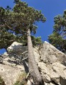
A challenging hike that allows you to discover the most beautiful (and least known) landscapes around the summit of Chamechaude.
The route includes a few fun climbs and descents, a very short off-trail section, a breach through a cliff, a spectacular couloir and an aerial sangle overlooking numerous chamois, a guaranteed spectacle for anyone aiming to reach the summit before midday.
The route is far from the summer and Sunday crowds.
Grand Ferrand via the sinkholes, return via La Vire Olympique
 7.81 mi
+5,089 ft
-5,082 ft
8h 00
Extremely difficult
Departure from Saint-Disdier (Hautes-Alpes)
7.81 mi
+5,089 ft
-5,082 ft
8h 00
Extremely difficult
Departure from Saint-Disdier (Hautes-Alpes)
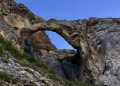
A superb route allowing you to discover the Canyon and the Arche des Adroits and climb up to the Grand Ferrand via two tunnels (sinkholes) and a very beautiful rocky ridge. The return journey allows you to visit the Chourum and the Vire Olympique as well as numerous karstic caves.
This little-used route is challenging and requires sure footing on scree and very steep grassy steps. It is almost entirely off-trail.
Col des Avalanches
 12.13 mi
+6,027 ft
-6,001 ft
10 hrs
Extremely difficult
Departure from Saint-Christophe-en-Oisans (Isère)
12.13 mi
+6,027 ft
-6,001 ft
10 hrs
Extremely difficult
Departure from Saint-Christophe-en-Oisans (Isère)
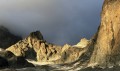
A very alpine hike in the magnificent Vallon de la Pilatte cirque, beneath the Dentelles des Écrins. Half of the route is off-trail and therefore requires good terrain reading skills.
After a steep climb through mountain pastures where marmots, chamois and ibex abound, the rounded rocks and scree precede the glacier leading to the Col des Avalanches, from where you can admire the splendid panoramic views of the Écrins, the Glacier Noir and the Rouies.
Dent de Crolles via the Terreaux and Rocheplane steps
 8.23 mi
+3,937 ft
-3,940 ft
6 hrs
Very difficult
Departure from Saint-Hilaire (Isère) (Isère)
8.23 mi
+3,937 ft
-3,940 ft
6 hrs
Very difficult
Departure from Saint-Hilaire (Isère) (Isère)
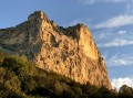
A splendid but little-used circular, starting from Saint-Hilaire du Touvet and passing through the Pas des Terreaux, the Dent de Crolles, the Cheminée du Paradis and the Pas de Rocheplane.
Much of the hike is on poorly marked paths on steep slopes. The Cheminée du Paradis is a small climbing step, which explains the level of difficulty.
It is possible to extend this hike in a pleasant way, either during the hike itself or nearby.
Pic du Grand Domènon and Grande Lauzière via Lacs du Bois and Lac du Bœuf
 12.56 mi
+6,247 ft
-6,243 ft
8 hrs
Very difficult
Departure from Revel (Isère) (Isère)
12.56 mi
+6,247 ft
-6,243 ft
8 hrs
Very difficult
Departure from Revel (Isère) (Isère)
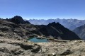
A stunning hike that allows you to discover two gems of the Belledonne massif that are almost never visited: the Lac du Bois and Lac du Bœuf are little jewels off the beaten track of the massif. The Pic du Grand Domènon, the highest point of the walk, is a magnificent viewpoint that is much less visited than the Croix de Belledonne, offering views of the Bauges, Mont Blanc, the Grandes Rousses, the Oisans, the Dévoluy, the Taillefer, the Vercors and the Chartreuse and, of course, Belledonne and its lakes.
Please note: this hike is on the borderline between very difficult and extremely difficult.
Têtes de Vallon Pierra and Lauzon via Lac du Lauzon
 8.60 mi
+4,498 ft
-4,501 ft
7h 50
Difficult
Departure from Lus-la-Croix-Haute (Drôme)
8.60 mi
+4,498 ft
-4,501 ft
7h 50
Difficult
Departure from Lus-la-Croix-Haute (Drôme)
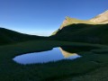
Starting from the legendary Jarjatte valley, this hike takes you to the rocky landscape of the Tête du Vallon Pierra via the Tête and Lac du Lauzon, nestled in its green setting, which is undergoing eutrophication. The landscapes criss-crossed by chamois and griffon vultures and the views are breathtaking.
A small part of the route is off-trail, but on obvious terrain, and the only real difficulty is the elevation gain of over 1,000 metres.
Rochers de Chalves via the south ridge
 6.02 mi
+3,635 ft
-3,612 ft
5 hrs
Extremely difficult
Departure from Mont-Saint-Martin (Isère) (Isère)
6.02 mi
+3,635 ft
-3,612 ft
5 hrs
Extremely difficult
Departure from Mont-Saint-Martin (Isère) (Isère)
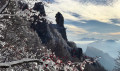
A fun hike bordering on mountaineering on a very little-used route leading to the Rocher de Chalves via its southern ridge. You will discover the Ouillon, a monolith clearly visible at the foot of the ridge, before climbing an easy rock face (never exceeding 3c) along the ridge.
Caution: there is a sheer drop below the ridge, so you must proceed slowly and test each hold carefully, as some boulders are ready to tumble down.
Rocher Rond via the Col de Charnier
 7.95 mi
+4,560 ft
-4,544 ft
7 hrs
Extremely difficult
Departure from Lus-la-Croix-Haute (Drôme)
7.95 mi
+4,560 ft
-4,544 ft
7 hrs
Extremely difficult
Departure from Lus-la-Croix-Haute (Drôme)
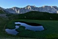
A magnificent circular route around the Cirque du Fleyrard, passing by the Tête de Plate Longue and the highest peak in the Vercors Natural Park, the Rocher Rond, 2453m.
From the Col de Charnier, the route is completely off-trail, with herds of chamois being the main encounters. A short 3c climbing section with a slight overhang, sharp ridges and exposed slopes on very steep scree justify the level of difficulty.
Tundra and lakes of Grand Galbert and Taillefer
 12.55 mi
+3,606 ft
-3,602 ft
8h 55
Difficult
Departure from Livet-et-Gavet (Isère)
12.55 mi
+3,606 ft
-3,602 ft
8h 55
Difficult
Departure from Livet-et-Gavet (Isère)
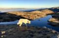
A peaceful exploration of one of the most beautiful alpine tundras, amidst sapphire-coloured lakes and weather-beaten rocks nestled amongst blueberry bushes, on the plateau separating the Grand Galbert from the Taillefer. The ascent and descent to Lac Fourchu follow very good paths. On the plateau, the route meanders as far as the eye can see and adapts to the mood of hikers eager for space and light.Le Grand Galbert offers a magnificent 360º view of all the mountain ranges surrounding Grenoble.
This hike passes through a Natura 2000 site and is subject to specific regulations. Please respect these (see practical information).
Rocher Blanc via the Col de Buyant
 5.98 mi
+3,960 ft
-3,947 ft
5 hrs
Very difficult
Departure from Saint-Colomban-des-Villards (Savoie)
5.98 mi
+3,960 ft
-3,947 ft
5 hrs
Very difficult
Departure from Saint-Colomban-des-Villards (Savoie)
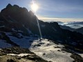
A short hike, mostly off-trail, allowing you to enjoy the wild splendour of the Aiguilles de l'Argentière area and come out at Rocher Blanc (2928m). The east face of Belledonne is much less frequented than its opposite, and the chances of encountering wildlife are therefore greater.
This hike is particularly recommended at the beginning of the season when the snowfields are still present, or at the end of the season when the snow begins to dust the slopes again.
(Danger) The difficulty of this hike increases to Extremely Difficult in summer when the slopes are snow-free.
Taillefer and Pyramide circular
 10.42 mi
+4,948 ft
-4,934 ft
8 hrs
Very difficult
Departure from Livet-et-Gavet (Isère)
10.42 mi
+4,948 ft
-4,934 ft
8 hrs
Very difficult
Departure from Livet-et-Gavet (Isère)
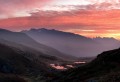
Two central viewing points offer views of the massifs of the Northern French Alps, from Mont Blanc to the limestone Pre-Alps of Chartreuse and Vercors, to Belledonne, the Grandes Rousses, the Cerces, Oisans and Dévoluy. Numerous lakes dot the vast “tundra” plateau separating the Taillefer from the Grand Galbert like sapphires.
Part of the hike is off-trail, though this does not add to the difficulty: only the elevation gain and distance justify the rating. See practical information.
Petit and Grand Replomb via Lac de Crop
 9.89 mi
+5,302 ft
-5,318 ft
8 hrs
Very difficult
Departure from Laval (Isère)
9.89 mi
+5,302 ft
-5,318 ft
8 hrs
Very difficult
Departure from Laval (Isère)
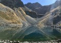
A wild hike in Belledonne, beneath the rocks of l’Homme and le Ferouillet, skirting well-trodden paths yet staying far enough away to offer unique views of the varied landscape surrounding Lac de Crop.
The vegetation and streams are particularly stunning in autumn, and setting off early in the morning guarantees a chance to spot chamois or ibex.
Tête de la Cassille via the Lacs Rouge and Lac de la Casse Blanche
 8.45 mi
+4,052 ft
-4,039 ft
7 hrs
Extremely difficult
Departure from Névache (Hautes-Alpes)
8.45 mi
+4,052 ft
-4,039 ft
7 hrs
Extremely difficult
Departure from Névache (Hautes-Alpes)
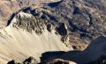
The dazzling gold of the larch trees, the stark, rocky peaks and the deep blue of the skies make the Clarée Valley one of the most beautiful landscapes in the world, especially in autumn.
This route, which is mainly off-trail, culminates in the ascent of the highest peak in the southern part of the Cerces massif, the Tête de la Cassille (3,069 m), passes by the lakes in the surrounding valleys and ends in the idyllic mountain pastures dotted with larch trees overlooking traditional chalets and small chapels.
Pic and Col de l'Agnelin and Lac de l'Âne
 5.76 mi
+3,406 ft
-3,432 ft
5 hrs
Very difficult
Departure from Saint-Colomban-des-Villards (Savoie)
5.76 mi
+3,406 ft
-3,432 ft
5 hrs
Very difficult
Departure from Saint-Colomban-des-Villards (Savoie)
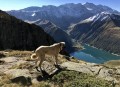
This is a wild hike that quickly leaves the beaten track to tackle the Lac de l'Âne glacial cirque via its highest peak, the Pic de l'Agnelin. There are superb views throughout this walk, both on the Bréda and Belledonne valley side and on the Eau d'Olle and Grandes Rousses valley side.
The difficulty lies mainly in finding the route, but the Visorando app makes it very easy to follow.
Grand Galibier from the Pont de l'Alp
 11.67 mi
+5,348 ft
-5,341 ft
8 hrs
Very difficult
Departure from Le Monêtier-les-Bains (Hautes-Alpes)
11.67 mi
+5,348 ft
-5,341 ft
8 hrs
Very difficult
Departure from Le Monêtier-les-Bains (Hautes-Alpes)
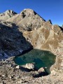
A magnificent hike leading to the legendary Grand Galibier viewpoint, from where you can admire almost the entire French Alps. Part of the hike is off-trail and often on poorly marked paths, but the most difficult part of the route is well marked with cairns.
On the agenda: unique panoramic views, numerous crystal-clear lakes, friendly wildlife, wild valleys dating back to the Ice Age, all under the deep blue skies of the Hautes-Alpes.
Sangle des Belles Ombres and Porte de l'Alpette
 7.44 mi
+3,432 ft
-3,419 ft
6h 25
Difficult
Departure from Sainte-Marie-du-Mont (Isère)
7.44 mi
+3,432 ft
-3,419 ft
6h 25
Difficult
Departure from Sainte-Marie-du-Mont (Isère)
A wild and off-the-beaten-track hike linking the high-altitude ridge of Les Belles Ombres, where chamois frolic all year round, with the bucolic meadows of L’Alpette, where marmots abound.
This route is mainly off-trail and requires sure-footedness and a good sense of direction. It is unlikely that you will encounter other walkers, except at the Croix de l’Alpe and on the section of path leading there.
Griffes de l’Ours circular loop and Belles Ombres trails
 5.36 mi
+2,369 ft
-2,352 ft
4 hrs
Extremely difficult
Departure from Sainte-Marie-du-Mont (Isère)
5.36 mi
+2,369 ft
-2,352 ft
4 hrs
Extremely difficult
Departure from Sainte-Marie-du-Mont (Isère)
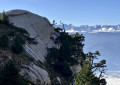
A circular loop exploring the Griffes de l’Ours and emerging onto the Belles Ombres ridge after a short stretch along the eponymous ‘sangle’.
The Griffes de l’Ours are usually tackled by returning via the same path as the outward journey. Our route allows you to climb up onto the ridge via a few rocky sections, enabling you to admire the Griffes de l’Ours from every angle.
Lacs du Bâton and Lac du Bœuf from Freydières
 13.76 mi
+6,529 ft
-6,503 ft
10 hrs
Very difficult
Departure from La Combe-de-Lancey (Isère)
13.76 mi
+6,529 ft
-6,503 ft
10 hrs
Very difficult
Departure from La Combe-de-Lancey (Isère)
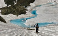
This is a very wild hike, half of which takes place in valleys completely off the beaten track, exploring the playground of the chamois, mouflons and ibex that abound in Belledonne.
The lakes of Bâton and Bœuf, nestled in the rounded rocks opposite the peaks of Oisans, are the highlights of the hike.
Rocher de la Grande Tempête and Pic du Lac Blanc
 10.59 mi
+4,288 ft
-4,288 ft
8 hrs
Very difficult
Departure from Névache (Hautes-Alpes)
10.59 mi
+4,288 ft
-4,288 ft
8 hrs
Very difficult
Departure from Névache (Hautes-Alpes)
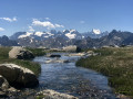
A circular hike passing two viewpoints and numerous lakes, all set against the spectacular panorama of the Écrins and the Cerces. Three-quarters of the hike is off-trail, and even in the height of summer it is very rare to come across other walkers.At an altitude of over 3,000 metres, the Rocher de la Grande Tempête offers a splendid view of Mont Thabor and the Vallée Étroite. The Pic du Lac Blanc, meanwhile, provides views of Mont Blanc and the Aiguille Rouge.
La Croix du Lautaret and the Haut Plateau du Vercors Sud
 12.46 mi
+3,881 ft
-3,855 ft
7 hrs
Very difficult
Departure from Treschenu-Creyers (Drôme)
12.46 mi
+3,881 ft
-3,855 ft
7 hrs
Very difficult
Departure from Treschenu-Creyers (Drôme)
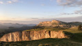
A very enjoyable route on the wild high plateau of southern Vercors. Solitude is guaranteed, except for ibex, marmots and vultures.
There are no marked trails on this hike, only a few topographical landmarks to help you navigate the nearly 16 km. However, orientation is easy, as the view is generally very clear. This hike is excellent practice for off-trail hiking.
See the practical information for some orientation tips.
Lake and Cross of Belledonne from Allemont
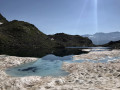 12.83 mi
+6,588 ft
-6,588 ft
12 hrs
Extremely difficult
Departure from Allemond (Isère)
12.83 mi
+6,588 ft
-6,588 ft
12 hrs
Extremely difficult
Departure from Allemond (Isère)
This superb hike starting from Allemont passes by the lake, the pass and the Croix de Belledonne before descending through the very wild Bâton valley and past the Lacs du Bœuf and du Bois.
Half of the route is completely off-trail, allowing you to observe wildlife and listen to the sounds of the mountains in complete tranquillity.
This challenging route requires crampons and an ice axe in all seasons and a night-time start in summer (see practical information).
Little wonders around the Crête des Crocs
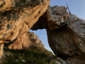 7.65 mi
+3,757 ft
-3,750 ft
6 hrs
Very difficult
Departure from Varces-Allières-et-Risset (Isère)
7.65 mi
+3,757 ft
-3,750 ft
6 hrs
Very difficult
Departure from Varces-Allières-et-Risset (Isère)
A circular walk along old, rarely used paths, offering the chance to discover the natural wonders around the spectacular Crête des Crocs: the magnificent Arche des Crocs, the Pierre Fendue, the ‘Main’, the Rocher de l’Ours with its unique view of the Roc Cornafion, and the Crête des Crocs with its bird’s-eye view of the Col de l’Arc and the Pic Saint-Michel.
The main challenge is finding your way, as the paths are very poorly marked. Please take care; see the practical information.
La Draye des Communaux and La Sure
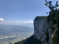 9.52 mi
+3,960 ft
-3,947 ft
7 hrs
Extremely difficult
Departure from Noyarey (Isère)
9.52 mi
+3,960 ft
-3,947 ft
7 hrs
Extremely difficult
Departure from Noyarey (Isère)
A physically demanding and challenging circular walk just a few minutes from Grenoble. After climbing the Draye des Communaux, the route passes through the magnificent interlacing formations of sharp limestone pavement at the Gouffre Berger, before reaching the summit of La Sure, where the view of Mont Blanc, the Chartreuse, Belledonne and Grenoble is as breathtaking as the drop-off beneath the cliff.You then head towards La Buffe (optional) and return via the (disused) Mortier tunnel.
Only to be attempted in very dry weather!
Pointe de Malhaubert and Neyrard
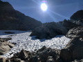 9.41 mi
+5,774 ft
-5,778 ft
10 hrs
Extremely difficult
Departure from Chantelouve (Isère)
9.41 mi
+5,774 ft
-5,778 ft
10 hrs
Extremely difficult
Departure from Chantelouve (Isère)
At 3,049m, Pointe de Malhaubert is the highest of the peaks surrounding Lac du Vallon above Chantelouve, offering a unique, unobstructed 360° panorama of all the Alpine massifs.Ibex, chamois and griffon vultures frequent the nearby peaks and slopes.
Warning:Reaching the summit requires proficiency in ridge walking (grade 3 climbing, with constant exposure) both on the ascent and descent. The snowfields require crampons and an ice axe, as well as an early start.
Mont Granier via the Porte de l'Alpette and the Pas de la Porte
 9.01 mi
+4,495 ft
-4,495 ft
7 hrs
Very difficult
Departure from Chapareillan (Isère)
9.01 mi
+4,495 ft
-4,495 ft
7 hrs
Very difficult
Departure from Chapareillan (Isère)
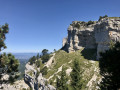
A very beautiful loop, much less frequented than the classic Mont Granier route, starting from the beautiful church of Bellecombe and particularly pleasant in summer.
After the Porte de l'Alpette, the hike runs along almost the entire cliff face of the mountain, passing through the magnificent "gardens" of the upper Alpette du Granier and returning to the Pas de la Porte pass overlooking the Grésivaudan valley.
Lac des Quirlies and Râteau des Rousses via the Échine de Praouat
 13.73 mi
+4,928 ft
-4,934 ft
10 hrs
Very difficult
Departure from Clavans-en-Haut-Oisans (Isère)
13.73 mi
+4,928 ft
-4,934 ft
10 hrs
Very difficult
Departure from Clavans-en-Haut-Oisans (Isère)
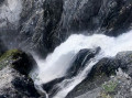
A stunning circular route around one of the most beautiful valleys in the Alps, the Ferrand Valley, leading to the Râteau des Rousses and the turquoise Lac des Malatres.
The route follows the Ferrand stream as far as the waterfalls, then bypasses the main path leading to Lac des Quirlies, before climbing to the impressive Pic du Râteau des Rousses — the only technical challenge — and returns to the valley via magnificent lakes, glaciers and meadows dotted with rounded boulders.
Solitude and wonder guaranteed!
Circular Grande Lance de Domène route via the Col des Lances and Lac du Loup
 10.14 mi
+5,709 ft
-5,709 ft
10 hrs
Extremely difficult
Departure from La Combe-de-Lancey (Isère)
10.14 mi
+5,709 ft
-5,709 ft
10 hrs
Extremely difficult
Departure from La Combe-de-Lancey (Isère)
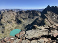
A circuit and ascent to Belledonne’s finest viewpoint, amidst the ibex. Climbing the Grande Lance de Domène is straightforward, but the return via the Col des Lances requires an ice axe and crampons in all seasons, and the very steep scree on the north face invariably turns the hiker into a left-turning dahu.
Between the Col des Lances and Lac du Loup, the Glacier de la Sitre and its lake form one of the wildest landscapes in the range, where you may encounter eagles and chamois.
Le Grand Armet
 8.86 mi
+5,230 ft
-5,210 ft
8 hrs
Very difficult
Departure from Lavaldens (Isère)
8.86 mi
+5,230 ft
-5,210 ft
8 hrs
Very difficult
Departure from Lavaldens (Isère)
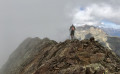
A wild hike around the Vaunoire waterfalls and along the exposed ridge leading to the Grand Armet (2,792m), a viewpoint offering a unique panorama of the Dévoluy, the entire eastern barrier of the Vercors, the Taillefer, Belledonne, Mont Blanc, the Grandes Rousses, and the whole of the Oisans.
Much of the route is off-trail and requires a (very) good sense of direction or the use of a GPS. The ridge, almost 2 km long, presents no technical difficulty but is exposed.
Vallon des Étages Glacier
 7.47 mi
+4,055 ft
-4,075 ft
7h 00
Difficult
Departure from Saint-Christophe-en-Oisans (Isère)
7.47 mi
+4,055 ft
-4,075 ft
7h 00
Difficult
Departure from Saint-Christophe-en-Oisans (Isère)
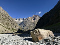
A short round trip through the sumptuous and little-visited Étages valley, between the summit of the Encoula and the peaks of the Étret and the Fétoules.
The Oisans’ reputation for endless approach walks is well deserved. A few valleys break the mould and offer quick access to the summits: this is the case with the Étages valley, which allows you to reach the bivouacs beneath the glaciers in a short time. The logical absence of a refuge explains why the valley is so little frequented, even in high season.
Lakes Mariande and Salude
 9.41 mi
+5,026 ft
-5,013 ft
8h 40
Difficult
Departure from Saint-Christophe-en-Oisans (Isère)
9.41 mi
+5,026 ft
-5,013 ft
8h 40
Difficult
Departure from Saint-Christophe-en-Oisans (Isère)
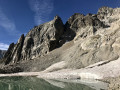
A hike to two magnificent lakes in a relatively uncrowded valley in the Oisans. From the bottom of the Vallon de la Mariande, the path disappears, giving way to adventure and trails that are sometimes poorly marked.
The glacial lakes dotted with snowfields and the rocky landscapes where ibex and chamois roam reward hikers for their efforts.
Please note: this difficult route is only suitable for hikers accustomed to off-trail walking on steep terrain.
Selle du Puy Gris via the Gleyzin and Grande Valloire valleys
 11.37 mi
+6,972 ft
-6,955 ft
10 hrs
Very difficult
Departure from La Ferrière (Isère) (Isère)
11.37 mi
+6,972 ft
-6,955 ft
10 hrs
Very difficult
Departure from La Ferrière (Isère) (Isère)
A circular walk through a rocky landscape shaped by glaciers and dotted with mirror-like lakes. After the peaceful mountain pastures of Lac Léat above the Haut Bréda valley and then the Combe Grasse, the walk takes you to the passes and peaks surrounding Puy Gris before descending towards the scenic setting formed by the lakes of Grande Valloire.
The hike can be done with an overnight stay in a mountain hut and can be combined with the easy ascent of Puy Gris: see the ‘During the hike’ section.
Tour of the Gardioles Lakes
 6.78 mi
+2,310 ft
-2,313 ft
5h 10
6.78 mi
+2,310 ft
-2,313 ft
5h 10
 Moderate
Departure from Névache (Hautes-Alpes)
Moderate
Departure from Névache (Hautes-Alpes)
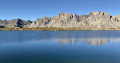
A classic hike in the Clarée Valley, set against the magnificent backdrop of one of France’s most beautiful landscapes.This easy walk allows you to admire the reflections of the Cerces and Écrins mountains in the crystal-clear waters of the many Gardioles lakes. The scenery is so breathtaking that you should allow at least an hour or two longer than the scheduled time to complete the circular walk.Much of the route takes you far from the beaten track, sometimes off any path at all.
Sambuis Peak and Lake, and Lake de la Croix
 7.44 mi
+3,734 ft
-3,704 ft
6h 40
Difficult
Departure from Saint-Colomban-des-Villards (Savoie)
7.44 mi
+3,734 ft
-3,704 ft
6h 40
Difficult
Departure from Saint-Colomban-des-Villards (Savoie)
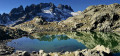
A splendid route, partly off-trail, offering views of the north face of the Aiguilles de l'Argentière and its reflections in the emerald lakes of Sambuis and La Croix: panoramic views. Many ibex frequent the rocky outcrops above the lakes.
This hike presents no difficulty apart from the elevation gain and finding the route (4km without markings).
Col de la Combe and Lac de la Croix
 6.90 mi
+3,438 ft
-3,435 ft
7 hrs
Extremely difficult
Departure from Saint-Colomban-des-Villards (Savoie)
6.90 mi
+3,438 ft
-3,435 ft
7 hrs
Extremely difficult
Departure from Saint-Colomban-des-Villards (Savoie)
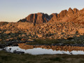
An introductory hike through one of the most beautiful landscapes in Belledonne, amidst the Aiguilles de l’Argentière. After climbing the Col de la Combe, the route leaves any defined path behind to explore the weathered rocks forming the northern foothills of the Aiguilles, eventually reaching the wild Col de la Marmottane, home to chamois and ibex.
The descent takes you past the magnificent Lac de la Croix and its splendid valley.
Bosse de la Momie
 8.35 mi
+4,108 ft
-4,094 ft
8 hrs
Extremely difficult
Departure from Pelvoux (Hautes-Alpes)
8.35 mi
+4,108 ft
-4,094 ft
8 hrs
Extremely difficult
Departure from Pelvoux (Hautes-Alpes)
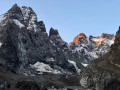
A challenging hike through a spectacular landscape where gigantic, jagged granite cliffs drop sheer down to a wild glacier. The lack of paths for most of the ascent helps to create an atmosphere of adventure and solitude reminiscent of expeditions in Patagonia or the Karakoram.
⚠️ It is essential to read the practical information before undertaking this extremely difficult hike.
Col et Lac des Balmettes and Brèches de la Passoire
 5.88 mi
+3,333 ft
-3,333 ft
5h 35
Difficult
Departure from Saint-Colomban-des-Villards (Savoie)
5.88 mi
+3,333 ft
-3,333 ft
5h 35
Difficult
Departure from Saint-Colomban-des-Villards (Savoie)
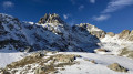
An original way to explore Lac des Balmettes and its pass, continuing on to the Col du Villonet – offering a front-row view of the imposing Pic du Frêne – and then on to the Brèches de la Passoire, which provide a superb view of the Grésivaudan.Along the way, you’ll spot ibex and chamois in the magnificent and little-visited Combe Rousse.The route is partly off-trail but poses no navigation difficulties.
Lakes of La Pra
 10.79 mi
+4,160 ft
-4,157 ft
8h 35
Difficult
Departure from Saint-Martin-d'Uriage (Isère)
10.79 mi
+4,160 ft
-4,157 ft
8h 35
Difficult
Departure from Saint-Martin-d'Uriage (Isère)
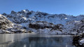
This hike takes you to a series of lakes set like precious stones along the path from the Oursière waterfalls to the Col de la Pra, between wave-cut rocks and alpine flora.
This route, which is partly off-trail, is particularly treacherous: there is no way to keep to a schedule, as the fascinating landscapes compel you to linger and contemplate.
A small part of the route is off-trail but there are no difficulties with orientation.
Rocher de Lorzier and Rocher de Chalves
 8.94 mi
+3,035 ft
-3,015 ft
6h 45
Difficult
Departure from Saint-Pierre-de-Chartreuse (Isère)
8.94 mi
+3,035 ft
-3,015 ft
6h 45
Difficult
Departure from Saint-Pierre-de-Chartreuse (Isère)
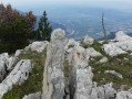
A pleasant hike, half of which is in the magnificent Génieux forest and the other half in the Hurtières and Vararey mountain pastures. The route, which runs off the marked trail along the Crête du Rocher de Lorzier, offers spectacular views of the Gorges de Crossey and the Voironnais, then, from the summit of Rocher de Chalves, of the Chartreuse, Belledonne, Dévoluy, Taillefer and Vercors ranges and peaks.
The trail is poorly marked in the forest, so a GPS is recommended.
Trou Saint-Michel and Moucherotte
 8.81 mi
+5,305 ft
-5,276 ft
6 hrs
Extremely difficult
Departure from Saint-Nizier-du-Moucherotte (Isère)
8.81 mi
+5,305 ft
-5,276 ft
6 hrs
Extremely difficult
Departure from Saint-Nizier-du-Moucherotte (Isère)
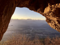
A splendid circular route around the Moucherotte, allowing you to (literally) pass through the rock to reach a ledge right on the cliff face above Grenoble, where you can enjoy a unique view of the city and the mountain ranges from Belledonne to Dévoluy, taking in Les Rousses, Oisans and Le Taillefer. The wild Vallon des Forges is on the itinerary.This hike may require a 30-metre rope (or a 15-metre abseil rope as an alternative) in the Trou Saint-Michel if you’re not comfortable descending a grade 3 section.
Tête de l'Aupet
 8.60 mi
+4,600 ft
-4,580 ft
7h 55
Very difficult
Departure from Saint-Disdier (Hautes-Alpes)
8.60 mi
+4,600 ft
-4,580 ft
7h 55
Very difficult
Departure from Saint-Disdier (Hautes-Alpes)
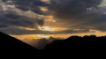
A very beautiful, uncrowded walk leading to the splendid viewpoint at the Tête de l’Aupet and winding through two wild valleys where chamois and marmots seek refuge.
The summit offers a spectacular view of its two higher neighbours, the Grand Ferrand and the Obiou, as well as the ridge connecting them and the neighbouring Vercors and Oisans mountain ranges.
Please note: the route is mainly off-trail but does not present any navigation difficulties. See the ‘Practical information’ section.
Not Charassons and Arche Miracle
 8.16 mi
+4,783 ft
-4,780 ft
6 hrs
Extremely difficult
Departure from Saint-Bernard (Isère) (Isère)
8.16 mi
+4,783 ft
-4,780 ft
6 hrs
Extremely difficult
Departure from Saint-Bernard (Isère) (Isère)
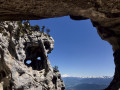
A breathtaking circular route linking together numerous wonders: the rugged Pas des Charassons, the scenic Crête de l’Alpette, the magnificent Écaille du Pas de Ragris, the famous Tour Percée, the precarious Arche Miracle and the beautiful Aup du Seuil pass.
This hike, covering less than 13km with 1,500m of elevation gain, requires a good sense of direction and sure-footedness (short sections of grade 3c climbing). Please note: the IGN topographic map is completely unreliable here!
An agreement has been signed between the department and the owner of the 800 hectares in the Hauts de Chartreuse nature reserve to allow free access to the two paths that run across the Marcieu plateau. The exit at Pas des Charassons, which leads back onto the plateau, joins one of these paths within a few metres. You may request permission to pass from the landowner, although there are no visible prohibition signs on the ground.
Pinéa and Charmant Som via the Vermorel trail
 9.62 mi
+3,481 ft
-3,474 ft
7h 25
Difficult
Departure from Proveysieux (Isère)
9.62 mi
+3,481 ft
-3,474 ft
7h 25
Difficult
Departure from Proveysieux (Isère)
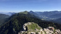
A very beautiful circular route linking two of the peaks overlooking the Col de Porte, via a picturesque and relatively quiet route. The peaks and ridges offer superb views of the Chartreuse and the surrounding mountain ranges: Vercors, Dévoluy, Taillefer, Oisans, Grandes Rousses and Belledonne.As the ascent is mainly in the shade, this hike—ideal for hot weather—presents no technical difficulties; however, care should be taken on the Vermorel path.
Pointe de l’Aup du Pont
 8.06 mi
+4,442 ft
-4,416 ft
6 hrs
Very difficult
Departure from Saint-Alban-des-Villards (Savoie)
8.06 mi
+4,442 ft
-4,416 ft
6 hrs
Very difficult
Departure from Saint-Alban-des-Villards (Savoie)
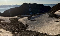
A superb viewpoint between Puy Gris and Pic du Frêne, easily accessible and offering a magnificent panorama of the main peaks of the French Alps.
This walk takes place largely off the beaten track or along very faint paths, but there are no navigation difficulties in good weather, as the terrain offers plenty of landmarks.
Vultures, chamois and ibex can be spotted, particularly below the Pointe du Villonet.
Col de Burlan
 8.04 mi
+5,797 ft
-5,794 ft
7 hrs
Very difficult
Departure from Saint-Christophe-en-Oisans (Isère)
8.04 mi
+5,797 ft
-5,794 ft
7 hrs
Very difficult
Departure from Saint-Christophe-en-Oisans (Isère)
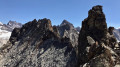
The Col de Burlan, between the Vallon de la Selle and the Cirque du Soreiller, offers the most spectacular views across the whole of the Oisans, without requiring any climbing. Higher than the Dibona, the ascent allows you to watch the stream of mountaineers abseiling down from this sharp peak.
A short section of the route is off-trail, but the route and direction are clear. The final ascent to the pass is, however, very steep.
Several interesting alternatives are described.
Combeynot Lake and East Peak
 7.44 mi
+4,908 ft
-4,908 ft
6 hrs
Very difficult
Departure from Le Monêtier-les-Bains (Hautes-Alpes)
7.44 mi
+4,908 ft
-4,908 ft
6 hrs
Very difficult
Departure from Le Monêtier-les-Bains (Hautes-Alpes)
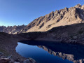
The Pics du Combeynot viewpoints are two promontories offering the finest views of the Écrins and Cerces mountain ranges. Set well apart from these massifs – close enough to observe them in detail yet far enough away to avoid obstruction – they overlook the highest peaks: Pelvoux, Barre des Écrins, Meije, Galibier, Mont Blanc, Thabor, Viso…
The Pic Ouest is a few metres higher, but the view is more spectacular from the Pic Est, which is also easier to reach.
Vallée Étroite and the Rochers du Tru
 13.89 mi
+5,020 ft
-5,003 ft
8 hrs
Extremely difficult
Departure from Névache (Hautes-Alpes)
13.89 mi
+5,020 ft
-5,003 ft
8 hrs
Extremely difficult
Departure from Névache (Hautes-Alpes)
A magnificent route around the Tours du Vallon, exploring numerous lakes and viewpoints offering unique views of the summits of Mont Thabor, Séru and Rois Mages.
This walk is ideal when the golden larch trees stand out against the deep blue of the clear autumn skies and are reflected in the emerald waters of the famous Lac Vert, the highlight of the outing.
More than two-thirds of the walk is off-trail, but it is easy to find your way.