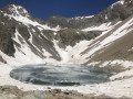
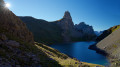
Combeynot Lake and East Peak

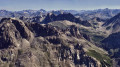
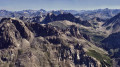
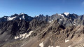
The Pics du Combeynot viewpoints are two promontories offering the finest views of the Écrins and Cerces mountain ranges. Set well apart from these massifs – close enough to observe them in detail yet far enough away to avoid obstruction – they overlook the highest peaks: Pelvoux, Barre des Écrins, Meije, Galibier, Mont Blanc, Thabor, Viso…

The Pic Ouest is a few metres higher, but the view is more spectacular from the Pic Est, which is also easier to reach.

Details

2348229
Creation:
Last update:
Last review:
  • Walking
    Activity: Walking
  • ↔
    Distance: 7.44 mi
  • ◔
    Duration according to the author: 6 hrs 
  • ▲
    Difficulty: Very difficult

  • ⚐
    Back to start: Yes
  • ↗
    Ascent: + 4,908 ft
  • ↘
    Descent: - 4,908 ft

  • ▲
    Highest point: 10,243 ft
  • ▼
    Lowest point: 5,322 ft

Photos

Description of the walk

(S/E) From the car park, follow the road for 50 metres towards Les Boussardes until you see a yellow sign on the right indicating the direction of Lac du Combeynot. The path climbs westwards for 50 metres and then turns southwards.

At an altitude of 1,682 metres, do not continue straight on but turn 90° to climb above the meadows on the south-western side of the valley. The well-marked path enters a coniferous forest and climbs westwards along the shaded shoulder of an ancient moraine. Blue markers dot the path here and there, but these are hardly necessary as the trail is very clearly marked.

On emerging from the forest, a few cairns mark the route, and it follows the northern slopes of the Vallon du Fontenil. Pass the lake’s narrows via a few hairpin bends, then follow the path for 500m to reach the lake’s spillway.

(1) At Lac de Combeynot, take an unmarked but clearly visible path that climbs north-westwards through the scree on the lake’s left bank to go round a large moraine boulder overlooking the lake’s bottom on the left. Once near this boulder, carefully identify the route to follow using the photo of the Jumelles Nord and Pic Ouest and its caption.

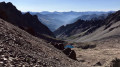
After the moraine boulder, continue climbing through the scree, now heading west, and ignore two couloirs ascending northwards towards the Brèche de Combeynot. Climb up the increasingly steep scree, keeping close to the base of the rocks, to go round them and enter a third couloir ascending north-east.

Climb up this couloir, using the rocks lining its left-hand side for support, until you reach a shoulder marking the top of the couloir.

(2) Climb up the scree to the north-north-east, following the few cairns marking the route, as close as possible to the base of the rocks descending from the ridge. This will take you to the wide pass of the Brèche de Combeynot.

(3) From the breach, follow the jagged line of the ridge eastwards. Two rock pinnacles form an obstacle on the ridge, but you simply need to bypass them to the right, via their base on the southern flank, to reach the summit without difficulty.

(4) At the summit, take in the view (see annotated panorama and spherical view), then retrace your steps for the descent.

As snowfields persist late into the season, head for the snowfield at the bottom of the valley for a descent that’s easier on the knees.

(5) Follow the snowfield at the bottom of the valley until you rejoin the ascent route, then follow this back to the starting point (S/E).

Waypoints

  1. S/E : mi 0 - alt. 5,335 ft - Les Boussardes car park - Guisane (rivière)
  2. 1 : mi 2.47 - alt. 8,396 ft - Lake spillway - Lac de Combeynot
  3. 2 : mi 3.4 - alt. 9,774 ft - Summit of the couloir
  4. 3 : mi 3.51 - alt. 10,026 ft - Brèche de Combeynot
  5. 4 : mi 3.75 - alt. 10,207 ft - Summit - Pic Est de Combeynot
  6. 5 : mi 4.32 - alt. 9,236 ft - Snowfields at the bottom of the valley
  7. S/E : mi 7.44 - alt. 5,335 ft - Les Boussardes car park

Notes

?️ Park at the Boussardes car park on the right bank of the Guisane, just after the bridge crossing the river between Le Lauzet and Les Boussardes.

? There isn’t much water along the route, except of course at the lake; make sure you bring enough with you.

? Dogs are not permitted, even on a lead, as the walk takes place almost entirely within the boundaries of the Écrins National Park.

?‍♀️ The difficulty of this walk lies mainly in the elevation gain and the very steep scree slope below the Brèche de Combeynot: you take two steps forward only to slip one step back.

? The walk is short, but it is possible to camp near the lake if you wish to enjoy the sunrise.

? Standard hiking kit is sufficient; telescopic walking poles are useful.

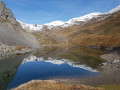
⏰ The reflections of the Crête de Combeynot in the lake of the same name are only visible at sunrise, so you’ll need to set off early to see them.

? The IBP statistics for the route give an index of 179, a distance of 12.63 km, a total elevation gain of 1,572 m, a walking time of 4:21:44 and an average speed of 2.9 km/h.

? Finding your way is easy, even in the off-trail sections. The photo of the Northern Twins and the Western Peak makes it easy to spot the easiest route up the couloir.

You’ll be hiking in the heart of the Écrins National Park.

The Écrins massif is an exceptional area, open to all, with a natural, cultural and scenic heritage that is truly unique. To protect these treasures, the heart of the park is marked by blue-white-red flags, and certain regulations must be observed. Please familiarise yourself with these regulations when planning your hike to help preserve this shared heritage, on the website https://www.ecrins-parcnational.fr.

Worth a visit

? Alpine wildlife is, of course, abundant here. Chamois inhabit the slopes of the Fontenil valley and vultures are also numerous.

? The views are magnificent. See this interactive spherical photo of the summit and this one of the lake.

? Several alternative routes are possible. The suggested route is the easiest, but the two couloirs preceding the one indicated are also passable and more direct. If you’re an experienced hiker, it’s possible to climb the two gendarmes leading to the Pic Est rather than skirting round them at their base.

It is also possible to reach the West Peak of Combeynot, which offers a superb view of the Vallon de la Romanche and the Homme and Lautaret glaciers. Please note, however, that this constitutes PD-grade mountaineering on extremely loose terrain where it is virtually impossible to secure yourself. To reach the western summit, simply follow the ridge, bypassing obstacles to the left (south-facing slope); the final slope below the summit is very steep, so it is best to stay as close as possible to the ridge, but you must test each hold.

? Le Fontenil refers to the springs that discharge the waters of Lake Combeynot via an underground channel. Combeynot probably derives from Combe Eynaud, a ‘combe’ being a dry mountain-side valley generally situated above the springs, and ‘Eynaud’ being a proper name.

Reviews and comments

5 / 5
Based on 2 reviews

Reliability of the description
5 / 5
Ease of following the route
5 / 5
Route interest
5 / 5
jmgorce
jmgorce

Overall rating : 5 / 5

Date of your route : Jul 27, 2023
Reliability of the description : ★★★★★ Very good
Ease of following the route : ★★★★★ Very good
Route interest : ★★★★★ Very good
Very busy route : No

An exceptional hike with breathtaking views.
Suitable only for experienced high-mountain walkers in good physical condition. To be undertaken in good weather only

The ascent to the lake is very well signposted and involves a steady climb. Suitable for experienced walkers only, but with no technical difficulties
1) The ascent to the peak is in three sections: a climb up the scree slopes above the lake to a flat area. The stones are a bit loose, but you can follow the GPS track or the cairns closely.
2) Climb up the third couloir to reach the Brèche de Combeynot. This is the most technical section. We climbed on the right-hand side of the couloir, using the rocks for support; it’s steeper but more stable than the scree slope. Once out of the couloir, follow the cairns or head towards the left-hand side of the breach.
You’ll then be treated to a sweeping view of the Col du Lautaret and the Galibier. Magical! And when you turn round: the Écrins Glacier
3) The climb to the East Peak from the breach is easy if you follow the cairns carefully. Pass to the right of the rock pinnacles. A bit exposed but not overly risky.
The view from the top is a full 360° panorama: Meije, Lautaret, Mont Thabor, Mont Blanc, the Cerces massif, the Serre-Chevalier valley, the Écrins…

Machine-translated

bouvierjr
bouvierjr ★
• Edited:

Thanks for the information!

Indeed, snow continues to dominate above 2,200–2,300 metres and, given the aspect, there is a significant risk of snowmelt avalanches below the Combeynot Pass.
However, at this time of year it is possible to climb to the Pic du Lac de Combeynot from the lake on sight, provided you are properly equipped (ice axe and crampons). I’ll describe this route as soon as possible; the view from the peak towards Lac d’Arsine is superb.
In the meantime, the Chartreuse, Dévoluy and Vercors are more accessible!

Happy hiking!

PS: Be careful – the IGN topographic map changes its contour interval without warning to the south of the lake. When the contour lines run east-west, this is very difficult to spot (and it led to me having to call a helicopter to get me out of a rocky outcrop near the Vénéon). Two years ago, the IGN told me they intended to add warnings or a border to highlight the change and limit their liability, but unfortunately this still hasn’t been done, despite the technical simplicity of implementing it (an hour’s coding at most).

Machine-translated

l'ours04
l'ours04

Overall rating : 5 / 5

Date of your route : Jun 16, 2020
Reliability of the description : ★★★★★ Very good
Ease of following the route : ★★★★★ Very good
Route interest : ★★★★★ Very good
Very busy route : No

Hello,
Hike completed today.
No trouble getting to the lake.
However, there’s still far too much snow to carry on towards the peaks.
I reckon it’ll be about three weeks before we can reach the summits.

Machine-translated

Other walks in the area

For more walks, use our search engine .

The GPS track and description are the property of this route's author. Please do not copy them without permission.