Country:

 City:


Park in the car park situated on a small road leading down below the D530, just before the hamlet of Champhorent when coming from Saint-Christophe (Waze).
(S/E) From the car park, take the path that runs alongside the road to the south-east and descends towards the Vénéon stream. Cross the bridge over the stream and you’ll reach a signpost. The trail is marked in yellow.
(1) Follow the sign opposite indicating “Lavey”, then climb the winding path, generally heading south. A second signpost confirms the direction to follow, and the path emerges from the forest at around 1,530m, with a small group of chalets in view. Pass between the chalets and climb gently southwards, on the right bank of the Muande torrent below. You’ll reach a signpost (at around 1,660 m) at the Combe de la Valla.
(2) At the signpost, turn left to follow the direction of Lac des Fétoules. The path climbs quite steeply in hairpin bends to the east before veering south, becoming less steep and crossing a first stream at around 1,760 metres.
Once you reach a second stream (the Mandes), the path heads east again, winding its way up the right bank of this stream, then veers south at around 2,000 metres to cross the torrent.
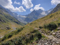
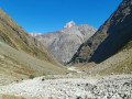
It continues along the southern slope, without gaining much altitude. At around 2,170 metres, it makes a hairpin bend to the left, then another to the right at around 2,180 metres (yellow marker and cairn). The Tête des Fétoules and its glacier are visible from this point.
Please note: from this point onwards, there is no longer a path or any markings.
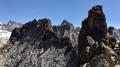
(3) Leave the path and climb straight up the slope, heading south-southeast, aiming first for the Tête des Fétoules and then for the Pointe Jeanne (the summit to the left of the Glacier des Fétoules). This takes you round a small rocky outcrop on the right.
(4) Turn north-east (left) until you reach a faint track climbing north-north-east (left), beneath low rocky outcrops overlooking mountain pastures dotted with large boulders.
You will then come within sight of a large cairn overlooking the valley, below the Côte du Faoutre.
(5) Once you can see the cairn, turn sharply right, due east, to climb up the system of weathered rocks, large boulders and sparse mountain pastures leading to the northern foot of Pointe Lemercier (the one to the left of Pointe Jeanne, which is itself to the left of the Tête des Fétoules). With a bit of luck, you’ll spot the few cairns marking the route here and there. Be careful: the IGN map is misleading, as it changes the equidistance between contour lines without warning, giving the impression of a flat section, which is not the case.
(6) When you reach the base of the northern foot of Pointe Lemercier, look out for the Passage de l’Ours a little further up (do not head for the Col de l’Ours, which is significantly further north but poorly marked – see photo).
Climb up beneath the rocky cliff face blocking the east, then veer northwards to ascend the slope towards the Passage de l’Ours.
(7) Cross the Passage de l’Ours and descend the steep slope (east) to then cross the gully that runs down to the north of the Tête de Malacombe. Cross to the opposite bank of the stream and climb as the terrain dictates (east-north-east) towards a ridge overlooking steep slopes to the east. Turn right onto this ridge, climbing its steep southern ridge for 200 metres, then turn due west to follow the gentler ridge to the summit.
(8) From the summit, retrace your steps to return to the Passage de l’Ours.
(7) Then descend below Pointe Lemercier.
(6) Return to the Cairn de la Côte du Faoutre.
(5) At the cairn, follow the ascent route in the opposite direction.
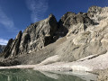
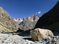
(4) Stay on the paths descending along the south-south-western slope, without ever heading straight down the steepest part, until you come within sight of the small Lac des Fétoules. Head down towards it and cross the Donzelière stream just before reaching the lake.
(9) At the lake, join the marked (yellow) and cairn-marked path which climbs gently southwards. A sign marks the end of the ascent and points towards La Lavey. Follow this direction: the path descends generally south-westwards in wide switchbacks, before veering north-west shortly before reaching the bottom of the valley at Plan de la Lavey.
The path joins the one coming from Lac des Rouies and continues along the right bank of the Ruisseau des Muandes towards the Lavey refuge to the north.
(10) Cross the footbridge at the Lavey refuge to reach the left bank of the Muandes. Continue due north, above the stream, to the Eymards stone bridge.
(11) Cross the bridge to return to the right bank, then continue due north along the correct path until you rejoin the ascent route at the Combe de la Valla.
(2). Follow this route back in the opposite direction to the car park (S/E).

 Visorando Member
 Difficult

 Moderate