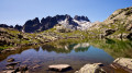
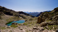
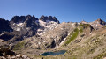
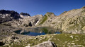
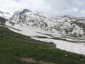
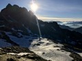
Lakes of La Combe, La Croix and Le Sambuis

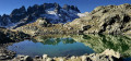
One of the most beautiful hikes in Belledonne, between Isère and Savoie. The route, which is mainly off-trail, crosses the legendary Aiguilles de l’Argentière, runs alongside a beautiful glacier in the massif, takes in three high-altitude passes and offers views of splendid lakes and small lakes.

⚠️The abundance of wildlife and the extraordinary landscapes add at least 1 to 2 hours to this hike compared to Visorando’s estimate, not to mention the off-trail terrain; you should allow for around 8 hours of walking.

Details

15972745
Creation:
Last update:
Last review:
  • Walking
    Activity: Walking
  • ↔
    Distance: 7.77 mi
  • ◔
    Duration according to the author: 7 hrs 
  • ▲
    Difficulty: Extremely difficult

  • ⚐
    Back to start: Yes
  • ↗
    Ascent: + 3,688 ft
  • ↘
    Descent: - 3,684 ft

  • ▲
    Highest point: 8,786 ft
  • ▼
    Lowest point: 6,293 ft

Photos

Description of the walk

Warning:
?️ Information on how to reach the starting point, as well as details regarding ?♀️ difficulty levels, ? alternative routes and ⚠️ safety precautions, is summarised in the sections ‘Practical Information ’ and ‘During the hike’. Any challenging hike requires preparation, and this hike is no exception.

Signposting:
This walk is mainly off-trail but follows marked paths near the start and finish points:
Park at the Glandon car park.

Yellow markings

(S/R) From the car park, take the almost level path heading west-north-west towards Lac de la Croix. On a flat stretch, a signpost indicates the direction of Lac de la Combe.

No signposting

(1) Turn left (south-west) towards the lake. The path crosses the mountain pastures on the slopes of the Carrelet before joining another path at Mollard du Gai.

(2) Continue westwards, keeping close to the ridge of the grassy slope, then follow the path as it winds in wide loops through the stubble towards the lake. The lake comes into view at the very last moment, near a shepherd’s hut.

Cairn-marked path

(3) After admiring Lac de la Combe, set off again north-east, below the shepherd’s hut, to reach, via gentle grassy slopes, a ridge running parallel to the Petites Aiguilles (do not go as far as the moraine at the bottom of the valley, which is less convenient for the ascent).

This ridge, initially grassy and then consisting of large boulders, runs north-west towards the foot of the Col de la Combe (this photo of the grassy hump helps with orientation). Climb (north-west) up the ridge, keeping closer to the eastern flank to avoid the two rocky outcrops, following the few cairns marking the route.

Then leave the shoulder to reach the foot of the pass, traversing upwards over steeper and less pleasant scree, still heading north-west.

The route leading to the pass itself is only visible at the very last moment (do not confuse it with the Grand Coup de Sabre du Piniollet, further to the east) as it is hidden by the Aiguille Jérome Gaillard: the pass has two ascending couloirs, separated by a small, unnamed rocky outcrop; the right-hand couloir (on the orographic left) is not used.

Get kitted out at the top of the scree marking the base of the left-hand route: stow your poles in your rucksack and put on your helmet. Then climb up the left-hand route, belaying yourself if necessary on the bolts and quickdraws that equip the route: a few very short sections are grade 3 and require the use of your hands.

No path

(4) At the pass, head north-west to cross the large cirque beneath the Aiguille d’Olle, which is littered with large, often unstable boulders (difficult terrain, especially in the presence of ice or snow). This leads to the steep rocky shoulder forming a continuation of the north-east ridge of the Aiguille d’Olle. A steep, straight couloir descends due north along the eastern flank of this shoulder; it is possible to descend this straight couloir (due north), using an ice axe and crampons if there is snow, and thus reach the bottom of the valley leading from the Argentière Glacier. Another option is to take the zigzagging slopes slightly to the east of the straight couloir.

The location photo and the one of the straight couloir show these two routes; the GPS track for this hike follows the zigzagging slopes.

(5) From the bottom of the valley, head up the north-facing slope, first over moraine scree and then across grass, towards a broad ridge covered in rounded boulders. Lac de la Croix is then visible to the north, on the other side of a narrow valley.

Note: to get the most out of the walk, do take a stroll along this magnificent ridge and discover the countless little lakes nestled amongst the granite polished by the glaciers.

Then head up this ridge, generally heading west. As you approach the Col de la Marmottane (this pass is not marked on the IGN map; it lies on the Crête de la Marmottane, just below the Rocher Armorié at 2,602 m – not to be confused with the pass of the same name, which lies much further south), head northwards to reach the low point on the hillside.

(6) From the pass, descend the very steep couloir to the east, which quickly turns into an easier gully heading east-north-east. Follow the gully until you reach a pile of large boulders marking the bottom of the Combe de la Croix, where you will come across a cairn-marked path.

(7) Follow this winding path uphill to Lac de la Croix.

Cairn-marked path

(8) Go round the lake along its eastern shore, then head diagonally north-east up towards the Col du Sambuis. A faint track and a few cairns mark the route. Below the pass, the slope becomes steeper and the track climbs beneath the rocks through a gully of small, greasy, dark grey schist.

(9) At the pass, head east behind (north face) the eastern summit bordering the pass, descending slightly towards an elongated lake. Then follow the thalweg of the lake’s outlet briefly, heading due east along the left bank, before veering left off the thalweg to skirt the base of the rocks, still heading due east, and arriving in a wide couloir overlooking Lac du Sambuis.

(10) Once you have descended to the lake, go round it along its eastern shore, then follow its outlet, zigzagging a few times to get round the rocky outcrops. When you reach the flat area below, a path follows the stream, passing two small pools before joining the green-marked route leading to the Cime du Sambuis.

Green markings

(11) Join the path and follow it down, first southwards, then south-eastwards, to reach the footbridge crossing the Glandon.

Yellow markings

(12) Cross the footbridge, climb up the opposite slope to join the main path to Lac de la Croix and follow it down towards the Col du Glandon. Take the path leading uphill (right) at the first junction, then continue on almost level ground, leaving the various paths on your right that join the main track (S/E).

Waypoints

  1. S/E : mi 0 - alt. 6,319 ft - Car park - Col du Glandon
  2. 1 : mi 0.29 - alt. 6,365 ft - Towards Lac de la Combe
  3. 2 : mi 1.02 - alt. 6,903 ft - Mollard du Gai
  4. 3 : mi 1.68 - alt. 7,293 ft - Lac de la Combe
  5. 4 : mi 2.82 - alt. 8,786 ft - Col de la Combe (2684m)
  6. 5 : mi 3.36 - alt. 7,910 ft - Thalweg of the Argentière Glacier valley
  7. 6 : mi 3.95 - alt. 8,406 ft - Col de la Marmottane
  8. 7 : mi 4.29 - alt. 7,717 ft - Junction with a cairn-marked path
  9. 8 : mi 4.42 - alt. 7,927 ft - Lac de la Croix
  10. 9 : mi 4.95 - alt. 8,291 ft - Col du Sambuis (2528m)
  11. 10 : mi 5.27 - alt. 7,986 ft - Lac du Sambuis
  12. 11 : mi 5.68 - alt. 7,815 ft - Junction with the Sambuis summit path
  13. 12 : mi 6.46 - alt. 6,755 ft - Glandon Footbridge
  14. S/E : mi 7.77 - alt. 6,319 ft - Car park - Col du Glandon

Notes

?️ Park at the Col du Glandon car park, N 45.23965° / E 6.175581°. By clicking on this Waze link, you can enter these coordinates directly into your favourite navigation app.

? Water is plentiful except between the pass (4) and the valley floor (5).

? Dogs are permitted in this part of Belledonne, but the walk is not particularly suitable due to several sections involving easy scrambling. Beyond the area around the lake (3) and up to the footbridge (12), there are few herds, but it is best to keep your dog on a lead so as not to disturb the wildlife.

?♀️ The difficulty of this walk lies on the borderline between ‘very difficult’ and ‘extremely difficult’. The main challenges are the ascent to the Col de la Combe (4) and the descent along the valley floor of the Argentière Glacier (5).

? Best undertaken in good weather to ensure you can find your way easily.

? A bivouac near the Col du Glandon will allow you to reach Lac de la Combe or Lac du Sambuis at sunrise.

? Standard hiking kit must be supplemented with an ice axe in all seasons (the snowfields below the Col de la Marmottane are permanent) and a helmet for the crossing of the Col de la Combe.

⏰ In summer, it is essential to set off very early to ensure the snow is hard enough beneath the Col de la Marmottane, which faces due east. Setting off two hours before dawn is advisable.

? Finding your way is easy in good weather, but as the IGN topographical map is particularly inaccurate around the Aiguilles de l’Argentière (every other peak and pass is misplaced; consult camp2camp for correct information), a GPS — or, of course, the Visorando app — is recommended.

Descent from the Col de la Combe
The reference photo shows the descent route between the Col de la Combe and the Talweg.

Orientation terms:

  • ‘Right bank’ and ‘left bank’ are always understood in the orographic sense, i.e. relative to the direction of water flow.
  • A tributary is a stream or watercourse feeding into a lake (the opposite is an outflow).
  • Upstream is the direction towards the top (the mountain); downstream is the direction towards the bottom (the valley).
  • The ‘adret’ is the sun-facing slope; the ‘ubac’ is its opposite.

? There is only one emergency number in France: 112. Other numbers (15, 17, or direct numbers, etc.) have no priority on mobile networks, do not route through other operators’ networks when there is no signal, and in the event of an overload of calls, ongoing calls are cut off to prioritise 112. So forget about them as soon as possible; they are dangerous and serve no purpose any longer (contrary to what some outdated guidance claims). If you cannot speak or hear, use 114 to communicate via text message. 112 works on any mobile phone (and landlines, of course), including on a locked phone and even if the SIM is blocked (however, since 2004, France has been in breach of European recommendations and blocks calls to 112 when there is no SIM in the phone. This blocking measure required special investment, as the GSM standard naturally allows calls without a SIM card. Taxpayers will appreciate this particularly clever use of public funds).

⚠️ Please note: if your call is cut off, it is up to you to ring the emergency services again: they have no way of contacting you or locating you. Remember to note down your GPS coordinates before calling, as the French government has still not deigned to equip mountain rescue centres with AML (Advanced Mobile Location) technology (despite this having been made mandatory by the EU since 2018).

? In the mountains, switch your phone to 2G: this technology has 4 to 8 times the coverage of newer technologies and uses significantly less power. Remember to switch off your Wi-Fi, as it drains the battery quickly and serves no purpose outside homes and offices. ? Bear in mind that your phone’s GPS location tracking works even in aeroplane mode (GPS has nothing to do with mobile phone calls).

?Reminder

  • ☑︎Essential in addition to standard hiking kit
  • ☑︎helmet
  • ☑︎ice axe
  • ☑︎head torch (if setting off early in the morning)
  • ☑︎1.5-litre water bottle
  • optional
  • ☐telescopic poles (must fit inside your rucksack)
  • ☐30m rope and harness (for the Col de la Combe, if in a group)
  • ☐crampons (for snowfields)
  • ☐water filter
  • ☒not required
  • ☒nut
  • ☒quickdraws

⚠️ The IGN topographical map is particularly inaccurate around the Aiguilles. Please refer to camp2camp for the locations of the passes and peaks.

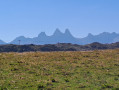
Annotated panorama of the Aiguilles de l’Argentière
Generally speaking, treat IGN topographic maps with a healthy dose of scepticism (in my experience, the institute never corrects reported errors, even after serious accidents caused by these errors – see my profile for further details and an example). The base maps for the IGN topographical maps date back more than 25 years and have not been updated since (!). The free OpenStreetMap, updated by volunteers, is usually much more up to date; it is best to consult its OpenTopoMap version, which is easier to read.

Worth a visit

? There are plenty of ibex and vultures amongst the scree and snowfields to the south-east of the Aiguilles.

The same ibex at the foot of the Col de la Combe. They also frequent the valley where Lac du Sambuis is located, from above the pass down to the small lakes and below the path at (11). Chamois are also present but more elusive.

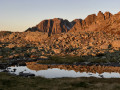
? The sunrises at Lac de la Combe or Lac du Sambuis are absolutely spectacular, as is the view of the Aiguilles de l’Argentière.

Lac de la Combe at sunrise To reach the latter at dawn, you need to walk the route in the opposite direction.

Full-resolution photos are available in this album and this one. The alternative route via the summit of Sambuis is also available.

? Apart from the ascent of the Aiguille de la Combe

For mountaineers at the summit of the Aiguille de la Combe – which I shall describe in due course – several alternative routes are possible. This hike partly combines the route to the Col de la Combe and Lac de la Croix with the route to the Cime du Sambuis and Lac de la Croix. See these two hikes to visualise the alternatives, particularly the ascent to the Cime du Sambuis.
From the Col de la Marmottane (6), it is also possible to descend westwards down the steep couloir and then climb back up to the north to join the winding path leading up to the Col de la Croix. From there, descend the path to the east to reach the lake (8).

? Explanation of some terms:

  • a cairn is a pile of stones used as a landmark along a route. You can add cairns if you are sure of the route, and it is useful to replace any stones that have fallen from a cairn.
  • scree = rockfall
  • a ‘combe’ is a relatively wide valley or the hollow of a fold in the terrain
  • Sambuis is a common surname in the Saint-Sorlin area.

Other walks in the area

For more walks, use our search engine .

The GPS track and description are the property of this route's author. Please do not copy them without permission.