


 Country:

 City:


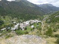
Park in the car park near the Pont du Rately, below the D301T road, at the end of a track that turns south between the Chapelle Sainte-Barbe and Sainte-Anne.
(S/E) From the car park, follow the yellow signposts for the Chalets and the Col de Buffère. The path heads westwards and crosses the Clarée at the Pont du Rately. Turn right after this bridge and continue uphill along the Clarée, still heading west.
At the junction for the Basse Gardiole chalets, head left up towards the Chalets de Buffère (signpost) and follow the narrow track, which winds through four hairpin bends before emerging from the forest, passing the Chalet du Serre and arriving at the beautiful Buffère refuge.
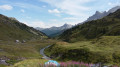
(1) Continue south on the path (which is actually theGR®57) that follows the valley floor of the Torrent de Buffère towards the Col de Buffère; the path climbs gently towards the pass, which it reaches after a few final hairpin bends, beneath the remains of military fortifications.
Please note: From the pass, the route is off-trail and, for the most part, without a defined path, until you return to the Buffère refuge.
(2) At the pass, leave the path and turn right to join a faint track climbing straight up the slope through small scree, heading west. Stay close to the ridge leading to the pass, crossing either its southern or northern flank (the GPS track for the ascent tends to follow the northern side). You will then cross a track that runs along the slope towards the north-north-west.
(3) Do not take this path but continue the ascent straight up the slope towards the west. After the slope becomes steeper, reach the flat, grassy ridge overlooking the Col de Buffère. Turn right, north-west, to follow this grassy ridge on the Torrent de Buffère side (eastern flank), staying close to the ridge. A few small rocky outcrops can be bypassed on the right, whilst remaining mainly on the grass. See the reference photo taken from above (i.e. in the opposite direction to the route).
You’ll reach, still on the grass, a flat area and a gentle pass, and cross over to the western flank, on the Guisane Valley side. Head west to descend through scree and go round the base of the south-western rocky spur of the Tête Noire.
(4) At the base of this rocky spur, grass begins to take over from the scree. Then head off to the right, northwards, to climb up the grassy slope. Look out for a rocky outcrop (see the photo caption) which divides the slope into two ‘couloirs’ and climb the left-hand couloir, preferably over the rocks bordering it on the left, to avoid the unstable scree in its centre. This will take you onto the ridge; follow it south-east for 50 metres to reach the summit.
(5) From the summit, descend along the north-western ridge until you reach a wide gap in the Rochers de Privé, overlooking the lake of the same name. Then turn left to descend the schist slope to the south and, when the slope levels out, veer south-east to cross a small ridge and head for the foot of the south-west spur of the Tête Noire.
(4) Ascend either via the route taken on the way up, or (as shown on the GPS track) via a traverse along the south-eastern flank which ends at rocky escarpments; climb up along these escarpments through scree and boulders to return to the ridge overlooking the Col de Buffère. Descend towards the pass through the scree, taking care not to go lower than the level of the path you crossed on the ascent (2,550 m). At this point, traverse the scree northwards, keeping level, to reach the Clarée side of the pass and rejoin the path.
(3) Follow this cairn-marked path which climbs north-north-west towards the small pass between Tête Noire and Pointe de Buffère, and climb the final, somewhat steep few metres to the pass.
(6) On the northern slope of the pass, several gullies (in the shade in the photo) allow you to descend via their narrow steps (early in the season, a snowfield allows you to descend in a group) and reach the enormous boulders that occupy the valley floor.
Reach these boulders, then make your way along this valley floor to the north-west, beneath the Rochers de Privé, until you can clearly see the slope leading down to the flat area by Lac de Privé on the right (north-east).
Descend, straight down the slope, over awkward boulders and through gullies. Aim for the quickest possible exit from the scree; progress through the grass is much easier, then reach Lac de Privé, which may be dry by the end of the season.
(7) At the lake, follow the thalweg of its outlet and one of the many faintly marked paths that wind their way through the larch trees and moraine boulders towards Le Privé.
Please note: It would be a shame to follow any specific route to the letter at this point: the place is magical and invites exploration; the vegetation here is magnificent, especially in autumn. Simply head down the easiest route, following your own whim, towards the bed of the Torrent de Buffère or the Torrent de Gardioles.
Once you reach one of the two torrents, follow it northwards towards the Buffère refuge. If you end up at the Ruisseau de Gardioles, stay on the right bank of the stream and head up to the refuge near a footbridge from which the Buffère chalets are visible (there is a first footbridge further up). If, on the other hand, you reach the Buffère stream (as shown on the GPS track), rejoin the path you took on the way there to reach the refuge to the north.
(1) From the refuge, follow the path you took on the way there back to the car park (S/E).


 Visorando Member

 Difficult

 Moderate
 Easy

