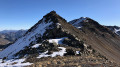
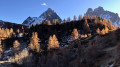
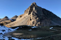
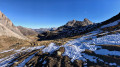
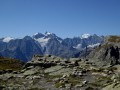
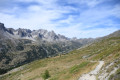
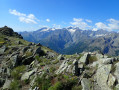
Pic Ombière and Pointe du Demi

Much of this magnificent hike takes place off the beaten track, but the going is easy.

Pic Ombière was given this name by regulars at the Refuge du Chardonnet, where the drink of the same name is consumed in abundance in ‘demis’ – a term which gave its name to the Pointe du Demi to the north of the peak. The IGN accepted these names without giving them a second thought and, ever since, a merry band of revellers has celebrated the occasion every year at the refuge, which is always fully booked.

Details

n°4321350
Creation:
Last update:
Last review:
  • Walking
    Activity: Walking
  • ↔
    Distance: 10.04 mi
  • ◔
    Average duration: 8h 05 
  • ▲
    Difficulty: Difficult

  • ⚐
    Back to start: Yes
  • ↗
    Ascent: + 3,976 ft
  • ↘
    Descent: - 3,963 ft

  • ▲
    Highest point: 9,262 ft
  • ▼
    Lowest point: 6,112 ft

Photos

Description of the walk

Warning:
Information on how to reach the starting point, as well as details regarding difficulty levels, alternative routes and safety precautions, is summarised in the ‘Practical Information’ and ‘During the Hike’ sections. Any challenging hike requires preparation.

Route:
(S/E) From the car park, take the correct path towards the Refuge du Chardonnet (signpost,GR®57), which heads south-southeast into the larch forest. After the Chalets de Laraux clearing (IGN elevation 1,982 m), it joins the path coming from La Souchère and veers right towards the west-north-west. On a ridge, it turns left towards the south-south-west and reaches a footbridge over a stream.

Off the trail

(1) Before crossing the footbridge, leave theGR® and head up the right bank of the stream for about 150 m. Then make a wide circular loop to the left across the mountain pasture, climbing up the north-eastern slope towards the larch trees. Cross through the larch trees to reach a ridge topped with meadows. Follow the contour line along the ridge to cross over to its eastern flank, heading south-southeast, above a peat bog, then climb up a valley floor lined with pine trees to the south-southwest. A watering trough is visible further upstream; take one of the paths leading up to it (west).

(2) From the watering hole, continue along the path crossing a stream to the south-west and arrive at a hillock bordered by larch trees to the north. The Refuge du Chardonnet is visible below. Continue along the edge of the hillock, still heading south-west, parallel to the path to the Refuge du Chardonnet. When you can see the footbridge over the Ruissau du Chardonnet, do not descend from the hillock, but continue along its edge towards the Ruisseau du Raisin, still heading south-west.
col
GR®

(3) Cross the stream to reach its left bank and follow it upstream once more along theGR®. The path reaches a flat section where it turns south, then climbs a valley floor towards the Raisin (IGN elevation 2,429 m).

Off the trail

(4) At Le Raisin, leave theGR® and follow a path heading south-west. This path disappears as the valley floor levels out. Continue climbing by sight, generally south-east, then due south, towards a small pass.

(5) At the unnamed pass (IGN elevation 2,662 m), join the ridge and follow it upwards to the right, heading due west.

(6) Once you reach Pic Ombière, order a half-pint to enjoy whilst taking in the view. Then, take the ridge descending north-west, towards the Col du Raisin. Bypass the few rocky outcrops to the right (north), where the terrain is easier. From the Col du Raisin, follow the ridge north-westwards, keeping to its right-hand side to avoid obstacles, and thus reach the Pointe du Demi.

(7) After another contemplative break, head back down the north-western ridge, then climb a small hump (or go round it to the right – north) before coming within sight of a grey mobile phone mast. Make your way to it, still following the ridge.

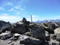
(8) From the mast (a sign on the ground indicates that this is Pointe Ulysse), follow the Crête du Chardonnet due north until you reach the pass of the same name.

GR®57

(9) At the pass, head right (south-east) onto theGR®57into the Chardonnet valley, making a short detour north to see Lac de la Mine. Then return to theGR®57and descend generally eastwards towards the Chardonnet plateau. Then head towards the meanders of the Ruisseau du Chardonnet, before continuing on to Lac du Châtelard and crossing the footbridges over the Ruisseau du Raisin. Stay on theGR®57link path, which leads to the Refuge du Chardonnet and then to the footbridge below.

(1). Head back down the wide path to the Fontcouverte car park (S/E).
Waypoints

  1. S/E : mi 0 - alt. 6,115 ft - Fontcouverte car park
  2. 1 : mi 1.12 - alt. 7,057 ft - Footbridge
  3. 2 : mi 1.77 - alt. 7,306 ft - Watering trough
  4. 3 : mi 2.45 - alt. 7,405 ft - Back to the GR57
  5. 4 : mi 3.08 - alt. 7,946 ft - Le Raisin
  6. 5 : mi 3.65 - alt. 8,773 ft - Anonymous pass, IGN elevation 2,662 m
  7. 6 : mi 3.93 - alt. 9,262 ft - Summit - Pic Ombière
  8. 7 : mi 4.64 - alt. 9,213 ft - Summit - Pointe du Demi
  9. 8 : mi 5.27 - alt. 9,121 ft - Summit and mobile phone mast - Pointe Ulysse
  10. 9 : mi 6.17 - alt. 8,658 ft - Col du Chardonnet
  11. S/E : mi 10.04 - alt. 6,115 ft - Fontcouverte car park

Notes

?️ Park at the Fontcouverte campsite car park, N 45.033913° / E 6.544229°. By clicking on this Waze link, you can enter these coordinates directly into your favourite sat-nav app. TheGR®57link trail starts from the campsite.

? There is no water available between (4) and [location], so make sure you bring enough with you.

? Dogs are allowed in this part of Les Cerces, but it is best to keep your dog on a lead so as not to disturb the wildlife.

?‍♀️ The difficulty of this hike is mainly due to the off-trail sections and the length of the route.

? Best undertaken in good weather so you can find your way easily, and above all to enjoy the scenery.

? The hike is too short to be suitable for camping.

? Standard hiking kit is sufficient. Towards the end of the season, when the larch needles turn vibrant colours, a pair of crampons comes in handy; see this route.

⏰ It takes between half an hour and an hour to walk from the (S/E) car park to the (1) first vantage point from which you can watch the sunrise over the Queyrellin. Setting off at dawn is therefore more than enough time to enjoy it.

? Finding your way is easy. I use the following terms in addition to the cardinal points to give directions:

  • ‘Right bank’ and ‘left bank’ are always understood in the orographic sense, i.e. relative to the direction of the water’s flow.
  • A tributary is a stream or watercourse feeding into a lake (the opposite is an outlet).
  • Upstream is the direction towards the top (the mountain); downstream is the direction towards the bottom (the valley).
  • The ‘adret’ is the sun-facing slope; the ‘ubac’ is its opposite.

? There is only one emergency number in France: 112. Other numbers (15, 17, or direct numbers…) have no priority on mobile networks, do not route via other operators’ networks when there is no signal, and in the event of an overload of calls, ongoing calls are cut off to prioritise 112. So forget about them as soon as possible; they are dangerous and no longer serve any purpose (contrary to what some outdated guidance claims). If you cannot speak or hear, use 114 to communicate via text message. 112 works on any mobile phone (and landlines, of course), including on a locked phone and even if the SIM card is blocked (however, since 2004, France has been in breach of European recommendations and blocks calls to 112 when there is no SIM card in the phone. This blocking measure required special investment, as the GSM standard naturally allows calls without a SIM card. Taxpayers will appreciate this particularly clever use of public funds).

⚠️ Please note: if your call is cut off, it is up to you to ring the emergency services again: they have no way of contacting you or locating you. Remember to note down your GPS coordinates before calling, as the French government has still not deigned to equip mountain rescue centres with AML (Advanced Mobile Location) technology (despite this having been made mandatory by the EU since 2018).

? In the mountains, switch your phone to 2G: this technology has 4 to 8 times the coverage of newer technologies and uses significantly less power. Remember to switch off your Wi-Fi, as it drains the battery quickly and serves no purpose outside homes and offices. ? Bear in mind that your phone’s GPS location tracking works even in aeroplane mode (GPS has nothing to do with mobile phone calls).

?Checklist

  • ☑︎Essential items in addition to standard hiking kit
  • ☑︎camera (the scenery is stunning)
  • ☐optional
  • ☐ telescopic or non-telescopic walking poles
  • ☐ crampons (in case of snow)
  • ☒not needed
  • ☒ice axe

⚠️ As a general rule, treat IGN topographical maps with a pinch of salt (in my experience, the institute never corrects reported errors, even after serious accidents caused by these errors – see my profile for further details and an example). The base maps for IGN topographical maps date back more than 25 years and have not been updated since (!). The free OpenStreetMap, updated by volunteers, is usually much more up to date; it is best to consult its OpenTopoMap version, which is easier to read.

Worth a visit

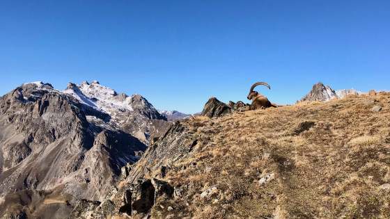
Bouquetin devant le Galibier et le Pic de la Moulinière
Ibex in front of the Galibier and the Pic de la Moulinière
? Alpine wildlife is present, in particular ibex and vultures; see this outing.

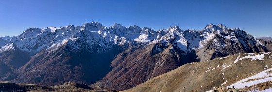
? The views from the summits are magnificent. See this interactive photo taken from the Pic Ombière and this one taken from the Pointe du Demi. To identify the names of the summits, use Peakfinder from the Pic Ombière or the Pointe du Demi.

Panorama depuis la Pointe du Demi
Panorama from the Pointe du Demi

? It is possible to shorten the walk slightly by going directly from the (1) to the (3) whilst staying on theGR®57. In this case, take theGR® towards the Col de Roche Noire when you reach the first footbridge.

The most interesting alternative is to climb up to the Refuge du Chardonnet via the Refuge de la Buffère, following the route of this hike. This adds 100 metres to the elevation gain, a good ten kilometres to the route, and places it in the ‘Very Difficult’ category. In autumn, when the larch trees are ablaze with gold and copper, allow a full day from dawn to dusk (around 12 hours’ walking), as the landscape is so captivating.

? Explanation of a few terms:

  • an ‘alpe’ (or ‘aulp’) is a meadow where cows and sheep are taken to graze.
  • A cairn is a pile of stones used as a landmark along a route. You can add cairns if you are sure of the route, and it is useful to replace any stones that have fallen from a cairn.
  • a ‘casse’ is a scree slope
  • a ‘combe’ is a relatively wide valley or the hollow of a fold in the terrain, generally without a major watercourse.
  • A ‘ru’ is a small stream.

Always be cautious and plan ahead when you're outdoors. Visorando and the author of this route cannot be held responsible for any accidents occurring on this route.

The GR® and PR® markings are the intellectual property of the Fédération Française de Randonnée Pédestre.

Reviews and comments

3.5 / 5
Based on 3 reviews

Reliability of the description
3.5 / 5
Ease of following the route
3.3 / 5
Route interest
3.7 / 5
cdudu
cdudu

Overall rating : 4.7 / 5

Date of your route : Sep 20, 2026
Reliability of the description : ★★★★★ Very good
Ease of following the route : ★★★★☆ Good
Route interest : ★★★★★ Very good
Very busy route : No

A very beautiful walk, but the section between points 4 and 5, beneath the unnamed pass, is indeed steep, involving a traverse across loose scree… a bit exposed! It’s therefore best suited to walkers accustomed to this sort of terrain, equipped with walking poles and good footwear, especially as there’s no alternative route (turning back would likely be tricky).The rest is magnificent – ibex, superb views and tranquillity – but the entire ridge still requires you to be careful. In short, without removing it from the list, perhaps it should be classified as ‘very difficult’?

Machine-translated

REBOX57
REBOX57

Overall rating : 1.3 / 5

Date of your route : Aug 13, 2024
Reliability of the description : ★★☆☆☆ Disappointing
Ease of following the route : ★☆☆☆☆ Very disappointing
Route interest : ★☆☆☆☆ Very disappointing
Very busy route : No

A route to the unnamed pass off the beaten track, extremely dangerous, involving a passage through very, very steep scree slopes.
This hike should be avoided as it is far too dangerous.

Machine-translated

Britanicus100
Britanicus100
• Edited:

Overall rating : 5 / 5

Date of your route : Aug 30, 2014
Reliability of the description : Not used / Not applicable
Ease of following the route : ★★★★★ Very good
Route interest : ★★★★★ Very good
Very busy route : No

Completed in 2014, descending via the Col du Raisin.
I’ve made a video, complete with the names of the peaks, which shows the route and the atmosphere of the hike up to this pass.
Thank you for suggesting this lovely route, which I’d forgotten to add to this fabulous hiking website.

Machine-translated

Other walks in the area

For more walks, use our search engine .

The GPS track and description are the property of this route's author. Please do not copy them without permission.