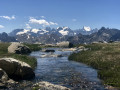
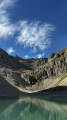
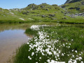
Pointes des Cerces from Laval

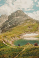
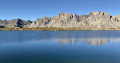
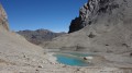
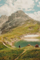
A magnificent circular route ascending to the Pointe des Cerces via the wild valley of Lac Sorcier, then exploring the Cerces lakes and those of the Col des Rochilles, before finishing at the headwaters of the Clarée and its upper valley. A very rocky start to the hike is followed by a peaceful return through the greenery lining the river.

⚠️ This very challenging route requires a good command of walking on scree or steep snowfields as well as along ridges, and crampons and an ice axe are essential even in the complete absence of snow.

Details

n°1515462
Creation:
Last update:
Last review:
  • Walking
    Activity: Walking
  • ↔
    Distance: 12.27 mi
  • ◔
    Duration according to the author: 8 hrs 
  • ▲
    Difficulty: Extremely difficult

  • ⚐
    Back to start: Yes
  • ↗
    Ascent: + 4,137 ft
  • ↘
    Descent: - 4,147 ft

  • ▲
    Highest point: 10,157 ft
  • ▼
    Lowest point: 6,631 ft

Photos

Description of the walk

⚠️ This hike requires specialist equipment and thorough preparation in all seasons. Please read the practical information below carefully.

(S/E) From the Laval car park, follow the signposts and the yellow markings towards the Pont du Moutet and Lac des Béraudes, reaching the lake via a well-marked route (which is described in detail in the ‘Lac Rouge to Lac des Béraudes’ walk, stages 1 to 3). The path arrives at the right bank of the lake’s outlet, on the ridge of the glacial dam.

(1) Take the signposted path which climbs gradually along the right bank of the lake (southern shore) and heads above the western end of the lake.

(2) Once you reach a point just beyond this end, where the path turns left to climb steeply up the slope, leave it (at around 2,575 m) and head due west along a cairn-marked track that descends towards the stream feeding the lake, then climbs gently back up to a large plateau.

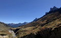
Veer right across this flat area and head towards the valley floor rising north-north-west towards a small pass beneath the western end of the Crête de Moutouze (looking towards the Pointe des Cerces, a grassy ridge separates two valleys ascending towards the peak; this is the valley on the right; in the reference photo, the ridge is in the sun and the valley to be taken is in the shade. To its right, the pass is entirely in the shade; only its outline is clearly visible).

Follow the bottom of this valley, keeping to the right-hand side, to reach the small pass separating the Sagnes Froides valley from the Béraudes valley, beneath the Crête de Moutouze.

(3) At the pass, stow your poles in your rucksack and look to the left (west) – and more specifically towards the direction you’ve come from (south of the pass) – for a route through the rocks leading up onto the rocky ridge bordering the western side of the pass. A small crack in the rock allows you to climb easily (grade 2) towards the summit of the rocky ridge to the west, bringing you out above Lac Sorcier.

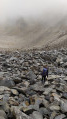
(4) From the lake, follow the moraine ridge heading north-north-east towards the foot of the Pointe des Cerces. Climb quite high (2,850 m) up the scree slope before veering left (west-north-west) to cross a first wide ravine. Don’t hesitate to use your ice axe to cross this ravine (anchor the blade of the ice axe into the ‘ground’ to create footholds). Continue to another large ravine without attempting to cross it, and make your way up to a small reddish rocky outcrop on the opposite side of the ravine.

(5) Put on your crampons and take out your ice axe if you haven’t already done so. The reference photos taken from below and above, along with their captions, give a clear idea of the route.

⚠️ Please note: if snowfields and the summit cornice are present, the main alternative route described below is an easier option; however, if there is no snow, stick to this route.

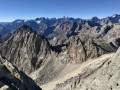
This involves climbing straight up the slope (north-north-east) between reddish rocks on the left and sharp, unstable schist on the right, following the least steep section of the slope (though everything is relative). The slope becomes steeper near the summit and a final push takes you onto the ridge. Climb an easy little rocky step to the right (north-east) along the ridge, then reach the secondary summit of the Pointe des Cerces (cairn).

(6) From the cairn, follow the clearly visible path slightly below which leads to the summit, heading due east.

(7) After admiring the view from the summit, explore the easy ridge to the north-north-east to enjoy splendid views over the valley flanking the northern side of the Roches de Crépin. Then return to the summit before beginning the descent via the standard route down from Pointe des Cerces, which heads north down the slope of the névé des Cerces, halfway between the summit and the secondary summit.

I am reproducing here the reliable description (4.78/5) of the hike to the Pointe des Cerces, reversing the direction and noting that the markings are yellow: ‘take the very well-marked mountain path leading towards the Col des Cerces; follow it down to the pass’.

(8) At the pass, follow the signpost for Lac des Cerces (GR®57, marked in red and white) and turn left, heading due south, to descend to the lake via an excellent path. Once the lake comes into view, take the first path on the left to descend to the lake.

(9) At Lac des Cerces, turn left to follow the lakeshore and walk round it until you reach the path leading uphill to the left towards a signpost on theGR®57. Head for this signpost and take the path heading right (north-west) towards Les Rochilles (do not take the main path which runs alongside the Ruisseau des Cerces and leads to the Plan Lachat car park, nor, of course, theGR®57which climbs back up to the pass).

This will take you to the track leading up to the mountain refuge and the Rochilles military camp; you can either walk alongside the track to cut across the bends, or take it to return to the delights of motorised civilisation. Follow the track to the Col des Rochilles, which overlooks Lac du Grand Ban.

(10) Take the path running south of the lake and heading east towards Lac Rond; once you reach the eastern end of the lake, go round it to the north to rejoin the track. Turn right (east) onto the track to climb up to the Seuil des Rochilles (military ruins) and descend to Lac de la Clarée.

(11) From the lake, head north following the direction of the signpost and the excellent path to the Refuge des Drayères. The path reaches the banks of the Clarée.

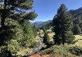
(12) Shortly after the refuge, leave theGR® to cross the Clarée via a footbridge and join the path on the right bank, which is much more pleasant. Continue along this path to the Moutet bridge and cross it to reach the car park (S/E).

Waypoints

  1. S/E : mi 0 - alt. 6,640 ft - Parking de Laval
  2. 1 : mi 1.25 - alt. 8,215 ft - Lac des Béraudes lock
  3. 2 : mi 1.71 - alt. 8,458 ft - The start of the path is only lightly marked with cairns - Lac des Béraudes
  4. 3 : mi 2.3 - alt. 8,957 ft - Col des Sagnes Froides - Vallon des Sagnes Froides
  5. 4 : mi 2.38 - alt. 9,091 ft - Northern end of Lac Sorcier - Lac Sorcier
  6. 5 : mi 2.63 - alt. 9,462 ft - Second major ravine and reddish rock formation
  7. 6 : mi 2.82 - alt. 10,066 ft - Secondary summit and cairn - Pointe des Cerces
  8. 7 : mi 2.93 - alt. 10,157 ft - Summit - Pointe des Cerces
  9. 8 : mi 4.63 - alt. 8,438 ft - Signpost - Col des Cerces
  10. 9 : mi 5.48 - alt. 7,904 ft - Lac des Cerces
  11. 10 : mi 7.84 - alt. 8,182 ft - Col des Rochilles (2491m)
  12. 11 : mi 8.87 - alt. 7,982 ft - Lac de la Clarée – Source of the > - Clarée (rivière)
  13. 12 : mi 10.34 - alt. 7,133 ft - Shortly after the refuge, leave the GR - Refuge des Drayères
  14. S/E : mi 12.27 - alt. 6,640 ft - Parking de Laval

Notes

Difficulty and equipment:
The ascent to the Crête des Cerces (linking the Rocher de la Sauma to the Pointe des Cerces) is extremely difficult in all seasons, due to the steepness of the slope and the nature of the terrain.

  • At the start of the season, and often until mid-August, a snowfield partially covers the slope. This snowfield is topped by a cornice on the ridge, and if this is present, the alternative route closer to the base of the Rocher de la Sauma (see this alternative route below) is easier as it is slightly less steep (however, great care must be taken when traversing the snow-covered ridge).
  • Towards the end of the season, the route described above is simpler despite a very steep slope, as the alternative route then passes over the jagged ridge of sharp, brittle schist, which is very difficult; it is therefore better to follow the main route description to reach the closest point to the secondary summit.

If you follow the recommendations above, an ice axe and crampons are essential even in the absence of any snow (towards the end of the season, when there is no snow, the alternative route allows you to avoid using this equipment, but at the cost of a passage along the ridge that is particularly tricky and dangerous in these conditions).
On rock and loose terrain, crampons and an ice axe are used in the same way as on frozen snow.

Rope belaying is difficult at the end of the season; there are no anchor points available on the ascent and the ridge is too loose to use the ‘becquets’ technique. At the start of the season, setting off before dawn (leaving the car park at around 2 am) allows you to benefit from ideal snow conditions, with crampons ensuring a good level of safety. An alternative is to bivouac at Lac Sorcier.

Towards the end of the season, climbing gloves or mittens allow you to place your palms on the sharp rocks.

Trekking poles are a useful addition, but you must be able to stow them in your rucksack (so they should be telescopic).

Shorts are not recommended (due to sharp rocks or hard snow).

Water:
The section between Lac Sorcier and the Col des Cerces has few water sources.

Dogs:
Although dogs are allowed on this route, this walk is absolutely not suitable for them.

Worth a visit

Alternatives:
The main alternative route involves climbing as close as possible to the base of the Rocher de la Sauma. This is the route that seems the most logical and is recommended when snowfields are still present and firm enough to support hikers. However, towards the end of the season, it leads to a ridge made up of sharp, brittle schist, which is particularly difficult to traverse. If, however, you do choose this variant, a technique involving straddling the ridge (be careful not to cut yourself!) whilst reaching your (gloved!) hands forward to brace yourself and pulling your legs up will allow you to cross the obstacle without too much risk.

At this stage (5), cross the ravine as best you can (easy if there are snowfields) and continue climbing diagonally towards the base of the Sauma cliffs. Once you reach this point, climb up along the rock face until you reach a much less steep slope leading to a pass (difficult to make out on the IGN map) at the foot of the Sauma’s North Rock. At this point, it is possible to cross the ledge and gain a foothold on the ridge that ascends north-eastwards, then head for the secondary summit at (6).

See this photo to locate the pass.

Other routes are possible:

  1. From the Col des Cerces, it is of course possible to shorten the walk by descending towards Lac Rond, which you then skirt along its southern shore.
  2. From Lac de la Clarée, it is possible to return off the path via Les Banchets. To do this, do not turn north at (11) but head slightly south-east towards the foot of the Pain de Sucre (a small lake that is dry at the end of the season), then the base of the Roches de Crépin and the Main de Crépin. From there, head south-east to reach the peatland stream, taking the least steep slope, then follow the stream to the Clarée.

These last two routes are very pleasant to combine.

Allow a good hour extra to take photos.

Always be cautious and plan ahead when you're outdoors. Visorando and the author of this route cannot be held responsible for any accidents occurring on this route.

The GR® and PR® markings are the intellectual property of the Fédération Française de Randonnée Pédestre.

Reviews and comments

3.8 / 5
Based on 2 reviews

Reliability of the description
3.5 / 5
Ease of following the route
3.5 / 5
Route interest
4.5 / 5
marcheur
marcheur

Overall rating : 2.7 / 5

Date of your route : Sep 02, 2024
Reliability of the description : ★★☆☆☆ Disappointing
Ease of following the route : ★★☆☆☆ Disappointing
Route interest : ★★★★☆ Good
Very busy route : No

This route should not be included in *Viso Rando* given its difficulty and the lack of cairns on the difficult and dangerous section. On the map, it would be a good idea to include a diagram of the difficult section, as the photos do not really show where to cross.
Despite a bit of a tumble down the slope – nothing too serious – I managed to reach the ridge and rejoin the path coming from the Col des Cerces, and I was 30 metres from the summit.

Machine-translated

dcohen
dcohen

Overall rating : 5 / 5

Date of your route : Sep 07, 2019
Reliability of the description : ★★★★★ Very good
Ease of following the route : ★★★★★ Very good
Route interest : ★★★★★ Very good
Very busy route : No

Splendid! I’ve just sorted through my photos – these are undoubtedly the most magical landscapes I’ve ever seen in the Cerces. The area around Lac Sorcier is reminiscent of the mountains of Morocco, and the climb up to the ridge leading to the Cerces certainly deserves to be described as extremely difficult (ice axes and crampons are very useful on the loose, jagged scree).

The alternative return route via Les Banchets comes highly recommended.

Machine-translated

Other walks in the area

For more walks, use our search engine .

The GPS track and description are the property of this route's author. Please do not copy them without permission.